Download
1 / 19
200 likes | 438 Vues
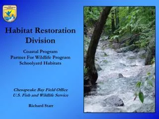
Habitat Restoration Division Coastal Program Partner For Wildlife Program Schoolyard Habitats Chesapeake Bay Field Office U.S. Fish and Wildlife Service Richard Starr. Stream Restoration Approach. Training and Education Technical Assistance Demonstration Projects. Training and Education.

E N D
Habitat Restoration DivisionCoastal ProgramPartner For Wildlife ProgramSchoolyard HabitatsChesapeake Bay Field OfficeU.S. Fish and Wildlife ServiceRichard Starr
Stream Restoration Approach • Training and Education • Technical Assistance • Demonstration Projects
Training and Education • Promote Fluvial Geomorphology and Natural Channel Design Methods • NCTC River Science Curriculum Advisory • Stream Classification and Assessment Courses (Levels I, II, and III at NCTC) • Natural Channel Design Review Checklist • Stream Function Pyramid • Protocol Development and Training • Since 1994, over 1000 participants representing non-profit, local, state and federal agencies • Training will be used in implementation of 500 projects • Close to 250 miles of stream and riparian habitat restoration in 18 major river basins
Types of Technical Assistance • Develop Assessment and Design Tools • Develop Protocols • Conduct Watershed and Stream • Monitoring • Conduct Project Review • Publish Findings
Demonstration Projects • Natural channel design methodology • Stream restoration • Fish barrier removal
Stream Functional Pyramid • Hierarchical framework that categorizes stream functions • Each level builds on the previous level • Based on work Fischenich 2006 • Functional based goals • Functional assessments with quantitative thresholds • Functional based monitoring • Mitigation debit and credit protocols • Supporting guidelines document • Training module
Natural Channel Design Review Checklist • Checklist of critical questions associated with NCD stream restoration projects • Four categories • Watershed assessment • Geomorphic assessment • Conceptual design • Final design • Supporting guidelines document • Training module
Natural Channel Design RFP Protocol • Checklist of critical tasks required for NCD stream restoration projects • Eight categories • SOW • Objectives • Watershed assessment • Geomorphic assessment • Alternative analysis • Conceptual design • Feasibility design • Final design
Bank Erosion Rate Curve • Used to estimate rate of bank erosion based on condition of bank stability • Provides a basis for prioritizing restoration • Quantifies sediment supply from bank erosion
Regional Curve Development USFWS, MD SHA, USGS 10000 · ¢ AP/VR Piedmont 0.94 Qbkf = 34.02DA 0.76 Q = 84.56DA bkf 2 1000 R = 0.99 2 R = 0.93 W. Coastal Plain 0.73 Q = 31.35DA bkf Bankfull Discharge (cfs) 100 2 R = 0.98 ¨ E. Coastal Plain 0.76 Q = 14.65DA 10 bkf 2 R = 0.97 1 0 1 10 100 1000 Drainage Area (mi2) Hydrologic Regional Curves • Bankfull calibration required for fluvial based assessments • Regional curves reduce the need for bankfull gage calibration • Current Curves in Maryland: • Piedmont, Coastal Plain, and Ridge and Valley and Allegheny Plateau Physiographic Regions
Reference Reach Database • Rosgen Stream Types C, E, and B reference stream database • Developed from western coastal plain streams • Departure from potential analysis • Design criteria
Defining River Corridors Widths • Buffer width based on fluvial geomorphic requirements • Meandering streams require, at the minimum, 3.5 times the bankfull width • Avoid meandering floodplains
Stream Stability Rapid Assessment Protocol • Rapid stream assessment based on observation of instability indicators • Watershed characteristics • Lateral stability • Vertical stability • Stability Trend • Localized v.s. widespread instability • Potential instability cause(s)
Stream Feasibility Assessment Protocol • Rapid stream assessment based on observations • Four evaluations • Existing habitat • Existing stream stability • Restoration feasibility • Proposed habitat • Quantitative score
GIS Stream Stability Prediction • GIS-based stream stability prediction model • GIS layers • Percent impervious • Stream slope • Percent forest cover • Forest age stand • Erodible soils • Thresholds set for coastal plain physiographic region • Field validated model accuracy with over 200 sites • Model accuracy 87 percent
Stream Monitoring Protocol • Tiered monitoring protocol • Tier 1 – rapid assessment based on observations of instability indicators • Tier 2 – monumented measurements or repair
Other Tools and Protocols • Riffle Stability Index (Kappesser 2002, USFS) • RiverRat (NOAA and FWS, 2009) • RiverMorph (Stantec) • STREAM Modules (Ward et al, Ohio State) • Proper Functioning Condition (Prichard et al., 1998, BLM) • Bed Material Composition Method (Potyondy and Bunte 2007, USFS) • GIS-based Streambank Erosion Rate Estimation (Evans et al, 2003, Penn State) • Watershed Assessment of River Stability Sediment Supply (WARSSS) (Rosgen 2006) • Vermont Watershed and Stream Geomorphic Assessment Protocols • Physical Stream Assessment: A review of Select Protocols (COE & EPA 2004)
Future Tools and Needs • Stream assessment checklist • Stream monitoring checklist • Site selection checklist • Sediment prediction model comparison • Climate change sediment transport
U.S. Fish & Wildlife Service - Chesapeake Bay Field Office 177 Admiral Cochrane Drive Annapolis, Maryland 21401 www.chesapeakebay.fws.gov Richard Starr (410) 573-4583 Rich_starr@fws.gov