Download
1 / 15
150 likes | 163 Vues
NW-AIRQUEST projects on Agricultural and Wildfire Smoke in the Inland Northwest: ClearSky and AIRPACT-3. presented by: Joe Vaughan WSU-LAR contributors: Jack Chen, WSU-LAR; Rahul Jain, Golman Associates; Kyle Heitkamp, Geomatrix, Inc.; Brian Lamb, WSU-LAR

E N D
NW-AIRQUEST projects on Agricultural and Wildfire Smoke in the Inland Northwest: ClearSky and AIRPACT-3 presented by: Joe Vaughan WSU-LAR contributors: Jack Chen, WSU-LAR; Rahul Jain, Golman Associates; Kyle Heitkamp, Geomatrix, Inc.; Brian Lamb, WSU-LAR WRAP - Fire Emissions Joint Forum Meeting October 18, 2006, Spokane, WA,
Outline • NW-AIRQUEST • ClearSky • System design • Plume Rise Field Studies • Initial ClearSky Evaluation • Ensemble Effort • AIRPACT-3 • System design • BlueSky wildfire emissions • Wildfire results
What is NW-AIRQUEST? • Northwest and International Air Quality, Environmental Science and Technology Consortium • Organized in response to results of the Northwest Air Summit of June 2003 • Inspired by Northwest Regional Technical Center’s success in supporting and utilizing regional meteorological forecasting (MM5 at UW). • Committed to supporting air quality policy with best available science
ClearSky Ag-Burn Smoke Dispersion Modeling System Ag-burn scenarios from web-based user interface IC/BC (GFS) landuse terrain www.clearsky.wsu.edu Hybrid emissions generation MM5 CALMET 3D met field ----------------- u, v, w, T, BL variables CALPUFF u, v formatted for each layer of CALMET MCIP Web-served PM2.5 plume animations
ClearSky Plume Rise Field Study • Objective: Evaluate CALPUFF plume rise • Measure top of plume height • Collect meteorological data • Document burns visually (Photographs) • Methods • Aircraft measurements • Ground-based measurements • CALPUFF reruns
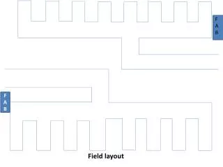
Field Burn Overview • 76 to 122 Acres • Wheat Stubble & Kentucky Bluegrass
Field Burn Surface Data • Blank areas represent missing or malfunctioning equipment • Field Loading ClearSky currently uses: • 2-6 Ton/Acre (Wheat Stubble) • 2.8 Ton/Acre (KGB)
CALPUFF Reruns • CALMET file from burn day recovered • Emission files modified for field burn • Field location, area, burn time, field loading • CALPUFF code modified to output plume heights • Buoyant Line Source (fire front) • Final plume height • Buoyant Area Source (smoldering field) • Plume evolution
Plume Rise Results from Original ClearSky 6 underestimated plume height 1 overestimated plume height 1 not compared due to large variation in observations
Buoyant Area Source Previous Value Updated Value Effective Height of Emissions (m) 0.5 0.5 Temperature (K) 333 324 Effective Rise Velocity (m/s) 0.01 1.4 Initial Vertical Spread (m) 100 100 Buoyant Line Source Line Height (m) 1 0.5 Average Line Width (m) 5 5 Temperature (K) 573 361 Exit Velocity (m/s) 0.5 2.2 Update Emission Parameters • from Evaluation of ClearSky (Jain, 2004) • and by reference to Air Sciences Field Studies
Final Results 2 underestimated plume height, slightly 2 - 3 overestimated plume height Newer emission parameters increase plume rise
ClearSky Evaluation • 2003 ClearSky Evaluation (Jain, 2004): • ClearSky is highly sensitive to Wind Speed & Wind Direction • Small differences in wind direction determine whether or not smoke plumes are predicted to affect an air quality monitoring station • How to represent the uncertainty of the meteorological conditions? Suggested an Ensemble Meteorology approach! Another story …for another time!?
Applied Sciences Program Approach to Integrated System Solutions for A Comprehensive Regional Air-Quality Decision Support System for the Pacific Northwest