GLOBE Land Cover Measurements
80 likes | 233 Vues
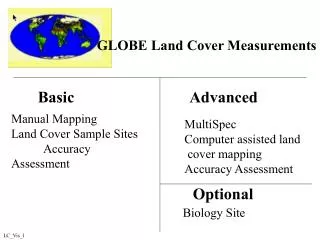
GLOBE Land Cover Measurements. Basic Advanced. Manual Mapping Land Cover Sample Sites Accuracy Assessment. MultiSpec Computer assisted land cover mapping Accuracy Assessment. Optional. Biology Site. LC_Vis_1.

GLOBE Land Cover Measurements
E N D
Presentation Transcript
GLOBE Land Cover Measurements Basic Advanced Manual Mapping Land Cover Sample Sites Accuracy Assessment MultiSpec Computer assisted land cover mapping Accuracy Assessment Optional Biology Site LC_Vis_1
We need to compare each ground site with a pixel in the Landsat image • Our GPS readings are accurate to about ± 16 meters. • Satellite ground tracks do not exactly cover any one 30 meter by 30 meter site • If an area is homogeneous over a 90 m x 90 m area, the Landsat image and the Land Cover Site can be aligned LC_Vis_2
Qualitative All MUC classes GPS Photos MUC Visit 1 time Quantitative MUC 0, 1, 4 GPS Photos MUC Biometry Visit 1 time Land Cover Sites • Biology • Quantitative measurements • Visit 1 or 2 times each year LC_Vis_8
MEASUREMENTS TO MAKE Locate center of homogenous site (90 m X 90 m) Complete field data worksheet Identify and record latitude, longitude, elevation Determine MUC class Record metadata Take a photo in each cardinal direction (N, E, S, W) Report data and send photos to GLOBE Equipment Needs GPS Compass MUC, GPS, and local vegetation student field guides Camera Qualitative land cover sample site - field data work sheet Tubular densiometer Clinometer 50m tape measure QUALITATIVE SITES LC_Vis_3
Tubular densiometer Field data work sheet Compass GPS 50-meter tape Pen or pencil Clinometer Tree species ID guides MUC Field Guide/Glossary Biology Site Permanent tree markers Site markers Quantitative: Forest/WoodlandEquipment LC_Vis_4
Canopy cover Ground cover Tree height Tree circumference MUC GPS Photos Tree species ID Quantitative:Forest/Woodland (MUC 0 or MUC 1)Measurements LC_Vis_5
Small bean bag Grass clippers or strong scissors 6 brown paper bags Tubular densiometer Biometry Field Data Work Sheet 50 m measuring tape GPS Compass Pen or pencil MUC Field Guide/Glossary Clinometer Tree species ID guides Permanent tree markers Quantitative: Herbaceous MUC 4Equipment LC_Vis_7
MUC GPS Photos 3 Grass samples green brown If trees are co-dominant Canopy cover Ground cover Tree height Tree circumference Tree species ID Quantitative: Herbaceous MUC 4Measurements LC_Vis_6