Download

1 / 9
90 likes | 494 Vues
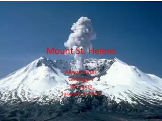
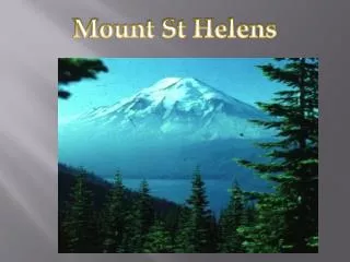
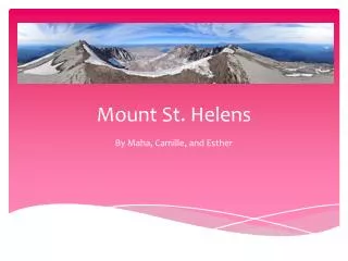
Mount St Helens by Alice Graham. Location of the volcano and background history. A volcanic peak, 2,549 m (8,363 ft) high The mountain is 6 miles (9.5 km) across at its base Location: South West Washington, USA The mountain is part of the Cascade volcanoes and the Cascade Range

E N D
Location of the volcano and background history • A volcanic peak, 2,549 m (8,363 ft) high • The mountain is 6 miles (9.5 km) across at its base • Location: South West Washington, USA • The mountain is part of the Cascade volcanoes and the Cascade Range • Type: Composite • Mount St. Helens is a part of the Pacific Ring of Fire that includes over 160 active volcanoes. • It only formed within the last 40,000 years, and the pre-1980 summit cone began rising around 2,200 years ago.
What were the main causes of the volcano erupting The Mt St Helens volcano results from subduction zone created between the Juan de Fuca plate and the North American plate. The oceanic Juan de Fuca plate is denser so subducts below the North American plate.
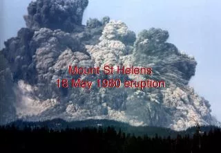
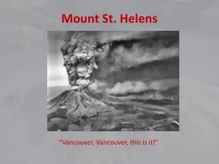
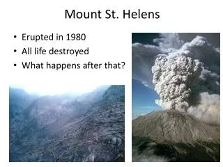
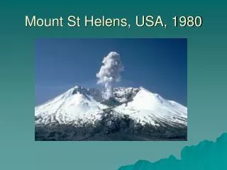
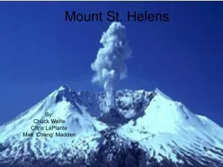
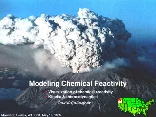
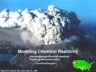
What were the main events and times of the eruptions • March 20 1980: Earthquake measuring 4.2 magnitude • March 27: Steaming vent • April: A bulge on the north side of Mountain • May18: A second earthquake- Massive collapse of North face of Mountain (Little warning). • The magma burst out causing large pyroclastic flow flattening vegetation and buildings for over 230 square miles ( 600 km²). • Plinian eruption. • Volcanic Mudflows- Due to collapse of northern side mixed with ice, snow and water. These flowed many miles down the Toutle and Cowlitz Rivers. • 3million m³ of material transported 7 miles (27 km) south into Columbia river by mudflows • For 9 hours ash erupted • By 5:39 became less severe – outbursts continued through the night. • Reduced height to 400m (1300 ft). • Left a crater 1-2 miles wide and 800m (0.5miles) deep.
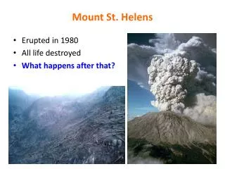
What were the main short term impacts of the eruption? • The eruption killed 57 people • Nearly 7,000 big game animals (deer, elk and bear) • An estimated 12 million fish from a hatchery. • Many tens of thousands of acres of prime forest destroyed • It destroyed or extensively damaged over 200 homes • Destroyed/ damaged 185 miles (300 km) of road • Destroyed/ damaged 15 miles of railways. • Airports closed (from 2days 2 weeks). Over a thousand commercial flights were cancelled following airport closures. • Unemployment rose rapidly after eruption. However returned to normal when the timber salvaging and ash-cleanup began.
What were the main long term impacts of the eruptions? • Economic: Trees amounting to more than 4 billion board feet of salable timber were damaged or destroyed, primarily by the lateral blast • Economic: Many agricultural crops, such as wheat, apples, potatoes, and alfalfa, were destroyed • Economic: Ash removal cost $2.2 million and took 10 weeks in Yakima • Economic: $1.1 billion cost overall • Social: Several months after May 18, a few residents reported suffering stress and emotional problems, even though they had coped successfully during the crisis. The counties in the region requested funding for mental health programs to assist such people. • Social: Homelessness- More than 200 houses and cabins were destroyed and many more were damaged in Skamania and Cowlitz Counties.
In what way was the volcano being monitored – was the eruption predicted • The volcano was being monitored to detect early signs of an impending eruption. • No one knew what types of monitoring techniques would prove most reliable because knowledge about the behaviour of Cascade volcanoes in general was limited and because Mount St. Helens had not been active recently. • University and USGS studies in the 1970's had monitored the volcano intermittently using three approaches: • 1. seismometers that could detect earthquakes caused by the movement of molten rock • 2. precise ground-surface measurements that could detect swelling of the volcano • 3. aerial infrared surveys and surface temperature measurements of the two "hot spots" high on the mountain to detect any changes in heat emission. • The volcano was also photographed routinely from the air to detect changes in snow and ice as part of a USGS glaciology research project. • At the beginning of March 1980 the only instrument directly monitoring Mount St. Helens was a seismometer on the western flank of the volcano. This station (SHW) automatically transmitted earthquake data by radio (telemetered) to seismic recorders at the University of Washington in Seattle.
How did people respond to the eruption? • The first response to the May 18, 1980 eruption of Mount St. Helens was to make sure that people and communities were safe. • People then needed to restore the area • Debris such as saleable logs were retrieved so as to try to restore the economy of the area
Has there been any activity since the main volcanic eruption • Five smaller explosive episodes occurred during the summer and fall of 1980. • Beginning with the October 1980 eruption, 17 eruptive episodes built a new lava dome that reached 876 feet above the crater floor • During a 12-month-long episode beginning in 1983 magma moved into the dome's molten interior, pushing its east side outward by at least 250 feet. • Since late 1986 several periods of increased seismicity have occurred. • Between 1989 and 1991 there were about 30 bursts of brief but intense seismic activity lasting minutes to hours – some also had small explosions from the dome • The explosions formed a new vent on the north side of the dome and produced small eruption columns that rose a few miles above the volcano. • A few explosions also hurled hot rocks three feet in diameter at least 1/2 mile northward from the dome, generated small pyroclastic flows in the crater, and formed small lahars. • During 1995 and 1998 seismicity increased for several months, but there were no accompanying explosions.