Download
1 / 14
140 likes | 315 Vues
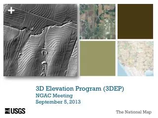
3D Elevation Program (3DEP) NGAC Meeting September 5, 2013. The National Map. Terrestrial Elevation. Target State – 3DEP. Evaluated 10 alternatives Benefit to cost – 4.7:1 Total benefits - $690 million/year Publically accessible Partnership approach Multiple data products and services

E N D
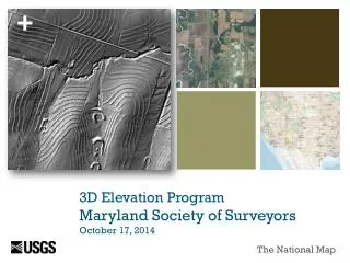
3D Elevation Program(3DEP) NGAC MeetingSeptember 5, 2013 The National Map
Terrestrial Elevation Target State – 3DEP • Evaluated 10 alternatives • Benefit to cost – 4.7:1 • Total benefits - $690 million/year • Publically accessible • Partnership approach • Multiple data products and services • Operational in January 2015 • Complete one cycle of data collection by 2023
2012 Inventory Update Data that “meet or partially meet” 3DEP specifications * Except Alaska where data meet 3DEP specifications at QL5 or better
2012 Inventory Analysis Data that meet or partially meet 3DEP specificationsare available or in progress for 26.4% of the nation (includes AK, HI, PR & VI) Bar chart depicts the amount of new data coverage that meets or partially meets 3DEP specifications by year since 2005 What Have We Learned So Far? • Of the data collected in 2012, 7% was repeat coverage; this equates to 0.4% of the nation’s area • Repeat coverage may include replacement of lower quality or older data, pre- and post-disaster coverage, collection for change detection, etc.
Acquisition Plans – Examples 1 year operational plan 3 year acquisition strategy identifying priority areas based on partnership funding and user needs 8 year target state objective Lidar and Ifsar coordinated through the National Digital Elevation Program (NDEP) Committee Hurricane Sandy Recovery and Mitigation – Example Plan Alaska Mapping Initiative – Example Plan
3DEP Acquisition Planning Revise the acquisition approach with input from the 3DEP Executive Forum and NDEP Establish a Broad Agency Announcement or other contract mechanism to streamline partnership development USGS Geospatial Liaisons work with state and local partners to facilitate move to new planning strategy Trial run of some steps (compiling agency requirements and plans against criteria) in FY14 Initiate 3 year planning in FY14 Implement new approach for FY15 (beginning in April, 2014) Next Steps
Managed Workflow 7 Terrestrial Elevation Source Data and Product Management Modernization Derived Products Pre-generated and Staged or On Demand Planning • Legacy NED Data • 1/9 arc second DEMs • 1/3 arc second DEMs • 1, 2 arc second DEMs • Metadata Delivery Services Lidar Project Real-Time Access Via Web Service Outreach Hydro Flattened 1 meter DEMs 1/3, 1, 2 arc second Ifsar Project Legacy Projects– source DEMs, Lidar point cloud, and Metadata Coordination 5 meter DEMs Alaska Spot Elevation Legacy Hydro Flattened DEMs 1/9, 1/3, 1, 2 Arc second Contract • Future Products • Hydro Enforced 1 meter DEMs • Product TBD • Product TBD • Product TBD • Product TBD • Project Package • Source DEM • Lidar Point Cloud • Intensity Image • Breaklines • Metadata Delivery Via Download Contour Receive Hillshade QA/QC • Ifsar Project Package • Source DEM • DSM • Intensity Image • Breaklines • Metadata Create 3DEP Products Delivery Via Portable Media Accept • Managed Database • Staged products • Project-based DEMs • Lidar Point Clouds • IfsarDSMs • Metadata • Other Data Package • Deliverable • Deliverable • Metadata
3DEP-Related Funding Increases FY14 President’s 3DEP Budget +$9M to USGS National Geospatial Program + $1M for Alaska to USGS National Geospatial Program +$2M for coastal elevation to USGS Natural Hazards/Coastal Marine Program +$750k for ecosystem data to USGS National Geospatial Program +$7M to NOAA +$500K to NPS for Alaska ifsar Hurricane Sandy Supplemental +$3.1M approved, additional $4M requested Other agencies? FY13 and FY14
Key Support Endorsements National Geospatial Advisory Committee (NGAC) Management Association for Private Photogrammetric Surveyors (MAPPS) National Digital Elevation Program (NDEP) – Member Federal Agencies National States Geographic Information Council (NSGIC) Appropriations Letters of Support National Society of Professional Surveyors American Society for Photogrammetry and Remote Sensing (ASPRS) Association of State Floodplain Managers, Inc. (ASFM) Association of American State Geologists (AASG) Coalition of Geospatial Organizations (COGO) (DRAFT – in process) Capacity Statement - MAPPS
Key Milestones Requirements and program recommendations – Complete Establish Executive Forum - Complete Implementation plan – November, 2013 Data acquisition transition to 3DEP specifications – Complete except for select planned projects NED modernization – April, 2014 Lidar and ifsar services – September, 2014 New 3DEP products and services – January, 2015
3DEP Resources NEEA Report 3DEP webpage USGS Fact Sheets NEEA at a glance 3D Elevation Program Resources in work State information sheets Journal articles http://nationalmap.gov/3DEP
3DEP Review Questions Is the content complete or are there any gaps or omissions in the plan? Is USGS doing everything that it can to bring states into the fold and to support their efforts to secure partnership funds? What are the programmatic and technical risks and what are some key strategies to mitigate those risk? Are there funding opportunities or strategies that the plan should address? Are there critical linkages to other organizations or efforts that we need to take advantage of? NGAC provided responses and recommendations relating to the following questions.
3DEP Implementation Plan Expand and consolidate the sections on the roles of states. Information about the states’ roles is included in the plan, but needs to be consolidated into one area that allows states to find this information more efficiently. Expand the section on other federal agencies roles in the implementation of 3DEP, including information concerning the MAP 21 Initiative. Expand the section on roles and responsibilities of the private sector. Develop a risk section. Consider adding information about the Administration’s Open Data Policy and its impact on the plan. NGAC Recommendations
NGAC Statement of Support “The NGAC approves the 3DEP Summary Paper, endorses the direction of the 3DEP Implementation Plan, and encourages the USGS with its partners to actively implement the plan. The NGAC welcomes other opportunities to provide input and feedback to the 3DEP Initiative.” 3DEP Implementation Plan