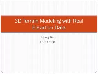
3D Terrain Modeling with Real Elevation Data
3D Terrain Modeling with Real Elevation Data. Qiang Gao 10/13/2009. A Terrain Snapshot from Demo. A Terrain Snapshot from Demo (Wire Frame View). We meet terrain modeling technologies everywhere……. Video Games (Flight Simulator): Online (real-time) rendering;

3D Terrain Modeling with Real Elevation Data
E N D
Presentation Transcript
3D Terrain Modeling with Real Elevation Data QiangGao 10/13/2009
We meet terrain modeling technologies everywhere…… • Video Games (Flight Simulator): • Online (real-time) rendering; • Randomly create height (elevation) map; • Performance is a big issue; • Cartoons or Movies with special effects (The Lord of Rings): • Offline rendering; • Higher quality; • Time-consuming;
We are talking about…… • Online (real-time) rendering; • Real elevation data (non-randomly created data); • Use ranged random elevation data to improve the quality.
The Issues involved • Geometry: • (Longitude, Latitude), plus Elevation • Texturing: • Procedural Technique • Lighting • Viewpoint (camera)
Case Study Location: Terrain View From Google Map 42.49933,-78.61354
Where to get the real elevation data? • USGS: • Download from the National Map Seamless Server (http://seamless.usgs.gov/index.php) • Use web service:
The data from USGS Server • (NED) 1 arc second data (about 10 meters) • NED: National Elevation Database • Format: GeoTiff • Resolution: 128 X 128
Higher Resolution? • From 128 X 128 to 2048 X 2048
Geo-Mapping + =
CLOD Algorithm • What is CLOD? • Continuous Level of Detail • Why CLOD? • Performance issue; • Basic Idea: • The basic ideas of CLOD is that we want to add more detail (more triangles) where it is needed. • The closer, the more details needed; • The more chaotic, the more details needed;
Lighting • Height-Based Lighting: • lighting based off the height of a vertex. • It is simple, however, unrealistic. • Lightmapping: • A lightmap is exactly like a, except that instead of having information for heights, the lightmap contains only lighting information. • Slope Lighting: • shades vertices according to their height in relation to a nearby vertex. • Simple and more realistic.
References • 1. Trent Polack. 2002. Focus On 3D Terrain Programming. • 2. David S. Ebert et al. 2006. Texturing and Modeling: A Procedural Approach. • 3. Adrian G. Bors, Edwin R. Hancock and Richard C. Wilson. Terrain Modeling in Synthetic Aperture Radar Images using Shape-from-Shading. • 4. Richard C. Wilson and Edwin R. Hancock. Terrain Reconstruction with an Adaptive Surface Mesh. • 5. http://en.wikipedia.org/wiki/Wiki • 6. http://seamless.usgs.gov/index.php
Thank you! • Questions and Comments?