Download
1 / 28
280 likes | 398 Vues
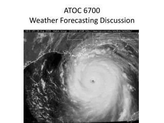
This weather discussion reviews conditions from the evening of May 17 to the morning of May 19, 2011. A persistent blocking pattern limited low-pressure movement, slowly breaking down by Thursday, allowing dry air from the southwest. Low-pressure systems shifted east across Pennsylvania, leading to increased cloudiness and isolated showers in central North Carolina. The forecast indicated limited instability but potential for scattered showers, particularly in the eastern locations. Area temperatures were adjusted upward in light of decreased cloud cover.

E N D
Weather Discussion Evening May 17 2011-Morning May19 2011
Summary • Tues 5/17 (Evening)- Blocking on 500mb map keeps lows in our area • Wed 5/18- Continuing of broad areas of low pressure; trough associated with lows moves NE and dry air moves in from SW • Thurs 5/19- Blocking begins to break down with low pressure systems shifting eastward
Interesting observation… • .NEAR TERM /THROUGH FRIDAY/... -- Changed Discussion -- • AS OF 1130 AM THURSDAY... PERSISTENT BLOCKING PATTERN CONTINUES TO SLOWLY BREAK DOWN WITH THE DEEP LOW PRESSURE SYSTEM BEGINNING TO SHIFT EAST ACROSS PA. ENHANCED MID AND HIGH CLOUDINESS ALONG WITH A FEW SPRINKLES MOVED ACROSS CENTRAL NC THIS AM AND IS REACHING THE COAST AT THIS HOUR. A BREAK IN THE CLOUDS IS EVIDENT ACROSS THE FOOTHILLS AND W PIEDMONT. THIS BREAK WILL SHIFT EAST THROUGH MID AFTERNOON WITH SOME SCTCUMULUS REDEVELOPMENT LIKELY. ONE MORE DISTURBANCE WILL MOVE ACROSS VA AND NORTHERN NC THIS AFTN AND EVENING AND MAY PRODUCE AN ISOLATED SHOWER OR SPRINKLE. VARIOUS HIGH RES WRF SIMULATIONS SUGGEST THAT SCT SHOWERS ARE POSSIBLE LATE THIS AFTN AND EARLY THIS EVENING. WRF RUNS OVER HYPED THE CONVECTIONPROGGED FOR WEDNESDAY AFTN AND EVE AND FEEL THEY MAY BE TOO EXCITED TODAY AS INSTABILITY IS RATHER LIMITED AND FORCING IS MODEST.SFCDEW POINTS SHOULD REMAIN IN THE LOW/MID 50S WHICH SHOULD LIMIT/PERHAPS PRECLUDE CONVECTION. FORECAST BUFR SOUNDINGS INDICATE SOME CAPPING ACROSS THE WESTERN HALF OF THE CWA THIS AFTERNOON WHICH SHOULD KEEP ANY CONVECTION SHALLOW...LESS CAPPING IS EXPECTED ACROSS THE EASTERN LOCATIONS WHICH COULD SUPPORT BETTER ALBEIT ISOLATED COVERAGE. HAVE TRIMMED POPS BACK TO SLIGHT CHANCE/ISOLATED RANGE EVERYWHERE AND REDUCED TEMPORAL COVERAGE OF SHOWERS. GIVEN LESS CLOUDINESS AND PRECIP AND WITH A DEVELOPING LOW LEVEL WARM ADVECTION PATTERN...HAVE ADJUSTED MAX TEMPS UPWARD A DEGREE OR SO INTO THE 75-82 DEGREE RANGE. -BLAES
May 21st… • Judgment day? • World wide earthquakes, floods, chaotic weather