Download

1 / 38
380 likes | 403 Vues
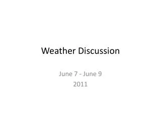
Weather Discussion..Halloween. Big Change. TREAT. Frontal Passage, “Windstorm”, Convergence Zone, Pass Snowstorm, and Arctic Front. Snoqualmie Pass Snowstorm of October 29, 2006. By Associated Press

E N D
Frontal Passage, “Windstorm”, Convergence Zone, Pass Snowstorm, and Arctic Front
By Associated Press • SEATTLE - Interstate 90 was closed for hours Sunday at Snoqualmie Pass after heavy snow and hail iced the roads, causing a series of collisions. • It was the first heavy snow of the season, and the first snow-related road closure this fall, the state Department of Transportation reported. • The Washington State Patrol ordered the closure in both directions at 3:30 p.m. Transportation Department spokeswoman Lauren Chudecke said more than a dozen cars were stranded sideways, in the ditch or on the median.At 8 p.m. - after agency trucks were dispatched from the Seattle area carrying chemicals to melt roadway ice - Chudecke reported one lane open in each direction.By 8:45 p.m., all lanes were open in both directions, she said, but motorists were advised to expect delays due to congestion. Traction tires were advised and oversized vehicles were prohibited.
A brief but fierce storm with wind gusts clocked at more than 50 miles per hour swept through New York, New Jersey and Connecticut yesterday, blacking out, at least temporarily, hundreds of thousands of people. The storm also hobbled passenger service on parts of the Long Island Rail Road and delayed flights by as much as two and a half hours. Still, unlike the prolonged aftermath caused by the remnants of Tropical Storm Ernesto in September and the heat wave in July, utilities reported rapid restoration of service under quickly clearing skies. The storm cut a huge circular swath of some 400 miles, meteorologists said. “It was not a northeaster,” which tends to track the East Coast, said Fred Gadomski, a meteorologist at Pennsylvania State University. “It was more of a southeaster, which began in the interior, in Tennessee. But it was a big sprawling storm that is going to hang around southeastern Canada.” At Kennedy International Airport, wind speeds were clocked at 54 m.p.h. at 9:30 a.m. and at 53 m.p.h. at Groton, Conn. The ferocious wind swept Connecticut throughout the night and morning, whipping up whitecaps on New Haven Harbor, and leaving the Connecticut River brown and swollen. In some towns, the wind stripped away the brightest of the fall foliage, leaving piles of sodden red and orange leaves on roads and in backyards. The Port Authority of New York and New Jersey, which operates the biggest airports in the region, reported widespread air traffic delays. Aircraft headed into La Guardia Airport, for example, were delayed an average of 2 hours and 25 minutes in the early afternoon, and the airport was still reporting wind delays in the evening. Long Island, where winds knocked down hundreds of trees and power lines, was the worst hit in the area. At the storm’s peak, around noon, the Long Island Power Authority reported nearly 80,000 customers, perhaps a quarter of a million people, without power. But by 5:30 p.m., it was reporting that the number had dropped to about 15,000 customers. Richard M. Kessel, LIPA’s chairman, said at a news conference yesterday that some customers were impatient. “Someone called this morning and said there was nobody working in their neighborhood,” Mr. Kessel said, “but they called back and said the lights came on 10 minutes later. That means someone was there working.” Mr. Kessel said 650 LIPA employees were working 16-hour shifts to replace poles, repair power lines and remove trees from LIPA facilities. On the Long Island Rail Road, hundreds, perhaps thousands, of passengers were inconvenienced because of the storm. Sam Zembuto, a railroad spokesman, said a tree fell on the tracks in Queens at the height of the storm around 10 a.m. and then a LIPA power line was knocked down in Great Neck, damaging a signal system. The Port Washington line experienced cancellations and delays of two hours or more, he said. Buses were used to take passengers at Great Neck and stations east of there to Bayside, Queens. “But it’s taking time to repair everything because of damage to the signal system,” Mr. Zembuto said. Consolidated Edison reported fewer than 400 customers without power at some point yesterday in New York City, and 2,500 customers in Westchester County. In Connecticut, Connecticut Light and Power reported nearly 18,000 customers without power at noon, but said the number had dropped to 1,438 by 11:05 p.m. Similarly, Public Service Enterprise Group in New Jersey reported that several thousand customers were out of power at the peak of the storm and that the number had dropped to about 1,400 by 5:30 p.m. A power problem, however, that was unrelated to the weather accounted for more than 10,000 customers in the Trenton area losing power shortly before midnight Friday. It knocked out service briefly to the State House and other government offices as well as The Trenton Times. Workers were still trying to determine the cause.
Recent Evolution of Equatorial Pacific SST Departures Time Longitude
Niño Indices: Recent Evolution The latest weekly SST anomalies are positive (between +1.0C and +1.4C) in all of the Niño regions.
Average SST Departures in the Tropical Pacific: Last 4 Weeks • Equatorial ocean surface temperatures were greater than 0.5ºC above average across the equatorial Pacific between 165ºE and the South American coast. Departures exceeded +1ºC between 170ºE and 145ºW, and between 80ºW and 125ºW. • 1-28 October 2006
Niño 3.4 evolution – Comparison for El Niño episodes Recent Niño 3.4 values, derived from ERSST.v2, lie in the lower half of the distribution of historical El Niño episodes since 1950. Most recent Niño 3.4 values (heavy black line) compared to values for 14 historical El Niño episodes. On the time axis year 0001 is the first year of a warm episode.
Pacific Niño 3.4 SST Outlook • Most statistical and coupled model forecasts indicate weak or moderate El Niñoconditions through April-June 2007. Figure provided by the International Research Institute (IRI) for Climate and Society (updated 18 October 2006).