Mastering Compass Traverses for Precision Mapping
Learn about the compass traverse technique used in forestry and historical expeditions for accurate mapping. Explore the importance of magnetic declination, distance measurements, and tools like tape measures and laser range finders. Enhance your mapping skills with the total station technology.

Mastering Compass Traverses for Precision Mapping
E N D
Presentation Transcript
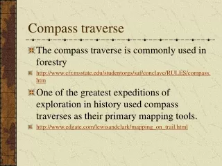
Compass traverse • The compass traverse is commonly used in forestry • http://www.cfr.msstate.edu/studentorgs/saf/conclave/RULES/compass.htm • One of the greatest expeditions of exploration in history used compass traverses as their primary mapping tools. • http://www.edgate.com/lewisandclark/mapping_on_trail.html
The Forks of the Missouri sketched by Capt. Wm. Clark.. Note the grid base, the transect data and the features sketched along the river (bluffs, meanders, islands etc.)
course distance comments South 1 1/2 to a point on the Stard [starboard or right] Side S 28º W 2 1/4 to a rock resembling a tour [tower] in the Stard [Starboard] bend S 10º E 1 3/4 to the Stard. point passing a rapid S 60º W 3/4 to a tree in the Std [Starboard] bend rocks & rapds [rapids] all the dist[ance] South 3/4 to some bushes on a Lard [larboard or left side] point passed a large Creek at 1/2 a mile on the Lard. Side which we called Shield's Creek A portion of the field notes for a daily compass traverse recorded by Capt. Wm. Clark
Orienteering as a sport…. http://www.orienteering.org/ http://www.us.orienteering.org/ http://www.williams.edu/Biology/orienteering/o~index.html http://www.learn-orienteering.org/ Using the map and compass to ‘wander around’ in the backside of the world!
A compass does not always point north! The degree to which a compass points a direction OTHER than north… is called magnetic declination
In order to make accurate maps using a compass it is essential to understand how the compass can be deceived, and the natural distortions inherent in the earth’s magnetic field. Lines of equal magnetic declination are called agonic lines..Note the magnetic declination lines in North Alabama are very close to 0
… measuring distance with the human body… The pace is the standard measure used by field workers… it can be a highly accurate tool for distance measurements.
OTHER TOOLS FOR MEASURING DISTANCE: The survey chain, 33 or 66 feet long, forged iron (fair dimensional stability) … THE tool for original survey work.
Tape • Tape measures, made possible by the development of new materials, mylar or steel strips. Tapes are accurate, and awkward.
Measuring wheel • Measuring wheel, accurate and can be used by a one man crew. Mechanical counters have been replaced by electronic counters. Fairly common.
Parallax range finder • Parallax range finder uses the principle of parallax to estimate distance based on the path of light from an object. Camera range finders work on this principle.
Laser Range finder • the big time. Highly accurate, no problems with dimensional stability, the basis for modern survey practice! Send a laser pulse to a target… and measures the time required to for the reflection to return to the observer.
The laser total station combines a laser based distance measuring device with a highly accurate device to measure angles (vertical and horizontal) • The total station can convert all field observations into a data file which can be downloaded directly into a computer mapping application.