Download
1 / 17
170 likes | 326 Vues
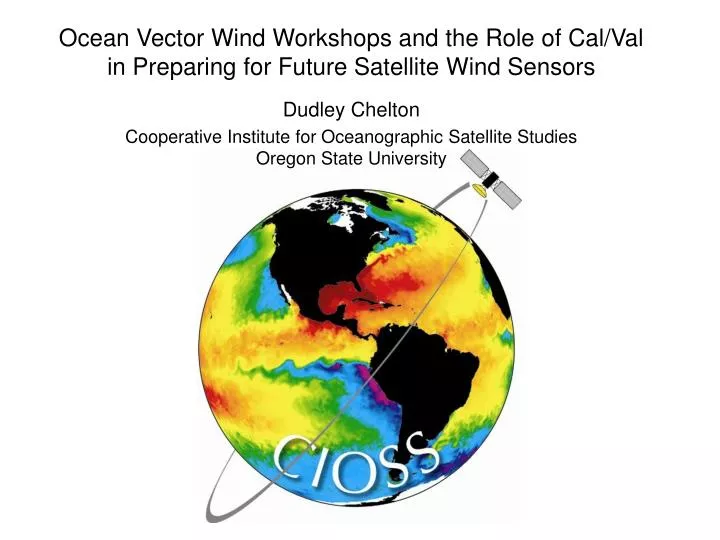
Ocean Vector Wind Workshops and the Role of Cal/Val in Preparing for Future Satellite Wind Sensors Dudley Chelton Cooperative Institute for Oceanographic Satellite Studies Oregon State University. The Future of Satellite Measurements of Ocean Vector Winds

E N D
Ocean Vector Wind Workshops and the Role of Cal/Val in Preparing for Future Satellite Wind Sensors Dudley Chelton Cooperative Institute for Oceanographic Satellite Studies Oregon State University
The Future of Satellite Measurements of Ocean Vector Winds NOAA and DoD have adopted the Conical Microwave Imager/Sounder (CMIS) polarimetric radiometer as the sensor for satellite measurements of ocean vector winds on NPOESS. In preparation for NPOESS, the U.S. Navy launched the WindSat polarimetric radiometer in January 2003 as a “risk reduction demonstration project.” Note that CMIS is not identical to WindSat : - higher instrument noise; polarimetric at 18.7 GHz only; somewhat different incidence angle; … - wider swath width (~1700 km, compared with ~900 km for WindSat) The Concern The detailed measurement characteristics of polarimetric estimates of ocean vector winds that are of interest to the research community (and the operational community) are presently unknown. Although the research community was not involved in the planning of future satellite measurements of ocean vector winds, there is an opportunity to participate in Cal/Val activities for both WindSat and CMIS.
The Role of CIOSS CIOSS can play an important role in assuring the best possible quality in the WindSat and CMIS polarimetric measurements of ocean vector winds through a 3-pronged approach: • Organize a series of workshops to facilitate communication between the research and operational communities and to clarify the requirements for both communities. • Carry out Cal/Val activities to quantify the accuracy of WindSat (and later, CMIS) polarimetric estimates of vector winds through comparisons with collocated, high-quality observations from the NASA QuikSCAT scatterometer. • Produce new vector wind data products that are useful for both the research and the operational communities.
WIND MEASUREMENTS: Mission Schedules WindSat History - January 6, 2003: Launch date. - July 30, 2004: First 6 months of data released (September 2003 – February 2004). - February 13, 2005: Operations halted on because of a failure in the Bearing and Power Transfer Assembly (BAPTA) that resulted in increased satellite yaw rates. - June 15, 2005: Operations restored. Note gap in U.S. satellite measurements of ocean vector winds between QuikSCAT/WindSat and CMIS
Satellite Measurements of Ocean Vector Winds: Present Capabilities and Future Potential A workshop co-sponsored by CIOSS and NASA Organized by D. Chelton and M. Freilich, OSU/CIOSS 8-10 February 2005 Florida International University/NOAA Tropical Prediction Center • Objectives: • Review and refine satellite vector wind measurement requirements. • Identify new data products that can be generated from QuikSCAT, WindSat, ASCAT and SAR wind measurements. • Identify scientific studies and operational applications that require data with enhanced resolution, sampling and/or accuracy than can presently be obtained.
Attendees (65 total) 27 from Academia, International and Industry 27 from NOAA and the Naval Research Lab 11 from NASA and JPL Summary of the Agenda Day 1 Programmatic Perspectives (5 talks) Overviews of Missions, Data Products, and Operational Uses (invited, 9 talks) Day 2 Operational Marine Prediction (3 talks) Tropical Cyclone Prediction (4 talks) WindSat (3 talks) QuikSCAT Winds in Extreme Conditions & Rain (4 talks) Discussion Day 3 Research Applications (5 talks) Discussion and Writing Assignments (report due Fall 2005) Poster Session (10 posters)
Surface Analysis without QuikSCAT From Rick Knabb, Tropical Prediction Center
Surface Analysis without QuikSCAT From Rick Knabb, Tropical Prediction Center
Surface Analysis with QuikSCAT From Rick Knabb, Tropical Prediction Center
The overly aggressive rain flag in this early version of the WindSat data has been fixed. But note that, at best, WindSat sampling is only about half that of QuikSCAT.
WindSat: Selected NDBC Validation Locations (22) From Mike Freilich, CIOSS/OSU
Windsat & QSCAT (dir. edit) vs. NDBC -- Rain-Free 50 km distance threshold, Non-Raining From Mike Freilich, CIOSS/OSU • WindSat directional errors are: • Larger than QuikSCAT for wind speeds below about 10 m/s • Slightly smaller than QuikSCAT for wind speeds above about 15 m/s • Note: There were very few collocations in conditions with wind speeds above ~17 m/s
QuikSCAT - WindSat Pairwise Global Collocations There is a 20 m/s saturation of WindSat retrievals of high wind speeds. This WindSat underestimate of high wind speeds was not apparent from the buoy comparisons because of the small number of collocations above 17 m/s. From Mike Freilich, CIOSS/OSU
Selected direction (rel to N.) WindSat & QuikSCAT Directional Distributions Unrealistic wind direction histogram for WindSat (discontinuities near ±90º). Collocated global QuikSCAT and WindSat, non-raining conditions From Mike Freilich, CIOSS/OSU
Summary • The high-quality QuikSCAT dataset is providing extensive global calibration and validation of WindSat polarimetric estimates of ocean vector winds. • WindSat Issues: • - Sampling is only about half that of QuikSCAT • - Saturation of high wind speeds at ~20 m/s • - Lower directional accuracy than QuikSCAT at wind speeds below ~10 m/s • - Other directional retrieval issues (discontinuities in histogram) • The extent to which these issues will affect research and operational uses of WindSat and CMIS data is not yet known. • Workshops as a means of facilitating communication between the research and operational communities yield valuable clarification of the wind measurement requirements for both communities. • Presentations of operational applications and Cal/Val results when representatives of both communities are present flush out issues that are not otherwise addressed.
Concerns for the Future • There will be a gap in the data record of high-quality satellite measurements of ocean vector winds after QuikSCAT & WindSat. • QuikSCAT data will not be available for global calibration and validation of the NPOESS CMIS estimates of ocean vector winds. • There are differences between the CMIS and WindSat instruments. • Primary concerns: • - CMIS has higher instrument noise. • - CMIS measures polarimetric radiances at 18.7 GHz only, whereas WindSat measures • polarimetric radiances at 10.7, 18.7 and 37 GHz. • - CMIS measures at a somewhat different incidence angle => WindSat vector wind retrieval algorithms will have to be recalibrated for the CMIS incidence angle.