Download
1 / 24
290 likes | 755 Vues
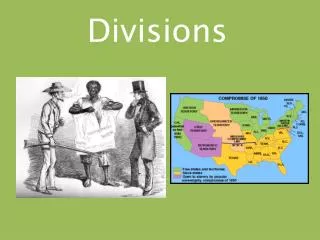
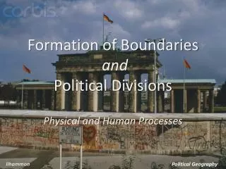
Formation of Boundaries and Political Divisions. Physical and Human Processes. llhammon. Political Geography. Political Regions. Governments establish clear boundaries so that they may assert their authority . This area is known as a political region or political unit .

E N D
Formation of Boundariesand Political Divisions Physical and Human Processes llhammon Political Geography
Political Regions • Governments establish clear boundaries so that they may assert their authority. • This area is known as a political region • or political unit. • Boundaries between countries are • known as borders. • Countries have several levels of government (e.g. cities, counties, or states (provinces) ). • Overlapping can occur within these units with authority. • An area may belong to more than one political region as it can belong more than one physical/cultural region. • Boundaries between states can be the product of historical circumstances or political agreements. •A national government is sovereign, or supreme, within its own borders.
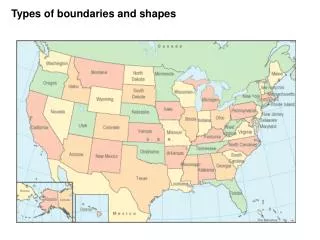
TYPES OF BOUNDARIES •GEOMETRIC •PHYSICAL/POLITICAL •CULTURAL/POLITICAL • ANTECEDENT • SUBSEQUENT • SUPERIMPOSED • RELIC /RELICT Great Wall of China
GEOMETRIC • Straight line or curved boundaries • Totally unrelated to any aspects of the cultural or physical landscape. • Ex: African nations, borders between US and Canada to the west of the Great Lakes
PHYSICAL-POLITICAL • Conform to physiographic features in the landscape such as rivers or mountain ranges • Ex: Rio Grande, Pyrenees (shown – b/t Spain and France); Great Lakes of Africa and N. America; Himalaya in South Asia
CULTURAL-POLITICAL • Mark breaks in the human landscape • Ex: Israel/Egypt (shown); Christian Armenia and Muslim Azerbaijan; new borders of SE Europe/Balkans; Greek/Turk division in Cyprus (shown)
Origin Based classifications • •Antecedent : • Boundary formed before present-day human landscape developed • Can be seen on population maps • Ex: Borneo boundary b/t Indonesia and Malaysia (shown)
•Subsequent: • These are installed after settlement - but take into account cultural/ethnic/religious/ • language differences. • Some conflict - but minimized • Shows a long process of boundary modifications. • Ex: Border b/t China and Vietnam (shown)
•Superimposed: • Forcibly drawn with no regard to culture. • colonial boundaries and truce lines • Ex: Indonesia and Papua New Guinea, many former colonies in Africa, • Berlin Wall (shown) • *Wall that is being built b/t US/Mexico *Wall being built b/t Israel and Palestinian lands Berlin Wall
•Relic: boundaries that are not currently relevant but have been in the past - and have important cultural/social implications. • Ex: Former boundary b/t North and South Vietnam (shown); • East and West Germany
What Type of Boundary ? antecedent superimposed Physical/Political Cultural-Political subsequent Geometric relic
Political Regions/Units •Size and Shapes of a country •Identifying characteristics: ◊Compact ◊ Fragmented ◊ Protruded ◊ Elongated ◊ Perforated State Perforated State
•Compact State •States that are roughly circular in shape. Cambodia
•Fragmented States •States are split into two or more parts, often separated and isolated by international waters. •Non-contiguous parts Ex: Malaysia, Indonesia, Philippines (shown) in SE Asia; Hawaiian Islands in the United States Philippines
•Protruded States •States that exhibit long, narrow extensions. •This protruding land extension is from a more compact core area. Ex: Thailand (shown) and Myanmar (Burma) Thailand
•Elongated States •States that are at least six times longer than their average widths Ex: Vietnam, Chile (shown); state of California in United States Chile
•Perforated States •States that totally surround the territory of other states, so that they have a “hole” in them. •Most are small enclaves. Ex: Vatican City which perforates Italy; Lesotho within South Africa (shown) Lesotho
Buffer Zone •Set of countries/areas separating ideological or political adversaries (enemies). Ex: Southern Asia – Afghanistan, Nepal, and Bhutan were parts of a buffer zone between British and Russian-Chinese imperial spheres; Thailand was a buffer state between British and French colonial domains in mainland SE Asia Peninsula that serves as buffer zone between North /South Korea
Shatter Belt •Region caught between stronger, colliding external cultural-political forces, under persistent stress and often fragmented by aggressive rivals. Ex: Eastern Europe and Southeast Asia
What Type of State? Elongated Protruded Compact Perforated Fragmented
International Relations and the “Balance of Power” • Many physical and human factors influence a government’s ability to control territory and influence international events. • The main point of the “balance of power” is to manage and limit conflict among the most powerful nations. • The amount of power that the largest states have should • not become too unequal. The size of the country. The country’s physical features. The population of the country. The country’s wealth (economy). Educational Level of the country’s citizens. A country’s military strength.
The World’s Major Powers • These countries have an influence on international relations because they have either: • Powerful armed forces, • large populations and, • a dynamic economy. • Many of these countries have all three of these characteristics. China United States Japan Russia
The Balance of Power International Organizations • United Nations is an organization of all the sovereign nation states in the world. • Established after WWII, it is to promote peace, prevent war, and encourage development in all nations. • All member states belong to the General Assembly. • Some very powerful states like, US, China, Russia, United Kingdom and France belong to the UN Security Council. • Their power is to send in UN peace keeping forces to areas of conflict around the world. The United Nations
European Union • The EU is an economic and political union of member states. • The EU forms a large area in which people and goods can pass freely. • The members also cooperate on many matters • They follow EU directives and regulations. • They use the EURO (common currency); • Citizens of member states elect representatives to a European Parliament in Strasbourg, France.