Download
1 / 69
690 likes | 827 Vues
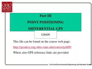
Part III POINT POSITIONING DIFFERENTIAL GPS. GS609. This file can be found on the course web page: http://geodesy.eng.ohio-state.edu/course/gs609/ Where also GPS reference links are provided. GPS Positioning (point positioning with pseudoranges). r 2. r 1. r 4. r 3. signal transmitted.

E N D
Part III POINT POSITIONING DIFFERENTIAL GPS GS609 This file can be found on the course web page: http://geodesy.eng.ohio-state.edu/course/gs609/ Where also GPS reference links are provided
GPS Positioning(point positioning with pseudoranges) r2 r1 r4 r3 signal transmitted signal received Dt range, r = cDt
Point Positioning with Pseudoranges • Assume that ionospheric effect is removed from the equation by applying the model provided by the navigation message, or it is simply neglected • Assume that tropospheric effect is removed from the equation by estimating the dry+wet effect based on the tropospheric model (e.g., by Saastamoinen, Goad and Goodman, Chao, Lanyi) • Satellite clock correction is also applied based on the navigation message • Multipath and interchannel bias are neglected • The resulting equation : corrected observable
Point Positioning with Pseudoranges • Linearized observation equation • Geometric distance obtained from known satellite coordinates (broadcast ephemeris) and approximated station coordinates • Objective: drive (“observed – computed” term) to zero by iterating the solution from the sufficient number of satellites (see next slide)
Point Positioning with Pseudoranges • Minimum of four independent observations to four satellites k, l, m, n is needed to solve for station i coordinates and the receiver clock correction • Iterations: reset station coordinates, compute better approximation of the geometric range • Solve again until left hand side of the above system is driven to zero
In the case of multiple epochs of observation (or more than 4 satellites) Least Squares Adjustmentproblem! • Number of unknowns: 3 coordinates + n receiver clock error terms, each corresponding to a separate epoch of observation 1 to n
Point Positioning with Pseudoranges Point Positioning with Pseudoranges • Minimum of three independent observations to three satellites k, l, m is needed to solve for station i coordinates when the receiver clock error is neglected • Iterations: reset station coordinates, compute better approximation of the geometric range • Solve again until left hand side of the above system is driven to zero
If point is occupied for a longer period of time receiver clock error will vary in time, thus multiple estimates are needed • New clock correction is estimated at every epoch for total of n epochs • Multiple satellites are observed at every epoch (can vary from epoch to epoch) • Superscripts 1,2,…,n denote epochs; thus rows in the above system represent a single epoch (all m satellites observed at the epoch) in the form of eq. (1) two slides back • [c] is a column of c with the number of rows equal the number of satellites, m, observed at the given epoch
In the case of multiple epochs of observation (or more than 4 satellites) adjustment problem! • Number of unknowns: 3 coordinates + n receiver clock error terms, each corresponding to a separate epoch of observation 1 to n • Rewrite eq. (2) using matrix notation Y is a vector of “observed – computed” A is a design matrix of partial derivatives is a vector of unknowns is a white noise vector Where is the observation standard deviation, uniform for all measurements
Rearranging terms in eq. (2) leads to a simplified form of a design matrix A, and subsequently to a normal matrix easy to handle by Gaussian elimination Bj=[1 1 1 … 1]T where the number of 1 equal to the number of satellites (1,…,m) observed at epoch j (j=1,…,n)
Rewrite eq. (3) in the following form: • Where is a vector of unknown station coordinates [Xi Yi Zi] and matrices Ai (size (m,3)) are of the form of (1a), written for m satellites (ranges) observed at the epoch • yj is a m-element vector of the form where j is the epoch between 1 and n • Final system of normal equations following from eq. (3) Where m is number of observations at one epoch VERIFY !
Dilution of Precision • Accuracy of GPS positioning depends on: • the accuracy of the range observables • the geometric configuration of the satellites used (design matrix) • the relation between the measurement error and the positioning error: pos = DOP• obs • DOP is called dilution of precision • for 3D positioning, PDOP (position dilution of precision), is defined as a square root of a sum of the diagonal elements of the normal matrix (ATA)-1 (corresponding to x, y and z unknowns)
Receiver Dilution of Precision PDOP is interpreted as the reciprocal value of the volume of tetrahedron that is formed from the satellite and user positions Receiver Bad PDOP Good PDOP Position error p= r PDOP, where r is the observation error (or standard deviation)
Dilution of Precision • The observation error (or standard deviation) denoted as r or obs is the number that best describes the quality of the pseudorange (or phase) observation, thus is is about 0.2 – 1.0 m for P-code range and reaches a few meters for the C/A-code pseudorange. • Thus, DOP is a geometric factor that amplifies the single range observation error to show the factual positioning accuracy obtained from multiple observations • It is very important to use the right numbers for r to properly describe the factual quality of your measurements. • However, most of the time, these values are pre-defined within the GPS processing software (remember that Geomatics Office never asked you about the observation error (or standard deviation)) and user has no way to manipulate that. This values are derived as average for a particular class of receivers (and it works well for most applications!)
Dilution of Precision • DOP concept is of most interest to navigation. If a four channel receiver is used, the best four-satellite configuration will be used automatically based on the lowest DOP (however, most of modern receivers have more than 4 channels) • This is also an important issue for differential GPS, as both stations must use the same satellites (actually with the current full constellation the common observability is not a problematic issue, even for very long baselines) • DOP is not that crucial for surveying results, where multiple (redundant) satellites are used, and where the Least Squares Adjustment is used to arrive at the most optimal solution • However, DOP is very important in the surveying planning and control (especially for kinematic and fast static modes), where the best observability window can be selected based on the highest number of satellites and the best geometry (lowest DOP); check the Quick Plan option under Utilities menu in Geomatics Office
Differential GPS (DGPS) • DGPS is applied in geodesy and surveying (for the highest accuracy, cm-level) as well as in GIS-type of data collection (sub meter or less accuracy required) • Data collected simultaneously by two stations (one with known location) can be processed in a differential mode, by differing respective observables from both stations • The user can set up his own base (reference) station for DGPS or use differential services provided by, for example, Coast Guard, which provides differential correction to reduce the pseudorange error in the user’s observable
DGPS: Objectives and Benefits • By differencing observables with respect to simultaneously tracking receivers, satellites and time epochs, a significant reduction of errors affecting the observables due to: • satellite and receiver clock biases, • atmospheric as well as SA effects (for short baselines), • inter-channel biases • is achieved
Differential GPS Using data from two receivers observing the same satellite simultaneously removes (or significantly decreases) common errors, including: • Selective Availability (SA), if it is on • Satellite clock and orbit errors • Atmospheric effects (for short baselines) Base station with known location Unknown position Single difference mode
Differential GPS Using two satellites in the differencing process, further removes common errors such as: • Receiver clock errors • Atmospheric effects (ionosphere, troposphere) • Receiver interchannel bias Base station with known location Unknown position Double difference mode
Consider two stations i and j observing L1 pseudorange to the same two GPS satellites k and l:
Consider two stations i and j observing L1 phase range to the same two GPS satellites k and l:
Let’s consider differential pseudoranging first • The single-differenced (SD)measurement is obtained by differencing two observable of the satellite k , tracked simultaneously by two stations i and j: • It significantly reduces the atmospheric errors and removes the satellite clock and orbital errors; differential effects are still there (like iono, tropo and multipath, and the difference between the clock errors between the receivers) • In the actual data processing the differential tropospheric and multipath errors are neglected, while remaining ionospheric, differential clock error, and interchannel biases might be estimated (if possible)
DGPS in Geodesy and Surveying • The single-differencedmeasurement is obtained by differencing two observables of the satellite k , tracked simultaneously by two stations i and j: Non-integer ambiguity !
DGPS Concept, cont. • By differencing one-way observable from two receivers, i and j, observing two satellites, k and l, or simply by differencing two single differences to satellites k and l, one arrives at the double-differenced(DD)measurement: Two single differences Double difference • In the actual data processing the differential tropospheric, ionospheric and multipath errors are neglected; the only unknowns are the station coordinates
Differential Phase Observations Two single differences Double difference Single difference ambiguity
DGPS in Geodesy and Surveying • By differencing one-way observable from two receivers, i and j, observing two satellites, k and l, or simply by differencing two single differences to satellites k and l, one arrives at the double-differencedmeasurement:
Differential Phase Observations • Double differenced (DD) mode is the most popular for phase data processing • In DD the unknowns are station coordinates and the integer ambiguities • In DD the differential atmospheric and multipath effects are very small and are neglected • The achievable accuracy is cm-level for short baselines (below 10-15 km); for longer distances, DD ionospheric-free combination is used (see the future notes for reference!) • Single differencing is also used, however, the problem there is non-integer ambiguity term (see previous slide), which does not provide such strong constraints into the solution as the integer ambiguity for DD
Triple Difference Observable Differencing two double differences, separated by the time interval dt provides triple-differenced measurement, that in case of phase observables effectively cancels the phase ambiguity biases, N1 and N2 In both equations the differential effects are neglected and the station coordinates are the only unknowns
Note: Observed phases (in cycles) are converted to so-called phase ranges (in meters) by multiplying the raw phase by the respective wavelength of L1 or L2 signals • Thus, the units in the above equations are meters! • Positioning with phase ranges is much more accurate as compared to pseudoranges, but more complicated since integer ambiguities (such as DD ambiguities) must be fixed before the positioning can be achieved • Triple difference (TD) equation does not contain ambiguities, but its noise level is much higher as compared to SD or DD, so it is not recommended if the highest accuracy is expected
2 (base) 4 3 1 St. 1 St. 2 Positioning with phase observations: A Concept
Positioning with phase observations: A Concept • Three double difference (based on four satellites) is a minimum to do DGPS with phase ranges after ambiguities have been fixed to their integer values • Minimum of five simultaneously observed satellites is needed to resolve ambiguities • Thus, ambiguities must be resolved first, then positioning step can be performed • Ambiguities stay fixed and unchanged until cycle slip (CS) happens
Covariance Matrix for Phase Combination Four single differences Three double differences Where A is a differencing operator matrix
DD differencing operator • Thus DD covariance matrix is a full matrix for one epoch • For several epochs – it will be a block diagonal matrix
We have talked so far about single, double and triple differences of GPS observable (predominantly phase), which are nothing else but linear combinations of direct measurements. These linear combinations become very handy in removal (or at least significant reduction) of various error sources and nuisance parameters, making positioning process rather simple (at least for short baselines). Keep in mind that the covariance matrix becomes more complicated, but that is a small price to pay for a limited number of unknowns offered in double differencing! • There are, however, even more “advanced” linear combinations whose specific objectives would be to further eliminate some errors that might still be present in differential form in the, for example, double difference equation, and to simplify (or enable) certain actions – such as ambiguity resolution (we know that ambiguities must be resolved before we can do positioning with GPS phase observations). • So, let’s take a look at some of the most useful linear combinations (you can create any combination you like, the point is to make it in a smart way so that it would make your life easier!
Useful linear combinations • Created usually from double-differenced phase observations • Ion-free combination based on L1 and L2 observable eliminates ionospheric effects (actually, the first order only) • Ion-only combination based on L1 and L2 observable, (useful for cycle slip tracking) eliminates all effects except for the ionosphere, thus can be used to estimate the ionospheric effect • Widelane – its long wavelength of 86.2 cm supports ambiguity resolution; based on L1 and L2 observable
Ionosphere-free combination • ionosphere-freephasemeasurement • similarly, ionosphere-free pseudorange can be obtained • The conditions applied are that sum of ionospheric effects on both frequencies multiplied by constants to be determined must be zero; second condition is for example that sum of the constants is 1, or one constant is set to 1 (verify!)
Ionosphere-free combination Take the ionospheric terms on L1 and L2 and assume that they meet the following conditions (where 1 and 2 are the “to be determined” coefficients defining the iono-free combination: However, we only considered the 1st order ionospheric term here!
L1 L2 Residual Range Error First Order: 1/f 2 16.2 m 26.7 m 0.0 Second Order: 1/f 3 ~ 1.6 cm ~ 3.3 cm ~ -1.1 cm Third Order: 1/f 4 ~ 0.86 mm ~ 2.4 mm ~ -0.66 mm Calibrated 1/f 3Term Based on a Thin Layer Ionospheric Model ~ 1-2 mm • Estimated ionospheric group delay for GPS signal (see the table) • The first order effects are most significant • In the phase/range equation we use only 1st order ionospheric terms • Thus the iono-free combination is in fact only ion 1st order iono-free The phase advance can be obtained from the above table by multiplying each number by -1, -0.5 and -1/3 for the 1/f 2, 1/f 3 and 1/f 4 term, respectively
Integration of the refractive index renders the measured range, and the ionospheric terms for range and phase (see earlier notes) • Denoting the 1st and 2nd order iono term as follows (after the integration, in cycles; a and be are constants): • We can now consider forming so-called iono-free combination phase equation, but including the second order iono term (see the enclosed hand-out) • Based on the L1 and L2 frequencies, and assuming the proposed third GPS frequency called L5, we can form two iono-free combinations, and combine them further to derive a 2nd order ion-free linear combination (future!)
2nd order ion-free combination • Notice that the two 1st order iono-free combinations and • used here, were derived under the assumption that 1 was set to 1, as opposed to our condition used earlier that 1+2=1 (see also the handout) • We can now derive the 2nd order ionospheric term as follows (by using the above ion-free combinations for the ionospheirc terms only, including the 2nd order, as shown on the slide above): • Now, the general form of the 2nd order iono-free combination is as follows: • Where the inospheric terms above are used to estimate the n1 and n2 under the assumption that the final iono term in the linear combination will disappear
2nd order ion-free combination Assuming n1 =1 and using the conditions above we can write: And finally arrive at the n2 value for this combination: thus Represents the 2nd order ionosphere-free linear combination (future!) Notice the non-integer ambiguity!
Other useful linear combinations • widelanewhere is in cycles the corresponding wavelength [meter] ionospheric-only (geometry-free) combination is obtained by differencing two phase ranges [m] belonging to the frequencies L1 and L2 [meter] Non-integer ambiguity!
Widelane • Difference between phase observable on L1 and L2 (in cycles) Widelane in [m] Widelane wavelength
Phase observable, although very accurate, must have an initial integer ambiguity resolved before it can be used for positioning. • Any time we loose lock to the satellite or so called cycle slip happens, we need to re-establish the ambiguity value before we can continue with positioning! • What is a cycle slip and what do we do to fix it? • The ambiguity resolution algorithm is coming soon!
Cycle Slips • Sudden jump in the carrier phase observable by an integer number of cycles • All observations after CS are shifted by the same integer amount • Due to signal blockage (trees, buildings, bridges) • Receiver malfunction (due to severe ionospheric distortion, multipath or high dynamics that pushes the signal beyond the receiver’s bandwidth) • Interference • Jamming (intentional interference) • Consequently, the new ambiguities must be found
Phase observations with cycle slip at epoch t0 New ambiguity Initial ambiguity t0 time Cycle slips must be found and fixed before we can use the data (at the given epoch and beyond) for positioning
Cycle Slip Detection and Fixing • Use ionosphere-only combination • under normal conditions, ionosphere changes smoothly with time, so any abrupt changes in ionosphere-only combination indicates cycle slip • Single, double or triple difference residuals can be tested • Phase and range combination can also be used, however, this will not detect small cycle slips due to large noise on pseudorange • Receivers try to resolve CS using extrapolation, flag the data with possible cycle slips