Download
1 / 36
360 likes | 542 Vues
GIS Evaluation of the Ganges River. Shaw Lacy. Presentation Overview. Who are we? Who am I working for? What is the problem? What is the methodology? What are outcomes and products? The timeline and budget. 1. Who are we?. MS. Student: Shaw Lacy Advisors: Michael J. Wiley

E N D
GIS Evaluation of the Ganges River Shaw Lacy
Presentation Overview • Who are we? • Who am I working for? • What is the problem? • What is the methodology? • What are outcomes and products? • The timeline and budget.
1. Who are we? • MS. Student: Shaw Lacy • Advisors: Michael J. Wiley Dan Brown • India team: Still incomplete…
2. Who am I working for? • Michael J. Wiley
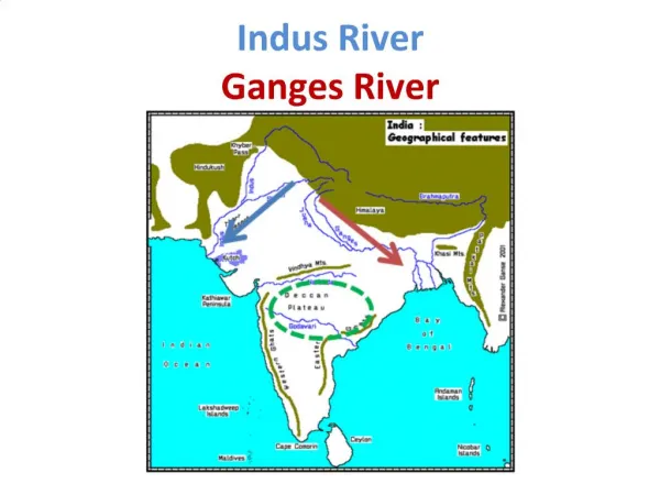
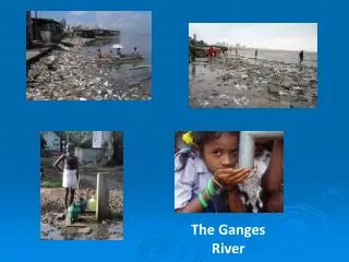
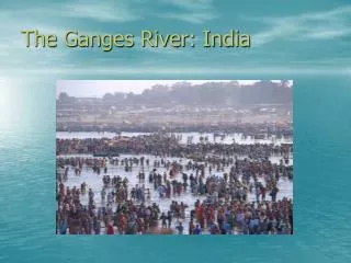
3. What’s the Problem? • The Ganges River is contained in the main watershed of India. • The region has the highest population density in the country, and the highest growth rate. • There is no comprehensive water management plan for the Ganges River.
3. What’s the Problem? • The Ganges River serves many different purposes… Given in no particular order…
Future Issues • As seen, there are many issues surrounding the Ganges River and its management. • As issue in the future is a plan to connect all the watersheds of India through canals…
Canal Project • The canal project may be a boon for the national economy, but it may be a death knell for the environment. • There are, however, no comprehensive environmental models available for policy makers and future managers. • This makes the problem of managing a river like the Ganges a monumental task.
The management problem The ecological complexity of large river systems and the many, inter-related impacts of our own societies on this ecology, make practical management and restoration activities in large rivers particularly difficult.
4. What is the methodology? • Literature review of Great Lakes watershed management. • Creating GIS data for Yamuna River. • Using declassified CIA maps and digitizing board. • GIS analysis of Yamuna River. • MREMS example of watershed management. • Constructing a watershed management model.
Ganges Watershed St. Lawrence Watershed The Ganges Watershed shares many similar physical characteristics with the St. Lawrence Watershed, making it a good starting point for constructing watershed models.
Regional River Management • Ecosystem Management Approach : Collaborative, Interdisciplinary, Cross-institutional • Ecological Classification frameworks for regional Ecological Inventory, Modeling & Assessment
Ecosystem Management Approach • Holistic, Collaborative, Stake-holder Sensitive River Planning and Management.
What is Ecological Classification? Identifying the “fundamental units of nature” (Tansley 1935) Biological character Geomorphic character Integrated multi-factor [Ecological] Character of a River Segment Hydrologic character Chemical character
MREMS Example • Regional landscape-scale modeling. • Ecological Unit Classification and Regional River Mega-modeling
Digitization • Use a digitizing board to convert topographic maps into GIS vector data. • Provides a baseline 1:240,000 scale series of maps of the Yamuna River.
GIS Analysis • Using the available data to look at the parameters of: • Geomorphology • Biology • Hydrology • Chemistry … ArcGIS will be used to model a “pristine” baseline system.
GIS Analysis • Using the known data for the parameters of the Yamuna, impact analysis will be completed. • A model based upon the Muskegon River Ecological Modeling System will be created.
5a. What is the product? • Baseline GIS data for the Yamuna River at 1:240,000 scale. • Watershed management model: • Will be used for further funding grants for SNRE from NSF and DST. • Can essentially be used to manage the Yamuna River, as a system independent of the Ganges River.
5b. What are the outcomes? • The potential outcome of the larger watershed management scheme will be the revitalization of the Ganges Watershed for current and future generation use.
6a. Timeline March 21, 2003 Correspond with all groups & ascertain the capabilities of each group. Make a request for all data available for to create the general GIS map. April 16, 2003 Set up methodology for data collection to ensure consistency of data. Agree upon a short list of environmental criteria for analysis. August 31, 2003 General GIS map. September 1, 2003 GIS analysis of all available collected data. December 2003 Meeting in Delhi with all working groups. January 31, 2004 Revised GIS analysis incl. additional collected data. February 29, 2004 Initial prototype methodology. March 31, 2004 Final prototype methodology. April 10, 2004 Bound opus.
6b. Budget (Costs) General: Report paper (print credits with SITES) $60 Stationery supplies $170 Library photocopying $40 Non-email communications (fax, phone, etc.) $230 Travel to India Airfare $1900 Travel and lodging within India $800 Acquisition of documents and publications $300 Miscellaneous $190 Subtotal: $2900 Report Preparation: Final report copies (8 copies) $90 Report binding (8 copies) $230 Color map plotting (8 copies) $230 Subtotal: $550 Project Total Cost: $4,140
6b. Budget (Funds) Client Contribution: $1500 Outside Sources: SNRE $115 Rackham Discretionary Funds up to: $2500 Rackham Travel Grants $700 Funding Total: $4,815 Costs: $4,140 Funding: $4,815 THE FINAL (a.k.a. hopeful) BALANCE: +$760