Download

1 / 27
270 likes | 510 Vues
Real Time Satellite Data Management for Operational Oceanography. The Example of a Satellite Receiving Station. Oscar Chic and Jordi Font, ICM, CMIMA-CSIC, Barcelona. Wide alongtrack swath (depending on sensor) Mostly sun-synchronous Data recorded and transmitted in real time

E N D
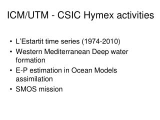
Real Time Satellite Data Management for Operational Oceanography.The Example of a Satellite Receiving Station Oscar Chic and Jordi Font, ICM, CMIMA-CSIC, Barcelona
Wide alongtrack swath (depending on sensor) Mostly sun-synchronous Data recorded and transmitted in real time Land stations receiving data when satellite over horizon (multiple channels) Spatial resolution decreasing from nadir Real time or delayed mode processing Geometric/radiometric corrections, spatial windows, archiving, distribution Earth observation orbiting satellites(scanning radiometers type)
CMIMA Barcelona station(Mediterranean Centre for Marine and Environmental Research - CSIC) • Installed autumn 2001 • Data-Tools system • Fully operational August 2002 • Web access to images • Spatial coverage Açores – Israel Denmark - Sahel
CMIMA Barcelona station Barcelona sea front
Satellites and sensors • Polar orbiting (99°, 700-800 km, helio-syncron, L-band (1.7 GHz), 100 min period, 2 passes/day, 5000x2400 km mid-latitude) • Satellites received at ICM NOAA (12->17) AVHRR (visible, infrared for SST) + other sensors SeaWiFS (ocean colour) FengYun1-C/D (not of much use over ocean) SPOT4/5 vegetation (land applications, 1 km resolution) • Future MODIS? (new hardware needed)
Data Acquisition • Programmed satellite passes • Orientable parabolic antenna automatically pointing to satellite • One acquisition computer + one data processing and archiving • 10 bits HRPT telemetry (High Resolution Picture Transmission) • Snapshot created and used as a background image in acquisition PC • Small metadata file created. • Backup of all the raw data in DVD+R and DAT media.
SST Data Processing • Semi-automated system to process every AVHRR pass over Western Mediterranean in near-real time (every hour) in order to compile a database of sea-surface temperature images at the best spatial resolution (1.1 km). • The system has routines for automatic navigation and cloud-masking. • After processing (split-window equation), navigated and annotated SST images are available on WWW only 90 minutes after the start of acquisition. • During processing a complete metadata file and snapshots of each channel are created. In metadata file, information like % cloud of ROI (region of interest). In the future this will be in a database allowing queries.
Metadata file (example) filename : 2004-01-19-0652-Noaa15.n10 satellite : noaa-15 start_time : 06:54:54 pass_date : 2004/01/19 orb_elements : 0.8210517 0.8357317 7e-05 0.0010789 0.1829084 0.7750761 0.2736992 sunelev : 0 satazim : 278 sunazim : 0 satelev : 87 subtrack : 34 sublat : 41 sublon : 2 duration : 00:13:53 coverage : 100 center_lat : 37.6352 center_lon : 0.5555 pixel_width : 0.7675 pixel_height : 1.1141 total_width : 2822.9829 total_height : 4258.8244 upper_left_lat : 57.3772 upper_left_lon : -15.0720 upper_right_lat : 51.0181 upper_right_lon : 27.7357 lower_left_lat : 20.4353 lower_left_lon : -17.8290 lower_right_lat : 16.4808 lower_right_lon : 8.6096 center_sun : -2.68 center_sat : 90.00 sat_sub_lat : 37.6351 sat_sub_lon : 0.5561 daytime : night Percent_cloud = 74
SST Processing Scheme 1 Visible channels 1 i 2 -> % albedo. Infrared channels 3a/b,4 i 5 -> brightness T. First georeferenciation with ephemerides/orbital elements. 2 Small errors on satellite internal clock and on horizon tracking require a finer georeferenciation. Windows correlation. 3 Satellite zenital angle > 53º --> bad data. Cloud filtering (different daytime and nightime procedure). 4 MCSST algorithm (McClain,1985) SST = A*T4 + B*(T4-T5) + C*(T4-T5)*(sec(sza)-1) + D*(sec(sza)-1) + E 5 Mercator projection with 1.1 km resolution on the square area (45N, 34N) x (9E, 6O) 6 Metadata file example 7Selected area 8 SST
Discarding pixels (mainly clouds) Sequential tests applied to all pixels. 1. if (satellite_zenith_angle > ref_angle (53º)) then bad_value 2. i (3x3) if (max(i-center) > threshold) then cloud cloud>sear 3. if (night) i (3x3) if (mean(Tb3-Tb4) < threshold) then cloud 4. if (ch2 > threshold) then cloud 5. if (Tb4 < threshold) then cloud 6. if (solar_ref_angle<min_solar_ref_angle) then bad_value IMPORTANT: Some clouds are not detected and appear on the image as anomalously cold areas. This is due to very dry atmosphere, low clouds, sun glint, noise in channel 3 …
Full process: from raw data to SST map21 January 2004 21h54 NOAA-17
Quality Control Real time control • Selection of passes depending on elevation angle (area coverage, enough spatial resolution) • Application of validated routines to build maps • Few years ago it was obtained a statistical RMS error lower than 0.6 comparing SST images with in-situ termosalinograph temperature. Delayed mode control • Visual inspection of data quality • We are studying to perform an automatic quality control using moored buoys off the Spanish coast (Puertos del Estado).
Bad data records 1. Satellite ocultation by nearby building 2. Transmission failure 3. Problems in scan motor 4. Undetermined problems with old NOAA-12
Temperature Left: SST (standard and zebra palettes). Up: Quick-look
NOAA products 1. SST 2. Raw channels (HDF) 3. DCS/Argos 4. TOVS (atmospheric data) avhrr_ch2 avhrr_ch4 Total ozone Air temperature Total precipitable water
SeaWiFS Data Management • ICM Barcelona is one of the 92 SeaWiFS Direct Readout Ground Stations (8 on research vessels). Real time decription possible for short periods under specific request • Format conversion • Telemetry raw format n10 (encripted Data-Tools) • n10 s10 (OGP Orbview key software, every 15 days) • s10 SeaWiFS-L0 (NASA standard, SeaStarLevel0 soft) • L0 L1a (data sent to NASA, NASA software) • Generation of quicklooks and data offered to SeaWiFS Authorized Data Users (http://seawifs.gsfc.nasa.gov/SEAWIFS/LICENSE/checklist.html). • Management of Barcelona and R/V Hespérides data archive • Future: automatic generation of chlorophyll a concentration maps IMPORTANT: “Just in time for the Christmas holidays, NASA is pleased to announce that a new contract has been signed with ORBIMAGE to acquire one additional year of SeaWiFS data starting on 24 December 2003 under the same terms and conditions as the previous agreement. ” Gene Carl Feldman 24/12/2003
Web map Introducción / Home Page Estación Receptora de imágenes de Satélite (ERS) Archivo de Datos Satélites visibles FAQ Novedades ICM SATPROCES Web Sitehttp://satproces.cmima.csic.es
Examples of operational use R/V Hespérides Fine tunning of hydrographic surveys of mesoscale circulation guided by infrared images provided in real time by an on-board satellite receiving station (October 1996) Alboran Sea Algerian basin
MFSPP - Observing system MFSPP - Observing system NOAA-AVHRR ARGOS Weekly SST, three days delay T/P and ERS2 along track sea level anomalies 1 day delay XBT temperature 700 m profiles 12 m.n. along track 1 day delay 3 hours data, 1 day delay VOS ~~~~~~~~~~~~~~~~~~~~~~~~~~~~~ M3A buoy Overall NRT Basin Scale Observing System
MFSPP - Observing system MFSPP - Observing system Sea Surface Temperature Sea Level Anomaly Satellite data sets in NRT
MFSPP - FCST Basin Scale MFSPP - FCST Basin Scale ECMWF AN ECMWF FC Wed Wed Thu Fri Sat Sun Mon Tue Thu Fri Wed Thu Fri Wed J J-7 J-5 J-4 J-3 J-2 J-1 J+1 J+2 J+7 J+8 J+9 J-14 FORECAST RELEASE SLA SST XBT The weekly forecasting system
The End This dramatic image of black smoke plumes over Baghdad was acquired the morning of March 31, 2003, by the Advanced Spaceborne Thermal Emission and Reflection Radiometer (ASTER) instrument aboard NASA’s Terra satellite.