Download
1 / 15
150 likes | 315 Vues
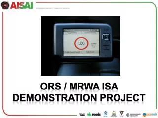
ORS / MRWA ISA Demonstration Project. Objectives Today. Provide a background to the ISA Demonstration Project. The project’s parameters and objectives. Details of other states trials and systems. Hardware and Software associated with WA’s project.

E N D
Objectives Today • Provide a background to the ISA Demonstration Project. • The project’s parameters and objectives. • Details of other states trials and systems. • Hardware and Software associated with WA’s project. • More technical information aiming to incorporate safety and compliance aspects from a heavy vehicle operations perspective. • Future plans for WA’s ISA project.
Background • ORS fund and assist MRWA to manage the ISA Project. • In 2005 MRWA engaged ARRB – scoping studies: • Suitability of sat nav units for ISA purposes. • Suitability of MRWA geospatially. • Discovered TAC beginning a similar trial – partnership. • TAC’s original demo: • seat belt reminder • distance warning • over speed warning
WA’s Project • ORS own and fund the project and assist MRWA to manage. • 30 non-MRWA vehicles fitted with full Advisory ISA Systems plus few vehicles from MRWA and ORS. • MRWA Demonstration vehicle with a Supportive ISA System. • 15 – 20 portable advisory systems available.
Project objectives • Proof of Concept Project – introduce ISA to WA. • Prepare MRWA with required internal procedures : • Mapping updates • Data delivery to vehicles/3rd party suppliers • Generate awareness within govt and fleet operators of ISA benefits – safety, environmental, fuel consumption. • Assist / lead / cooperate in the national initiative.
Other states • NSW • Large funding to update internal processes and map data. • Starting demonstration project shortly. • VIC • Funding to update internal processes and map data. • Possible demonstration project to follow • OTHERS (except NT) • Monitoring our trials and attending national meetings
Wa hardware • GPS Receiver and processor module • Display device – PDA or dedicated unit
Database info • ROAD_NO = A unique numerical identifier for each road. • TRUE_FROM = The start point of this vector is “TRUE_FROM” kilometres from the start point of it’s corresponding road. • TRUE_TO = The end point of this vector is “TRUE_TO” kilometres from the start point of it’s corresponding road. • ID = A unique identifier for this road vector which is unique only to this dataset extract, and system generated upon extraction. • ROAD_NAME =The name of the road the vector corresponds to. • CWAY = Single or dual carriageway. • SEAL_WIDTH= The width in metres of the sealed section of the road • SPD-fwd = The speed limit of the road in the forward direction of the vector • SPD-Rev = The speed limit of the road in the reverse direction of the vector • STRT_LONG / STRT_LAT = The GPS lat long pair of the start point of the vector • END_LONG / END_LAT = The GPS lat long pair of the end point of the vector • BEARING = The bearing of the vector
algorithms • Data obviously based on road centreline information. • System’s algorithms accurately identify location using: • Seal Width • Road Number • Bearing • Caters for less-than-perfect centreline information and provides a more robust system.
Heavy vehicles • Similar system used for the ISA project can easily add value for HV fleet managers and drivers themselves. • ISA system can: • Limit top speed around loading docks etc • Reduce functionality/speed without seat belt fastened • Log speed / direction for post trip analysis • Remotely log speed / direction for real time tracking • Remotely monitor any on-board sensors, e.g. airbag deployment, abs, sealt belt clip, horn, brake operation, load shifting, engine temp, wheel/brake temp etc etc.
Next steps • Currently setting up data transmitters to remotely update speed zone information in vehicles. • 900MHz transmitters, contacted via TOC’s server through NextG/3G network. • Also setting up roadworks transmitters for temporary speed zone changes. • Incorporating rail crossing alerts to drivers, as well as the presence of trains travelling through the particular rail crossing.
possibilities Sat nav Available now