Download
1 / 23
230 likes | 313 Vues
Learn from the experiences of Boyd T. Sigler in implementing GPS technology for accurate collision location data. Discover valuable lessons on partnership, training, data checks, and collaboration with field officers for improved highway safety.

E N D
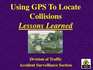
Using GPS To Locate Collisions Lessons Learned Division of Traffic Accident Surveillance Section
Boyd T. Sigler • Manager, KYTC Accident Surveillance Section • 26+ Years in Traffic Records Data Usage and Highway Safety Coordination • Former Cabinet Highway Safety Coordinator, KYTC • Chair, Traffic & Safety Research Advisory Committee • Board of Directors, Kentucky CODES Project • Instructor - Kentucky Department of Criminal Justice Training - Eastern Kentucky University • Contributing writer - Kentucky Law Enforcement News
Background • Kentucky Uses Route-Milepoint for Location • Milepoint Data on Collision Report Inconsistent/Inaccurate • Technology Grant Received In 1997 - KYTC Requests Exploration of GPS • Selective Availability Removed • Hand-held GPS Receivers Became More Affordable and More Accurate
Background • KYTC Worked With FHWA To Secure Funding - $900,000 HES Funds • Team of Enforcement, Engineering, GIS • Purchased GPS Receivers • Train-The-Trainer Session and Receiver Distribution • Started Reporting on Collision Reports January 2002
Lesson #1 Partner With All Necessary Agencies From The Beginning Enforcement - State & Local Transportation Engineering Staff GIS & Mapping Staff
Lesson #2 Make Sure That The Training Is Conducted By Knowledgeable Individuals Make Sure That The Correct Individuals Are On-Hand To Be Trained
GPS UNITS Provided To State & Local Enforcement At No Cost To The Agencies
Lesson #3 Do A Thorough Check Of Enforcement Agency Resources Even Though It Requires More Time
Lesson #4 Prepare Collision Report Form For Use With GPS
Lesson #5 Use Data Edit Checks For Coordinates Make Certain They Are In Place Before Data Entry Begins
Full Extent View Before Edits 76,000 Crashes - January 1-June 30, 2002
Full Extent View After Edits 41,000 Crashes - October 1 - December 31, 2002
Lesson #6 Allow For Various Mapping Changes
Lesson #7 Partner With Field Officers & Their Agencies http://www.kytc.state.ky.us/drvsmrt/
Lesson #8 Provide Feedback To Field Officers
Lesson #9 Spotlight Agencies That Provide Quality Data http://docjt.jus.state.ky.us/
Lesson #10 Develop A Method Of Evaluation
CONTACT • Boyd.Sigler@mail.state.ky.us • 502-564-3020 • 501 High St., Frankfort, KY 40622