Download
1 / 59
650 likes | 1.05k Vues
Urban Patterns. Defining “Urban” Models of Urban Structure Social Area Analysis Urban Patterns in Europe & Latin America Urban Problems. Defining Cities. We can define cities in two different ways:

E N D
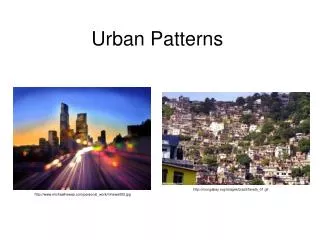
Urban Patterns Defining “Urban” Models of Urban Structure Social Area Analysis Urban Patterns in Europe & Latin America Urban Problems
Defining Cities • We can define cities in two different ways: • Based on the social character of cities – the ways in which life in cities differs from life in rural places. • Based on physical or legal criteria.
Terms: “City” vs. Town • There is no universally agreed on difference between a “city” and a “town.” • In some countries cities have to meet certain criteria (e.g. have a cathedral, have a population of over 50,000, etc.) • In others “cities” are legal entities, while “towns” aren’t. • In the US, definitions vary from state to state. For example: • In California “town” and “city” are synonymous. The only legal distinction are between “incorporated” towns and “unincorporated” towns. • In New York a “town” is a division of a county (and provides some services apart from the county), while a “city” is an incorporated entity.
Defining Urban Settlements:Social Definitions • In the 1930s sociologist Louis Wirth discussed how city life differs from life in non-urban places: • SIZE & SOCIAL RELATIONSHIPS: Cities are bigger than non-urban places – which means that in cities, you spend much of your time with strangers. Your relations with people you work with are mostly legal or contractual, not personal. • DENSITY & SPECIALIZATION: People in cities tend to specialize – otherwise competition for jobs and money becomes overwhelming. • HETEROGENEITY & FREEDOM: People in cities are far more diverse – behaviors or customs that would be socially unacceptable in a rural area are tolerated in cities.
Defining Cities:Legal Definitions • “An urban settlement that has been legally incorporated into an independent, self-governing unit.” • Legal definitions vary from country to country: • US – 2,500 persons • South Africa – 500 persons • India – 5,000 persons with an adult population predominantly in non-agricultural work.
Defining Urban Settlements:Physical Definitions • URBANIZED AREA: • “The central city and the surrounding built-up suburbs … where population density exceeds 1,000 persons per square mile.” • The physical city – thevisible city. • METROPOLITAN AREA: • The “zone of influence” of a city; the functional city.
Since 1949 the Census Bureau has used a method for measuring and comparing the functional areas of cities — the Metropolitan Statistical Area. The exact definition of an MSA has varied over time. Today an MSA is defined as A central city with a population of at least 50,000. The county within which the city is located. Adjacent counties with a high population density and a large percentage of residents working in the central city’s county. Defining Urban Settlements:Metropolitan Statistical Areas For more information see: http://www.census.gov/population/www/metroareas/metroarea.html
Overlapping MSAs are combined into Consolidated MSAs. An MSA within a CMSA that has more than one million people is a PrimaryMSA. “CMSA” — Beyond the MSA
Terms: Core Based Statistical Area • “A metro area contains a core urban area of 50,000 or more population, and a micro area contains an urban core of at least 10,000 (but less than 50,000) population. • “Each metro or micro area consists of one or more counties and includes the counties containing the core urban area, as well as any adjacent counties that have a high degree of social and economic integration (as measured by commuting to work) with the urban core.” For more information see: http://www.census.gov/population/www/estimates/aboutmetro.html; Map source: http://www.census.gov/geo/www/maps/msa_maps2009/us_wall_1209.html
Since 2000 the Census Bureau has used the “Core Based Statistical Area” or CBSA classification scheme. Under the CBSA standard there are two kinds of MSA: METROPOLITAN statistical areas MICROPOLITAN statistical areas. A CBSA consists of one or more counties with a central city with a population of at least 10,000: If the population is more than 50,000, it’s metropolitan. If it’s between 10,000 and 50,000 it’s micropolitan. There are at least 369 metropolitan, 576 micropolitan areas, and 125 “Combined Statistical Areas” in the US today. Clarifying:CBSA – MSA vs. mSA For more information see: http://www.census.gov/population/www/estimates/aboutmetro.html
US Metropolitan & Micropolitan Areas Source: http://www.census.gov/geo/www/maps/msa_maps2009/msa2009_previews_html/cbsa_us_wall_1209.html
The Central Business District • The central business district (CBDor downtown) is usually the best known and most distinctive area of a city. • Characteristics of the CBD: • Compact area. • High land costs. • Intensive land use. • Historically, services tend to cluster in the CBD. Skyline, Charlotte NC
Services in the CBD • Consumer services: • High threshold services (people have to travel a relatively long distance) • High range services (expensive or unusual services) • Downtown worker services • Business services: • Producer services (financial, legal, and other services cluster in the CBD for greater efficiency) • Public services (government)
Activities Excluded from the CBD • Manufacturing • Though important at one time, land costs and improved transportation have meant that manufacturing – except in rare cases – has moved out of the CBD. • Residential • High land costs mean that few people actually can live in the CBD. Rents are simply unaffordable.
Models of Internal City Structure • Starting in the 20th Century, social scientists began to try to create models — simplified representations of reality — to understand how cities function. • There are three popular models of North American city structure that are widely used and discussed. • Each has problems; none accurately describes how any particular city actually works — but the models are still useful because they give us insights into how cities grow and function.
Concentric Zone Model Oldest (1923) Postulates a series of concentric rings of decreasing land value surrounding the Central Business District (CBD) Sector Model Pre World War II (1939) Incorporates linear and transport corridors Continued emphasis on CBD Multiple Nuclei Model Post World War II (1945) Multiple “centers of attraction” Less emphasis on a single CBD Three Models
Concentric Zone Model The “Inner City”
Social Area Analysis • None of the three models is perfect – they are simplified, not “real.” • However, the test of a model is whether or not it’s useful – can we use the three models – individually or in combination – to make predictions about cities? • Maybe– some patterns (family size, income, ethnicity) can be predicted using the models.
Social Area Analysis: Using the Models? • Urban areas of the US are divided by the Census Bureau into census tracts – compact areas with about 5,000 residents each. • Using census tract-level data, social and economic characteristics can be mapped, and patterns seen – maybe!
Models Outside North America • None of the three models developed for North America are very useful in other parts of the world: • Europe • In Europe the wealthy tend to live in or near the center of town. • The poor tend to be concentrated in “slum suburbs.” • Less Developed Countries • As in Europe, there tend to be “slum suburbs” and a wealthy center. • Most cities in LDCs have also been affected by colonialism • Latin American cities often have a distinctive “elite spine.” • Most cities in LDCs have extensive squatter settlementsin and around them.
Europe’s CBDs • More people choose to live in the CBD in Europe than in the US. • Shopping, restaurants and entertainment cluster in and near the CBD. Pedestrian (and bicycle) friendly environments are common. • European CBDs tend to be less dominated by large businesses, and usually have large areas that have been preserved, and there are fewer high-rise buildings. Source: http://philip.greenspun.com/images/200101-d30-paris/rue-cler-fruit-market.half.jpg
Urban Models in Europe? • According to your book, this map shows an “elite” sector extending out from the CBD. • According to your book you can see “concentric zones” of residential poverty here (it is true that European cities often have “elite centers” and “slum suburbs.”)
Europe: Professional Centers, Slum (or at least poor) Suburbs • Wealthy Europeans tend to live in (or near) city centers. • Many also own suburban or rural houses – and weekend traffic is frequently terrible as they go to and from the country.
Precolonial vs. Postcolonial Cities: Fez, Morocco • Most major cities in the LDCs have gone through three periods: pre-European colonial, colonial, and post-colonial development. • Fez, in Morocco, is unique in that the French built the “New Town” next to the “Old Town.” • The differences between the two include: • Street layout and size. • Public squares and open spaces. • Density.
A Colonial City:Ho Chi Minh City, Vietnam • Unlike Fez, in Ho Chi Minh City, the French completely destroyed the original city and replaced it. • Note the similar street layout in Fez’s “New Town.”
Spanish Colonial Cities • Spanish colonial cities were built to a standard plan under “The Laws of the Indies”: • “… the town … must … be in an elevated and healthy location; [have] means of fortification; [have] fertile soil and … plenty of land for farming … [have] fresh water, a native population, ease of transport, access and exit … • “[Colonists] shall try as far as possible to have the buildings all of one type for the sake of the beauty of the town…”
The Latin America City Model • This model was originally developed here at San Diego State University! Yay! • Note that it combines elements of the Sector and Concentric Zone models. • Note the zone of squatter settlements and the elite spine.
Urban Problems: Fragmentation-Too Many Governments? • In many parts of the US, there has been an explosion in local governmental bodies – neighborhood councils, elementary school districts, high school districts, community college districts, fire districts, irrigation districts, flood-control districts, sewage districts, parks and recreation districts, sheriff districts, library district, mosquito abatement district, etc. • Many cities are now surrounded by independent suburbs– communities that are not legally part of the central city. • Many communities overlap dozens – sometimes hundreds – of these different districts and bodies. • This overlapping makes it hard for cities in the US to deal with their problems.
Chicago grew rapidly in the 19th and early 20th centuries through annexation. Today, Chicago (and most other cities) are surrounded by independent cities – who generally do not want to become part of large cities. Chicago: Historical Annexation
Annexation Today Jefferson City, Missouri http://www.jeffcitymo.org/jeffcityweb.nsf/DeptLinksView/CityAnnexation Austin, Texas http://www.ci.austin.tx.us/annexation/
San Diego: Independent Suburbs • San Diego county has a total of 18 cities within its borders: • Carlsbad • Chula Vista • Coronado • Del Mar • El Cajon • Encinitas • Escondido • Imperial Beach • La Mesa • Lemon Grove • National City • Oceanside • Poway • San Diego • San Marcos • Santee • Solana Beach • Vista Source: http://www.211sandiego.org/Cities-Reporting
Local Government Fragmentation: Solutions? • Metropolitan Governments • An association of local governments – council of governments – designed to coordinate activities in an urban area. • Usually not designed to replace other bodies – generally assists with planning – often involved with smart growth initiatives. • Usuallynotelected(Example: SANDAG). • Federations • A separate regional government – above local cities – that can make planning decisions and even impose decisions about land use. • Usually elected(Example: Portland OR). • Consolidations • In some areas cities have legally consolidated – combined governmental bodies together. • Usually elected (Example: Miami-Dade County FL).
Problems of “Inner Cities” • Instead of squatter settlements and slum suburbs, in North America areas of poverty are often concentrated in the inner city – the area surrounding the CBD. • North American inner cities suffer from physical, social and economic problems.
Inner City Challenges: Social Problems • Most people who live in inner cities are there because they can’t afford to go anywhere else – they are poor! • “The Underclass” • Inadequate job skills • The culture of poverty • Single parent families • Crime & drugs • Ethnic and racial segregation • Inadequate housing • Homelessness
Inner City Challenges: Economic Problems • Poor people and poor housing mean that inner cities have enormous needs – and no money to pay for them. • Cities have two choices when it comes to paying for services they can’t afford: • Reduce services (disastrousin areas that are already hurting). • Raise taxes (disastrousin areas that already find it hard to bring people and businesses to the area). • Other solutions have been tried: • Annexation (taking over land outside the city, thereby expanding the tax base – this once was feasible, but in most areas it isn’t any longer). • State and Federal contributions (loans and grants).
Inner City Challenges: Physical Problems • The major physical problem of the inner cities is the poor condition of the housing. • DETERIORATION • “Filtering” – large, old single-family homes become multi-family apartments – without upgrading the facilities. Eventually, as the facilities become worse and worse, they are abandoned. • Redlining& Blockbusting– illegal processes designed to concentrate ethnicities in ghettos– where services are few and it is impossible to get loans to improve property. • URBAN RENEWAL • In theory, a process of replacing deteriorated housing with public housing. • Although public housing has been successful in some places, in others it has been a brutal nightmare. • Gentrification– rather than tear down deteriorated housing, in some places it has been renovated – but the poor who once lived in the neighborhood can’t afford new renovated housing, and are forced to move.
The Robert Taylor Homes in Chicago, completed in 1962, was the largest single public housing project in the world – 28 sixteen story buildings and nearly 30,000 people. Because of a combination of factors – poor planning, lack of opportunity, crime, etc. – all of the 28 buildings have been demolished and the area is being redeveloped. Public Housing Sources: http://www.robsherman.com/information/report/2004/CHA.htm; http://www.route99.org/fundraising.html; http://www.illinoisleader.com/spotlight/spotlightview.asp?c=4404; http://www.lpb.org/programs/forest/chicago.html
Public Housing:Pruitt-Igoe http://www.pruitt-igoe.com/
Gentrification is a kind of renovation – buildings that have decayed, been abandoned, or are being repurposed (from industrial to residential) are turned into desirable homes. Gentrification can be beneficial – and controversial, if lower-income people are forced to leave their neighborhood because it’s become too expensive for them. Gentrification Adapted from: http://media.www.lewisflyer.com/media/storage/paper638/news/2005/04/25/News/Gentrification.Stirs.Issues-935125.shtml
Gentrification:Brooklyn http://www.bbc.co.uk/news/magazine-16827855
The Growth of Suburbs • The suburban population of the US has grown enormously in the past 50 years – much faster than the overall population growth rate. About 50% of all Americans now live in suburbs – and their popularity is extremely high (90% of people polled say they prefer suburbs to inner cities). • At the same time, the percentage of people living in central cities has declined. About 30% of all Americans now live in central cities.
The Peripheral Model • Around the central city is the suburban residential and business area, circled by a beltway. • Around the beltway are business nodes – edge cities (and of course – malls!)
Problems of Suburbs • Sprawl: “… the progressive spread of development over the landscape.” • Problems caused by sprawl include: • Costs of extending services; • Loss of agricultural land; • Dependence on the automobile (and a lack of public transportation). • Segregation • Physical segregation from work • Social segregation • By age • By family structure • By race • By income • By social class
Zoning • Since the 19th Century (and especially since New York’s ordinances of 1916) cities, counties and States in the US have used zoning to limit and control land use and development. • Zoning controversies: • Sprawl • Segregation • Property rights issues Source: http://www.greatergreenville.com/development/zoning_districts.htm
Suburbanization of Businesses • Many businesses have moved out of the CBD into the suburbs. • Reasons for moving to peripheral locations include land costs and accessibility. • Types of businesses that have moved to the suburbs: • Manufacturing (industrial parks, factories that need large amounts of land) • Business services (in locations with easy access) • Retailing The major malls of Columbus OH
The Mall of America • The Mall of America, in Bloomington MN • 4.2 million square feet • More than 520 stores • 20 sit-down restaurants • 30 fast food restaurants • 36 specialty food stores • 8 nightclubs • 14 movie screens • 11,000 employees • 12,550 parking spaces • Attractions include Nickelodeon Universe®, Underwater Adventures® Aquarium, LEGO® Imagination Center, Dinosaur Walk Museum, A.C.E.S. Flight Simulation, NASCAR Silicon Motor Speedway, and The Chapel of Love • Though it’s big, this is only the 23rd largest mall in the world today. Sources (4-1-2005): http://www.mallofamerica.com/about_the_mall/mallfacts.aspx; http://www.bloomingtonmn.org/mallofamerica_facts.asp