Electrical Resistivity
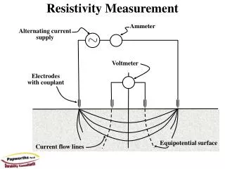
Electrical Resistivity. R = A/L V/I R = resistivity A = cross-sectional area of current flow L = length of the flow path V = voltage drop I = electrical current. Dry materials Gravel Salt water. Wet materials Silt or clay Fresh water. Resistivity. R = 2 a V/I. Wenner array. a.
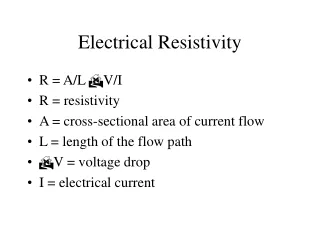

Electrical Resistivity
E N D
Presentation Transcript
Electrical Resistivity • R = A/L V/I • R = resistivity • A = cross-sectional area of current flow • L = length of the flow path • V = voltage drop • I = electrical current
Dry materials Gravel Salt water Wet materials Silt or clay Fresh water Resistivity
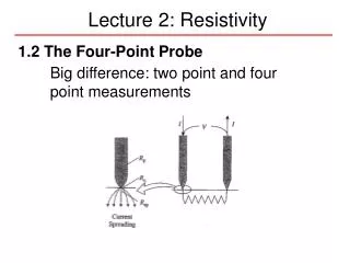
R = 2a V/I Wenner array a a a Schlumberger array R = [(AB/2)2-(MN/2)2]/MN V/I Dipole-dipole array R = n(n+1)(n+2)a V/I
Resistivity Surveys • Electrical sounding – variations of apparent resistivity with depth. • Horizontal profiling – lateral variations in resistivity.
Higher level Of dissolved solids
Seismic Gravity Aeromagnetic Magnetometer Seismic velocities Density variation Magnetic fields Magnetic fields Methods
Seismic Methods • Seismic velocities.
Magnetometer Surveys and GPR • Magnetic field – especially useful for metal detection. • Ground-penetrating radar – electromagnetic field.
Gravity and Aeromagnetic Methods • Aeromagnetic surveys measure magnetic anomalies which would be distorted by magnetic materials in the crust – useful in indicating the depth to magnetic basement rocks. • Gravity surveys measure gravity anomalies – reflections of mass distribution in the crust.
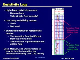
Geophysical Logs • Caliper – measure the diameter of an uncased borehole in bedrock units. • Temperature – temperature of the fluid. • Resistance • Resistivity • Spontaneous potential – natural electrical potential that develops between the formation and the borehole fluids – determination of bed thickness, geologic correlation, delineation of permeable rocks.
Nuclear Loggings Natural Gamma Radiation – emission of gamma activity by K40, U238, Th232 Neutron logging – measure gamma radiation produced by neutron-hydrogen atom collision - Hydrogen is related to water content – soil moisture or porosity below water table. Gamma-Gamma radiation – gamma radiation produced by a source, such as cobalt 60, is absorbed or scattered by the materials in contact with the source. The adsorption is proportional to the bulk density of the earth material.
Near borehole (with fluid influence) Average Lower resolution