Rapid Ecoregional Assessments
310 likes | 491 Vues
Northwestern Plains & Middle Rockies . Rapid Ecoregional Assessments. Introductory Webinar June 22 or 23, 2011 and July 13, 2011. Webinar Purpose and Agenda.

Rapid Ecoregional Assessments
E N D
Presentation Transcript
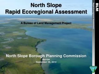
Northwestern Plains & Middle Rockies Rapid Ecoregional Assessments Introductory Webinar June 22 or 23, 2011 and July 13, 2011
Webinar Purpose and Agenda Webinar Purpose: To provide interested stakeholders information on the Rapid Ecoregional Assessment (REA) process, work completed so far, and provide opportunities for input. Agenda: • Purpose and Goals of BLM’s Landscape Approach • REA Process • Assessment Methods • Management Questions • Conservation Elements • Change Agents • Assessment Management Team, Partner, and Stakeholder Roles • Next Steps
Purpose and Need The BLM recognizes: • Public lands face increasingly complex and widespread environmental challenges transcending traditional management boundaries. • A landscape-scale management approach is the most effective way to evaluate these challenges through: • Examining landscape-scale resource conditions and trends • Identifying focal areas for conservation and development • Focusing resources where they are most needed • Integrating BLM management activities • Enabling adaptive management • Providing a foundation for management partnerships
In response, the BLM in 2010 launched REAs to improve the understanding of existing landscape conditions, and conservation elements that guide the assessment of how ongoing environmental changes and land use demands may alter them.
Landscape Approach 1. Rapid Ecoregional Assessments (REAs) REAs synthesize the best available information about resource conditions and trends within an ecoregion. Tie to future projections. 2. Ecoregional Direction Ecoregional direction will use the results of the REAs, with input from BLM staff, partner agencies, stakeholders, and Tribes, to identify key management priorities for the public lands within an ecoregion. 3. Field ImplementationManagement priorities and strategies identified in ecoregional direction put into practice on-the-ground. 4. Monitoring for Adaptive Management 5.Science Integration
Landscape Approach • Rapid Ecoregional Assessments • What do we know? What don’t we know? • Ecoregional Direction • How can we use this information to manage more effectively? • Field Implementation • How can we better coordinate planning, use authorization, and budgeting? • Science • Linking science with management • Monitoring • Standardizing data collection & retrieval
Site Specific Projects Site Specific Projects Restoration Area Restoration Area Priority Watershed/Landscape Ecoregion Actions in Ecoregional Context
What REAs Do and Don’t Do • REAs evaluate landscapes across an ecoregion to more fully understand: • ecological conditions and trends; • natural and human influences; and • opportunities for resource conservation, restoration, and development. • REAs seek to identify important resource values and patterns of environmental change that may not be evident when focusing smaller, local land areas. • REAs do not allocate resource uses or make management decisions. REAs provide science based information and tools for land managers and stakeholders to consider in subsequent resource planning and decision-making processes.
REA Top Five Goals • Identify and answer important management questions and provide a baseline to guide future management actions. • Identify and map key opportunities for collaborative resource conservation, restoration, and development. • Document key resource values or conservation elements (CEs), such as species of concern and regionally significant terrestrial and aquatic habitats. • Describe influences from environmental change agents (CAs) and the collective effects of projected trends from: • Climate Change • Wildfire • Invasive Species • Insect Outbreaks and Disease • Development • Identify science gaps and data needs.
Example REA Product: Maps Maps that synthesize: • Best available data about resource conditions • Trends within an ecoregion Maps that help BLM Managers and public land stakeholders understand environmental conditions and trends from a broader landscape perspective.
REA Phases • Initiation • Phase I Pre-Assessment • Task 1 Identify Management Questions, Conservation Elements, Change Agents, & Conceptual Models • Task 2 Identify, Evaluate and Recommend Potential Datasets • Task 3 Identify, Evaluate and Recommend Models, Methods and Tools • Task 4 Prepare REA Work Plan • Phase II Assessment • Task 1 Compile and Generate Source Datasets • Task 2 Conduct Analysis and Generate Findings • Task 3 Prepare REA Document
Management Questions • Ecoregional assessments are guided by management questions, which: • Identify regional problems faced by BLM managers • Provide clear direction for pressing problems • Guide the development of clear, measurable REA objectives • Tailor assessment to ecoregion • Identify data needs
Conservation Element Selection • Coarse-filter/fine-filter • Ecological Communities that are regionally important – made up of systems • Species of particular importance with regional issues (transboundary, multiple communities, etc.) • Ecological Integrity • Capacity of an area (watershed) • Integrity model made up of conservation elements (indicators)
Change Agents • Regional impact/activity of stressor • How does change agent tie into model for each conservation element (impact to indicators)? • Climate Change • CCVI – Vulnerability assessment on conservation elements (not spatial) • USGS Downscaled Climate Data • Where do conservation elements have the most exposure?
REA Process • Derivation of models for conservation elements and Ecological Integrity • Determine likelihood and magnitude of potential change in ecological values when exposed to identified change agents • Baseline information on watersheds • Risk and opportunity for two future times • Understanding of how we can build resilience into a system
Models, Attributes and Indicators U.S. Department of Agriculture (USDA) Forest Service. 2011. Watershed Condition Framework. Washington, DC: U.S. Department of Agriculture.
Northwestern Plains (NWP) Ecoregion • Combination of NW Great Plains & NW Glaciated Plains • With buffer encompasses approximately 236,000 mi2 • Includes parts of 13 BLM Field Offices • Within the boundaries of the Plains & Prairie • Potholes Landscape Conservation Cooperative (LCC)
Middle Rockies (MR) Ecoregion • Middle Rockies Level III Ecoregion • With buffer the MR Ecoregion encompasses approximately 105,000 mi2 • Includes parts of 20 BLM Field Offices • Within the boundaries of the Great Northern Landscape Conservation Cooperative (LCC) • ~4M acres of Federal Land
NWP and MR Management Questions The following management questions guide both REAs: • Where are the important regionally significant terrestrial and aquatic/riparian biotic features, functions, and services across the ecoregional landscape? • Where are the key habitat types (seasonal, refuges, corridors/connectivity, migration routes, concentrations of regionally significant species, etc.) for landscape species, keystone species, and regionally significant suites of species? • Where could core regionally significant values be negatively and positively affected from altered wildland fire regimes (frequency, severity, and seasonality change from historic to present to future)? • Where will regionally significant values be affected through: • changes in the spatial distribution and abundance of invasive, (undesired) non-native species, and insect/disease outbreaks; • development; and • climate change
NWP Conservation Elements • Prairie Grasslands • Sagebrush-Grassland Ecosystems • Prairie Pothole Wetlands • Grassland Birds • Black-Tailed Prairie Dog Communities • Greater Sage Grouse • Big River Fish Community • Prairie Fish Community • Plains Sharp-Tailed Grouse • Big Game Community • Wetlands and Riparian Areas
MR Conservation Elements • Alpine Ecosystems • Five Needle Pine (Whitebark/Limber Pine) Communities • Sagebrush-Grassland Ecosystems • Golden Eagle • Grizzly Bear • Forest Carnivores • Greater Sage-Grouse • Pronghorn (Migration Corridors) • Native Cold Water Fish Communities • Big Game Crucial Winter Range and Parturition Areas
Change Agents • Climate Change • Wildfire • Invasive Species • Insect Outbreaks and Disease • Development • Urban/Exurban • Agriculture • Hydrological • Energy
AMT and Partner Roles • Assessment Management Team (AMT) (composed of composed government managers and technical specialists within the ecoregion to provide overall direction) • Partners: • LCCs • State & Federal Agencies • Others
Stakeholders • Interested parties where the REA will provide information/utility • Native American Tribes • State and Federal Agencies Beyond Partners • NGO State and Regional Offices • LCC Members • Conservation Districts • Cooperative Extensions and Universities • Interested Citizens
Stakeholder Roles • REAs are information gathering exercises • REAs are not a decision-making process Therefore, there is not a formal public comment process • However, stakeholders can comment on process, data, methodology, memos, etc. • The public will continue to be engaged in BLM decisions, such as resource management plans (RMPs)
Next Steps for the BLM and REA Partners • Continue Phase 1, Task 3 • Update Data and Develop REA Models and Methodology • Provide Task 3 Memo to REA Partners for Review and Comment • Initiate Phase 1, Task 4 • Prepare the REA Work Plan to complete the REAs • July/August AMT Meeting • Further outreach • Additional Webinars • Continued Updates
Next Steps for Stakeholders If you or your organization • would like to be more involved in the REA process; • would like to discuss how to maximize involvement; or • is collecting data that may be of value to the REA process Contact David Wood at (406) 896-5246 or dwood@blm.gov
For more information, visit: www.blm.gov/wo/st/en/prog/more/climatechange.html Thank you!