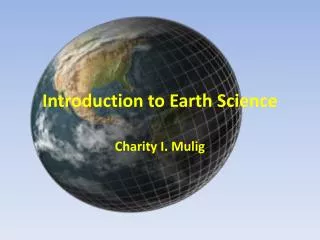
Introduction to Earth
Chapter 1. Introduction to Earth. Geography as a Field of Learning. Physical Geography Environmental geography Rocks Landforms Soil Flora Fauna Climate Water Minerals. Geography as a Field of Learning . Cultural Geography Human geography Population Settlements

Introduction to Earth
E N D
Presentation Transcript
Chapter 1 Introduction to Earth
Geography as a Field of Learning • Physical Geography • Environmental geography • Rocks • Landforms • Soil • Flora • Fauna • Climate • Water • Minerals
Geography as a Field of Learning • Cultural Geography • Human geography • Population • Settlements • Economic activities • Transportation • Recreation activities • Languages • Religion • Political systems • Traditions • Other “human” elements • Study of Geography is the • Why, What, Where, and so What
Science and Geography • Science as a Field of Geography • What exactly defines Science? • Science follows a process called scientific method • Observe to develop a question • Create a hypothesis, guess about the answer to the question • Design an experiment to test the hypothesis • Make a prediction for the outcome of the experiment • Conduct the experiment and observe the outcome • Draw a conclusion or formulate asimple rule based on the results of the experiment.
Numbers and Measurements • English Systems • Inches, feet, miles, pounds, Fahrenheit • International System of Measurement (SI) or metric • Kilometers, Kilograms, and degrees Celsius.
The Environmental Spheres • Lithosphere (litho (Greek for “stone”) • Rocks of the Earth’s crust • Broken and unconsolidated particles of mineral matter found over the bedrock • All landforms, both on the seafloor and the surfaces of the continents and islands. • Atmosphere (atmo Greek for “air”) • The complex mixture of gases needed to sustain life. • Found closely to Earth’s surface, densest at sea level, and rapidly thinning with altitude. • Constant motion by solar energy and Earth’s rotation.
The Environmental Sphere • Hydrosphere (hydro Greek for “water”) • All water in all its forms • Oceans • Precipitation • Cryosphere (cry Greek for ”cold”) for all the water frozen as snow and ice • Biosphere(bio Greek for “life”) • All the parts of Earth where living organisms can exists. • Includes the vast variety of earthly life forms (often called biota)
The Solar System • The Sun, center of the Solar System • Eight planets • With more than 100 revolving moons • Unknown number of dwarf planets • Scores of comets (dirty snowballs) • 50,000 asteroids • Millions of meteoroids
Our Planets • Four inner planets (Terrestrial planets) • Mercury • Venus • Earth • Mars • Four outer planets (Jovian planets) • Jupiter • Saturn • Uranus • Neptune
The Size of the Earth • Radius • 6400 kilometers (4000 miles) • Highest point (Mt. Everest) at 8800 meters (29,000 ft.) above sea level • Deepest point (Mariana Trench)11,000 meters (36,000 ft) below sea level • A difference of 20 kilometers or 12 miles • Diameter • 12,735 kilometers (7909 miles) • Circumference • 40,000 kilometers (24,900 miles) • First figured by Eratosthenes (Greek geographer, using mathematical calculations of angles) • His figures were 43,000 kilometers (26,700 miles)
The Shape of the Earth • Properly described as oblate spheroid. Not a true sphere. • Cut through the equator, the earth is circular • Cut through the poles, the earth is ellipsoidal. • This is due to the rotation of the earth which causes the middle to bulge and flatten the poles.
Geographic Grid • We use a geographic grid to help locate features on the surface of the earth • The grid system of the Earth is referred as a graticulegrid. • Rotation of the earth allows for the creation of the grid of latitude and longitude • The north and south poles are found on the rotational axis. • The equator is found on an imaginary plane passingthrough the Earth halfway between the poles.
Great and Small Circles • A great circleis the largest circle that can be drawn through a sphere. • The sunlit portion of the earth at any moment (the Circle of Illumination) is a great circle. • Only one great circle can be drawn on a sphere to include any two given points (not diametrically opposite each other) • All other planes intersecting through a sphere would be small circles • The Arctic and Antarctic Circles would be small circles.
Latitudes • The description of location expressed as an angle north or south of the equator. • Expressed in degrees, minutes, and seconds • 360 degrees in a circles • 60 minutes in a degree • 60 seconds in a minute • Latitude varies from 0 degrees at the equator to 90 degrees at the North or South pole.
Latitudes • All latitudes north of the Equator are considered in the North Latitudes. • All latitudes south of the Equator are considered in the South Latitudes. • All connecting points of the same latitude is called a parallel. • The Equator is the one great circle of the parallels with all the rest being small circles. • All parallels are aligned in true east-west directions on the Earth’s surface.
Latitudes • Seven latitudes of significance importance in the study of the Earth. • Equator, 0 • Tropic of Cancer, 23.5 N • Tropic of Capricorn, 23.5 S • Arctic Circle, 66.5 N • Antarctic Circle, 66.5 S • North Pole, 90 N • South Pole, 90 S
Regions of Latitudes • Low Latitudes • Generally between the equator and 30 N & S • Mid Latitudes • Between about 30 and 60 N & S • High Latitudes • Latitudes greater than about 60 N & S • Equatorial • Within a few degrees of the Equator • Tropical • Within the tropics (23.5 N and 23.5 S)
Longitude • Angular description of the east-west location • Measured in degrees, minutes, and seconds. • Lines are called Meridians • They are NOT parallel to one another EXCEPT at the Equator • As they move towards the Poles they become increasingly close, finally converging at the Poles.
Longitude • Distance between the Meridians varies • The distances is about the same as the Parallels are at the Equator. • As Meridians converge to the poles, the distance between the them decreases, diminishing to zero at the poles • The baseline for the Meridians is the “Prime Meridian” which passes through the Royal Observatory of Greenwich, England. • Halfway around the world at 180 degrees either east or west is the “International Date Line” • All Meridians are great circles.
Earth-Sun Relations • Earth Rotation on its Axis • Rotates west to east Counterclockwise looking down at the North Pole • One complete rotation every 24 hours
Effects of the Rotation of the Earth • Causes a deflection the flow path of both air and water, known as the Corolis effect • Brings any point on the surface through the increasing and then decreasing gravitational pull of the moon and the Sun • Rise and fall of water know as Tides • The effect of the diurnal (daily) alternation of light and darkness. • A misalignment of our circadian (daily) rhythms (your inner body clocks) are interrupted by air travel, it will cause “jet lag”.
Earth’s Revolution around the Sun • The revolution of the Earth around the Sun takes 365 days, 5 hours, 48 minutes, and 46 seconds. This is a tropical year and for practical purposes it is shortened to 365.25 days. • Because of the extra quarter of a day, we have leap year every fourth year.
Earth’s path around the sun • The path around the sun is an ellipse. • The farthest point, on July 4th is called the Aphelion (94,555,000 miles) • The closest point, on January 3rd is called the Perihelion, (91,455,000 miles) • The average distance of the earth from the sun is defined is One Astronomical Unit ( 1AU) or 92,955,806 miles.
Inclination of Earth’s Axis • The imaginary plane defined by the orbital path of the Earth is called the plane of the ecliptic. • The Earth maintains its 23.5 degree tilt away from perpendicular to the plane of the ecliptic. This tilt is called the inclination of the Earth’s axis.
Polarity of the Earth’s Axis • The Earth’s rotational axis is always at the same inclination during its rotation around the Sunand its axis always points in the same direction relative to the North Star, Polaris. • This characteristic is called the polarity of the rotation axis (or parallelism). • The combination of rotation revolution, inclination, and polarity result in the seasonal patterns.
The Annual March of the Seasons • Threeconditions of the changing of the seasons • The latitude receiving the vertical rays of the sun . • Sub-solar point or the declination of the Sun • The solar altitude (the height of the Sun above the horizon) at different latitudes. • The length of the day at different latitudes.
Special Days of the Year for the Seasons • June Solstice • Around June 21 (First Day of Summer) • Sun’s rays perpendicular to the Tropic of Cancer • Longest Day of the year • Areas of the Arctic Circle in 24 hours of sunlight • September Equinox • Around September 22 (First Day of Fall) • Sun rays perpendicular to the Equator • Equal hours of sunlight and night
Special Days of the Year for the Seasons • December Solstice • Around December 21 (First Day of Winter) • Sun’s rays perpendicular to the Tropic of Capricorn • Shortest day of the year • Areas of the Arctic Circle in 24 hours of darkness • March Equinox • Around March 20 (First Day of Spring) • Sun rays perpendicular to the Equator (again) • Equal hours of sunlight and night
Seasonal Transitions • Migration of the vertical rays of the sun between the latitudes from season to season • Day length • Equator only place on the earth where the day length is constant throughout the year • Migration of the sun and the length of the day • Angle of the rays of the sun in different latitudes, difference in the energy the surface receives • The relationship of the angle of the sun rays, the length of the day are the important seasonal transitions of the earth
Telling Time • Three natural units of time • Tropical year, return of the seasons • Lunar month, return of the new moon • A day, marked by the passage of the sun • Daily time kept since early civilizations • Romans identified the importance of the noon hour with termed relationships to the meridian • A.M comes from ante meridian • P.M. comes from post meridian
Time Zones • No standard time zones until 1884 • 24 standard time zones set starting at the Greenwich Prime Meridian • Prime Meridian is the center of the time zone, with 7.5 degrees to the east and 7.5 degrees to the west • Time at the Prime Meridian known as • Greenwich Mean Time (GMT) • Universal Time Coordinated (UTC) • Some countries do not adhere to standard times
Time Zones • Zones follow administrative boundaries, state or country boundaries • Some large countries have many zones • Russia with 9 zones • China, has only one, this is Beijing’s • Some areas have only one time zone • Europe is basically one time zone • International Date Line • Magellan’s crew first discovered the date line when they traveled around the world and found they were one day behind when the returned to Europe • Pacific Ocean location effects less people • Date line follows the 180 degree meridian (sort of)
Daylight-saving Time • Adopted in WWI to conserved energy in Germany • In 1918, the United States adopted it • Was not complete accepted until the Uniform Time Act was passed • Arizona, Hawaii, and parts of Indiana do not participate. • Russia has permanent daylight-saving time with double saving time in the summer. • In recent years, Canada, Australia, New Zealand, and most of West Europe have adopted it. • Not practiced in the tropics.