Download
1 / 53
530 likes | 551 Vues
Sustainability in Transportation The Genesee Riverway Trail. ?1. Agenda. Welcome Project Evolution – “Why Provide Multi-Modal Facilities” Multi-Modal History of the Area Design Challenges Construction Phase Questions and Answers. Why Provide Multi-Modal Facilities. ISTEA – 1991

E N D
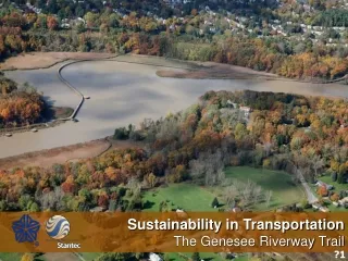
Sustainability in Transportation The Genesee Riverway Trail ?1
Agenda • Welcome • Project Evolution – “Why Provide Multi-Modal Facilities” • Multi-Modal History of the Area • Design Challenges • Construction Phase • Questions and Answers
Why Provide Multi-Modal Facilities • ISTEA – 1991 “MPOs need to include a bicycle and pedestrian component in their long-range transportation plans . . . . livable communities.” • Bicycle and pedestrian action plan for the Rochester Metropolitan Area – GTC 1996 • Vision – “Community that values and supports bicycle and pedestrian travel that is safe, pleasurable, and accessible for all users.” • Long-range planning documents are excellent resources for the design team. GTC, February 2006
Monroe County - 1991 Existing Trails A – Erie Canal Heritage Trail B – Genesee River Trail C – Genesee Valley Greenway D – Greece Route 390 Trail E – Route 104 / Webster Trail
G Community’s Vision “Make bicycling and walking more attractive and enjoyable travel options; and to make it safer for those who choose to bicycle or walk.”
Existing Conditions Map IPP 1996 – 1997 EPP 1997 – 1998 Preliminary Design 1999 – 2003 Center Segment South Segment North Segment
Existing Conditions – South Segment Existing trail ends at Turning Point Park Existing trail ends at Turning Point Park Existing access way at river’s edge Existing access way within Turning Point Park to the Genesee River (Slope > 20%)
Existing Conditions – Center Segment Existing dilapidated structure Existing 5’ wide Structure Existing Genesee River Turning Basin Safety concerns with original design
Existing Conditions – North Segment Existing Topography of the area Privately Owned Genesee Marina Genesee Marina
Multi-Modal History of the Area • 1870 – 1970: Coal from Pennsylvania was loaded onto ships and barges and transported to ports on Lake Ontario and the St. Lawrence River. • Typical year = 1,000,000 tons of coal Circa 2005 Circa Early 1900’s
Multi-Modal History of the Area Study Area USGS Mapping – Excellent Resource
Alternative Development Phase • Mapping Constraints • Topography • Wetlands • Genesee River • Contaminated Materials • Social Issues • Permitting Requirements • Constructibility • Railroad • Financial Obligations • Existing Land Use and Access Patterns Step 1 Step 2 Step 3 Corridor Analysis Segment Analysis Preferred Alternative Identified ?2
Stakeholder Collaboration • Community • City of Rochester • Genesee Transportation Council • New York State Department of Transportation • Federal Highway Administration • Department of Environmental Conservation (NYSDEC) • Army Corps of Engineers • Stantec “Field visits were essential to communicating the project’s vision.”
Preferred Alternative - South Segment Land-based trail, 2,968-feet in length, utilizing an old railroad bed to transition from the top of the bank to the river’s edge.
Preferred Alternative - Center Segment Bridge, 3,572-feet in length, over the Genesee River Turning Basin
Preferred Alternative - North Segment All new land-based trail, 3,406-feet in length, through Turning Point Park North and the Genesee Marina.
Design Challenges • Environmental Stewardship • Topography of the river channel • Steep slopes – 75’ vertical drop (1 on 1) (6 acres) • Impacted area – 0.03 acres
Design Challenges • Environmental Stewardship • Wetlands (22 total acres) • 0.01-acre of net loss – Federal • 0.11-acre of net loss – State • Temporary impacts < 0.5-acre
Design Challenges • Environmental Stewardship • Genesee River • NYSDEC – Three historical records of rare plants (vascular) within river gorge area (1 threatened; 2 endangered) • Critical Environmental Area (CEA) • Warm water fishery and spawning area (northern pike, black bass, common carp) • Seasonal river elevation fluctuations (1.5’) • Historic Great Lakes water level data - National Oceanic Atmospheric Administration (NOAA) • Sedimentation within the River channel Turning Basin (6”-8” per year) Swan Family
0.0 Silt -10.0 Peat -20.0 Silty Clay -30.0 -40.0 Silt -50.0 Sand -60.0 Peat -70.0 Sand -80.0 Silt Shale -90.0 Design Challenges • Sedimentation within the existing channel ?3
Design Challenges • Environmental Stewardship • Contaminated materials Genesee Marina – Leaking oil tanks, contaminated soils, and debris piles throughout Genesee River Channel (Sediment within channel has a high heavy metal content)
Design Challenges • Environmental Stewardship • Navigational channel, controlled by the US Coast Guard.
Design Challenges • Environmental considerations • Permitting • DEC • Art 15 Stream disturbance • Navigable waters • Art 24 Freshwater wetlands • Section 401 Water Quality Certification • US Army Corps • Section 404 (Waters of the US Nationwide Permit) • Section 10 (Rivers and Harbor Act) ?4
Design Challenges • Railroad Corridor • Rails with trails, co-exist with active CSX Line • At-Grade Crossing • Design consideration, separation distance • Overall constructibility due to geography (steep slopes)
Railroad Corridor • Rails-with-Trails: Lessons Learned, August 2002, U.S. Department of Transportation • “Trail users may not be considered trespassers if a railroad permits trail use and thus the railroad would owe a higher duty of care” • Incidents of injuries to trespassers will occur with greater frequency • Trail users may be insured by railroad activities
Design Challenges • Landscaping/Signage – Native plantings (1,025, e.g. maples, oaks, dogwoods, flowering cherry, berry bushes) & wayfinding signage • Security of the marina and trail infrastructure
Design Challenges • Project’s Horizontal and Vertical Alignment • Structure • Typical Section (land-based) • 3.0 m (10’) width • Stone Dust Surface • Structure Type (bridge) • Boardwalk With Steel Handrail (timber deck)
Design Challenges • Trail Structure Design References • Used AASHTO Guide Specifications for Pedestrian Bridges • AWPA, Southern Pine Council, USDA Forest Service • ADA guidelines • American Galvanizers Association • Trail guidelines from numerous sources (Books, Internet Sites such as www.americantrail.org and trail user groups etc.) • Other trail structures
Design Challenges • Trail Structure Design Criteria • 85 psf live load and emergency ATV vehicle • Fatigue not a concern with no vehicles allowed on structure • Structure selected must fit given budget • Construction means and methods (access, etc.) • Aesthetics • Material choices and simple repetitive details • Cost estimates refinement and adjustment process • Trail structure length 3,570 ft +/- and 12-ft out-to-out ?5
Substructure Options • Open ended steel pipe piles • Helical anchors (such as Chance anchors) • Micro-piles (drilled and filled with grout or concrete) • Closed ended steel pipe piles driven to rock (filled with concrete or grout)
Substructure Final Selection • Open ended 6” steel pipe piles driven to rock • Based on preliminary quotes from pile driving companies and geotechnical recommendations • Thicker wall section used • Combination of vertical and battered piles • Diagonal bracing between piles to stiffen the piles at the girder connection • 75 steel pile bents = 20,000 ft or just under four miles
Substructure Final Selection • Two-ft diameter drilled shafts with one-ft diameter columns • Used for 10 pier locations at the Northern end of the trail where rock was close to the surface • W-Section cap beam was used to support the superstructure at all pier locations
Superstructure Options • Single girder option • Signature span • Floating bridge • Prefabricated structure (truss) • Timber Structure • Twin Steel girders
Superstructure Final Selection • Twin steel girders consisting of W24 and W16 galvanized rolled shapes • 45` typical span with some shorter spans on the curves • PTFE Bearings were used • Cantilevered girders 2’ past pier caps • Field welding • Steel channel diaphragms and angles for lateral bracing • 600,000 lbs of steel for the superstructure
Deck Options • CIP concrete • Precast concrete deck planks • FRP deck panels • Iron wood (IPE) • Steel grating • Pressure treated wood deck • Nail-laminated deck (with asphalt surface) • Plank type deck • Composite lumber ?6
Deck Final Selection • Pressure treated 2x6 plank deck on 2x8 stringers (southern yellow pine KDAT or ADAT to reduce potential for warping, copper azole preservative) • Lightweight, widespread availability, drainage • Galvanized deck screws • Precast concrete end blocks • Over 7200 deck boards (16.5 miles) in addition to the 4.75 miles of stringers • Over 150,000 screws into the deck alone
Railing Options • Pressure treated railing • Picket type railing • Galvanized pipe railing
Railing Final Selection • Two-inch diameter galvanized steel pipe railing that was black powder coated • Railings must resist 50 plf horizontal and vertical load • 42” railing for majority of structure for aesthetics and visual purposes • 54” higher railing provided on 5% grade • Black vinyl coated mesh for safety and aesthetics • 7,200-feet of railing and mesh
Design Challenges • Right-of-Way • Turning Point Park north – land locked • Genesee Marina (acquisition – 4.2-acres / 2 easements – 0.32-acres; required subdividing parcel) • Genesee Marina environmental issues
Design Challenges • Cost Estimating/Funding Considerations • 2004/2005 inflation, supply & demand (cement, steel, oil) • Monthly updates • Alternative Bidding: Alternates / Deducts were incorporated into the final contract documents package • Design modifications (Alignment updates to minimize bridge length) ?7
Construction Phase • Bidding • *In order to assure bidders of the integrity of the competitive bid process, the criteria and formula for determining the low bidder, in an alternate bid process, must be fully and clearly described in the bid proposal documents. If the budget cannot be exceeded, the total budget figure should be announced in the public opening just prior to opening of bids. • If any bids for the base bid plus alternate 1 come under the budget figure, the award will be made based on the base bid plus alternate 1, however . . . .
Construction Phase Site Access
Construction Phase Drilling Rig Accident Prefab Superstructure
Construction Phase “Meeting in the Middle”
Construction Phase • Helicopter Operation ?8