3D Analyst
3D Analyst. Components. ArcScene Is where 3D Analyst is located Visualization and Some Analysis ArcGlobe Like Google Earth – google’s is better ArcMap - does NOT display 3D! ArcCatalog – can preview in 3D. 3D Data. Has a Z value Elevation is most common Z value
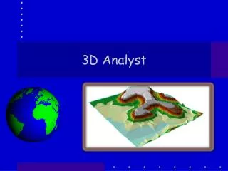

3D Analyst
E N D
Presentation Transcript
Components • ArcScene • Is where 3D Analyst is located • Visualization and Some Analysis • ArcGlobe • Like Google Earth – google’s is better • ArcMap - does NOT display 3D! • ArcCatalog – can preview in 3D
3D Data • Has a Z value • Elevation is most common Z value • But can also represent • Pollution levels • Noise levels • Precipitation …. Etc.
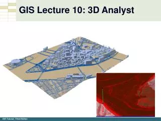
Kinds of 3D data structures • DEM raster • TIN (Triangulated Irregular Network)
TIN • Every 3 points of Z are connected to make a Triangle w/ Area, Slope, and Aspect.
3D view • Open ArcScene • Load DEM or TIN • Raster will be flat! • Set base height • Set vertical exaggeration • Illumination of DEM
Navigation tools different • General nav tool • Zoom tool Fly tool • Guess what? • Expand field of view • Narrow Field of View Done while we go through these demos
Vertical Exaggeration • Why? • used to emphasize small changes • bring z-units into proportion with x,y units • It is a only visual effect that does NOT affect analysis
Illumination • Every Scene has a light source – the sun • Thus different parts of the scene are illuminated differently • The sun’s position is described by… • The sun’s azimuth is measured from 0 (north) to 360 (north) ccw. (315 (NW) is default) • The sun’s altitude (0-90) is its height above the horizion.
Layer Properties • Base Heights • establishes the elevations of surface locations and features. • Extrusions • tells 3D Analyst how high a feature rises above the ground or extends below it.
Base Heights • Elevation values that are used to display a layer in 3D. • These values can come from various places. • layer: • the node elevations in a TIN, • the cell values in a raster, • the z-values in a 3D feature layer, • or the elevation attribute values for a 2D feature layer.
Rendering • In layer’s properties • Scene Layer properties
Extrusions • three-dimensional extension of features. • An extruded point a line; • an extruded line a wall; • an extruded polygon a chunk. • There are many methods used to do this
Surface Calculations • Slope • Aspect • Hillshade • Contours • (Reclassification) • Pretty much the same as ArcGIS but tools in 3D Analyst Tools
Adding 2D data • Turning on in TOC does not do much – maybe can’t even see it! • Have to set the layer’s elevations • Layer properties/Base Heights from DEM