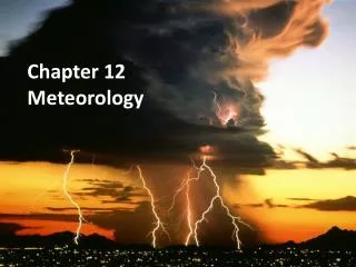
Chapter 12 METEOROLOGY
Chapter 12 METEOROLOGY. 12. 1 The Cause of Weather. Weather vs. Climate Meteorology is the study of atmospheric phenomenon Short term variations in the current state of the atmosphere that affect the environment and life on Earth are called weather.

Chapter 12 METEOROLOGY
E N D
Presentation Transcript
12. 1 The Cause of Weather Weather vs. Climate Meteorologyis the study of atmospheric phenomenon Short term variations in the current state of the atmosphere that affect the environment and life on Earth are called weather Climate is the long-term average variations in weather for a particular area.
Heating Earth’s Surface • The sun is always heating a portion of Earth’s surface. Why is a January day warmer in Miami than in Detroit? Why, when it is summer in America is it winter in Australia? Why do the North & South poles get 6 months of daylight and 6 months of darkness? ANSWER: Because the Earth TILTS In this illustration the same amount of solar radiation heats Miami more than Detroit because Miami is closer to the equator, which gets the majority of solar radiation. http://www.youtube.com/watch?v=DuiQvPLWziQ&feature=player_detailpage
Air Masses • Air over a warm surface is heated by conduction • This heated air rises because it is less dense than the air surrounding it. • This can take place over thousands of square kms over days or weeks • An air mass is a large volume of air that has the same characteristics (such as humidity and temperature) as its source region (the area over which it forms) • Air masses are classified according to where they form.
Types of Air Masses • Tropical Air Masses • Maritime tropical (mT): tropical bodies of water like Gulf of Mexico or Caribbean • Continentaltropical (cT): Southwestern US • Polar Air Masses - • Maritime polar (mP): North Atlantic or North Pacific oceans • Bring heavy rains to west coast of US in winter • Continental polar (cP): interior of Canada or Alaska • Winter: carries frigid air south • Summer: provides relief from from hot, humid weather • Arctic (A) Air Masses - • Source: above 60o N latitude • Receive virtually no solar radiation in winter • Bring coldest winter temperatures
12.2 Weather Systems: Fronts • When different air masses collide, they DO NOT MIX. • A collision of two air masses forms a dramatic weather change called a front. • There are four types of fronts.
Cold Front • When cold, dense air displaces warm air, it forces the warm air, which is less dense, up along a steep slope. • Brings intense precipitation and sometimes thunderstorms.
Warm Front • Advancing warm air displaces cold air. • Causes widespread light precipitation.
Stationary Front • When two air masses meet but neither advances, the boundary between them stalls. • Light winds and precipitation
Occluded Front • Sometimes a cold air mass moves so fast it overtakes a warm front and forces warm air up. • Advancing cold air mass collides with cold air mass in front of the warm front. • Strong winds & heavy precipitation.
Pressure Systems H • Sinking air = high pressure • Rising air = low pressure • Air flows from high to low pressure • Low Pressure System • Air rises, spirals toward the center and up • As it rises, it cools & condenses into clouds = cloudy weather & precipitation • High Pressure System • Sinking air moves away from the system’s center when it reaches Earth’s surface • Fair weather (like in subtropical ocean climates) L
Global Wind Systems • The direction of Earth’s winds are influenced by Earth’s rotation. • The Coriolis Effect results in a curved flow of wind & water. • The Coriolis Effect + the unbalanced heating of Earth = distinct global wind systems that move warm air from the tropics & cold air from the poles • There are three basic wind systems in each hemisphere, the polar easterlies, prevailing westerlies, and trade winds.
Polar Easterlies • 60oN latitude and the North Pole and 60oS latitude and the South Pole are the polar easterlies. • Weak, sporadic, cold wind that moves in an easterly direction away from each pole.
Prevailing Westerlies • Located between 30oN and 60oN, and between 30oS and 60oS • Steady winds that originate from the west and blow toward each pole • Move much of the weather across the United States
Trade Winds • Between 30oN and 30oS (including the equator) are two circulation belts of wind known as trade winds. • Air moves toward the equator (intertropical convergence zone ITCZ) in an easterly direction, rises, and moves back towards 30o latitudes. (horse winds)
Air Pressure • Air pressure is due to the weight of the atmosphere and is equal to the force/area or N/m2. The usual unit is 100 N/m2 or 1 millibar (mb). • At sea level air pressure is 1000 mb. Increases in elevation mean decreases in air pressure, as there is less air above you. • There are less oxygen molecules when there is less density. That is why we say the air on mountaintops is ‘thinner’ and makes it harder to breathe.
Jet Stream • The difference in air pressure causes wind. • A jet stream is a narrow band of fast wind that results from temperature differences of air masses at wind zone boundaries.
12.3 Gathering Weather Data A thermometer measures temperature A barometer measures air pressure An anemometer measures wind speed A hygrometer measures humidity
A radiosonde is a sensor attached to a high altitude weather balloon. • It measures • Temperature • Pressure • humidity • Radio signalsconstantly transmit this data to a ground station • If it measures speed & direction too it is a rawinsonde. (radio + wind)
A blast from the past…… • Radar stands for radio detection and ranging • The Doppler Effect is the change in pitch or frequency that occurs due to relative motion of a wave as it nears an observer. • Doppler Weather Radar analyzes the speed at which precipitation moves toward or away from a radar station. • Because the movement of precipitation is caused by wind, Doppler weather can also predict the speed of thunderstorms or tornadoes. http://www.weather.com/weather/map/interactive/Washington+NJ+07882
12.4 Weather Analysis & Prediction • After weather data is gathered, meteorologist plot data on a map. A station modelis a record of weather data for a particular site at a particular time.
Station Models • To plot data nationwide or globally, lines must connect points of equal or constant values. • Lines that connect equal pressure are isobars • Lines that connect equal temperature are isotherms Isobars Isotherms
Types of Forecasts • Digital forecasts rely on numerical data to predict how atmospheric variables change over time. Done mostly by computers. • Analog forecasts compare current weather patterns to similar weather patterns from the past. Useful for conducting monthly or seasonal forecasts.
Types of Forecasts • Short-term forecasts (hours – 1-3 days) are more accurate and detailed because weather systems change direction, speed, and intensity over time. • Radar & satellites accurately measure hourly forecasts • 1-3 day forecasts are based on large features (such as pressure systems) and are usually accurate for temperature & precipitation • Long-term forecasts • (1-2 weeks) • Always less reliable • Based mostly on weather cycles & patterns