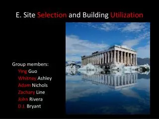
Building Site Selection Tool using Python
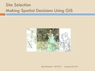
This tool helps in selecting optimal sites for civil buildings based on input parameters such as price, number of bedrooms, proximity to amenities, and schools. It utilizes Python for geoprocessing tasks like creating geodatabases, defining projections, batch processing data, site selection, geocoding, buffering, and more. The tool streamlines the site selection process, providing flexibility for adjusting selection criteria through a user-friendly GUI.


Building Site Selection Tool using Python
E N D
Presentation Transcript
Building Site Selection Tool using Python Jae Sung Kim
Input parameters • WorkSpace: workspace • Projection: Coordinate System • Civil Building: Feature Class • Church: Feature Class • Groceries: Feature Class • Street: Feature Class • West Lafayette High School: Feature Class • Satellite Image(EROS): Raster Dataset • Newly created geodatabase: string • Address Locator: Address Locator • Address Table • Buffer Mileage • Price & Number of Bed Room • The folder where new GDB will be saved
Selection Criteria • Price<$150000 • No. of Bedroom>=3 • Inside 1mile from major road • Inside 1.0mile from church and grocery • Inside 2.0mile from WL Jr.High School & CE building • All can be adjusted in GUI
Requirement of project • Create a geodatabase: gp.CreatePersonalGDB(arguments) • Batch define projection & georegister all data: Feature class: gp.BatchProject(arguments) Raster: gp.ProjectRaster_management(arguments) • Batch input features, raster and tables: gp.FeatureClassToGeodatabase_Conversion(arguments) gp.RasterToGeodatabase_Conversion(arguments) gp.TableToGeodatabase_Conversion(arguments)
Requirement of project • Perform site selection Table Select: gp.TableSelect(arguments) Geocode Address: gp.GeocodeAddresses(arguments) select feature: gp.Select(arguments) Buffer: gp.buffer_analysis (arguments) Clip: gp.clip_analysis (arguments) • Put message in the window gp.AddMessage(arguments) • Access and manipulate atomic elements Delete field: DeleteField_management(arguments) (We don’t need status, score, side from geocoding anymore)
Remarks • When creating geodatabase, we have to newly set workspace. ex) Gp.workspace=NewGDB • Have an attention about the paths of source code, reference data of Address Locator. • Everycode regarding to Geoprocessor can be found out at <http://webhelp.esri.com/arcgisdesktop/9.2/index.cfm?TopicName=welcome>