Download
1 / 5
Exploring Map Grids: Unveiling the World's Features
50 likes | 157 Vues
Dive into the world of map grids, indexes, and physical maps to uncover Earth's natural landforms and waterways. Learn about the South Pole and how lines of latitude and longitude intersect at this pivotal point on the globe.
Télécharger la présentation 
Exploring Map Grids: Unveiling the World's Features
An Image/Link below is provided (as is) to download presentation
Download Policy: Content on the Website is provided to you AS IS for your information and personal use and may not be sold / licensed / shared on other websites without getting consent from its author.
Content is provided to you AS IS for your information and personal use only.
Download presentation by click this link.
While downloading, if for some reason you are not able to download a presentation, the publisher may have deleted the file from their server.
During download, if you can't get a presentation, the file might be deleted by the publisher.
E N D
Presentation Transcript
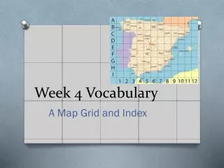
Week 4 Vocabulary A Map Grid and Index
GRID • A pattern of lines that forms squares
INDEX • An alphabetical listing of places names on a map and grid squares in which they are found.
PHYSICAL MAP • A map that shows natural landforms and waterways on Earth’s surface.
South Pole • The point on Earth located at 90 degrees south latitude where the lines of longitude meet


More Related