Air Quality Update Wind River Mountains
300 likes | 471 Vues
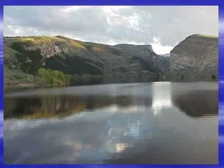
Air Quality Update Wind River Mountains. Shoshone and Bridger-Teton National Forests May, 2008. Objectives. GYACAP and assessment Wind River Range network Monitoring network data analysis NADP high elevation lakes bulk deposition visibility Ozone challenges and modeling results

Air Quality Update Wind River Mountains
E N D
Presentation Transcript
Air Quality Update Wind River Mountains Shoshone and Bridger-Teton National Forests May, 2008
Objectives • GYACAP and assessment • Wind River Range network • Monitoring network data analysis • NADP • high elevation lakes • bulk deposition • visibility • Ozone challenges and modeling results • Status of coordination efforts • Workload • Discussion and questions
GYACAP and Assessment • GYACAP and purpose • Technical advisory group to GYCC • Forum for communication • Coordination of monitoring • Assessment and purpose • Identify and address issues • Foster partnerships and secure funding
Assessment Summary • Membership • Park Service, Forest Service, BLM, Fish and Wildlife Service, State DEQs (ID, MT, WY) • Issues • Urban and industrial emissions • Oil and gas development in SW Wyoming • Prescribed fire and wildfire smoke • Snowmobile emissions
NADP Gypsum Creek Pinedale South Pass Mercury (South Pass) Other Monitoring CASTNet (Pinedale) WARMS (Pinedale) Quasi-IMPROVE (South Pass) WY DEQ Ambient Air Monitors and Cameras (3) Long-term Lakes Hobbs Black Joe Deep Upper Frozen Saddlebag Ross IMPROVE Aerosol (Pinedale) Transmissometer (Pinedale) Camera (Pinedale) Bulk Deposition Hobbs Black Joe Monitoring Network
Summary of South Pass Data • NH4 is on an upward trend and has basically doubled at most sites • NO3 shows no trend but values have increased substantially in winter, spring and fall seasons • SO4 is on a downward trend and has decreased by 25-50% • Inorg-N shows no trend at 95% level but upward trend at 90%, which is a concern
Summary of Lake Data • ANC is on a downward trend • Perhaps explained by upward NO3 trend • Magnitude of change at Ross Lake a real concern • Black Joe Lake is an exception • NO3 is on an upward trend • Upward trend at lake inlets and no trend at outlets a real concern relative to eutrophication • SO4 is on a downward trend • Perhaps due to reduction in use of high-sulphur diesel
Summary of Bulk Deposition Data • Above average total N and S at Hobbs and Black Joe Lake sites for 2005. • Same high values at Black Joe Lake for 2006. • Total N • Black Joe Lake 2005 & 2006 = 3.74 & 3.79 kg/ha/yr (Average total N = 2.66 kg/ha/yr) • Hobbs Lake 2005 & 2006 = 3.66 & 2.44 kg/ha/yr (Average Total N = 2.30 kg/ha/yr)
Bulk Deposition (cont.) • Rocky Mtn. NP has established a “critical load” for N deposition of 1.5 kg/ha/yr. • Changes in Lake Diatom Communities Affecting Lake Function • BTNF N deposition is > 2x that level some years. • BTNF average N depositions are 50-75% greater than NPS critical load. • Need to conduct more studies on BTNF. • BTNF looking to adopt that critical load.
Summary of IMPROVE Data • Visibility has improved slightly since 2002, however: • Pinedale site is not ideally located for monitoring impacts from nearby developments. • Securing a new monitor for monitoring maximum impact from developments. (2008) • Modeling for NEPA projects show visibility impacts are occurring.
Ozone Challenges • Ozone Issues(2005, 2006 and 2008) • State issued 5 ozone warnings in February and March 2008 • Exceeded old standard 7 times and new standard 14 times • 3 year average may place the area in “Non-Attainment” • May affect human health, visibility and plant growth on the Forest • Ozone Study (2007 and 2008) • Need to re-think science of ozone formation – not just a warm weather event • Ammonia Study (2007 and 2008)
NEPA Modeling Findings • Visibility – show days of impairment in Class I areas (PAPA 2000-2005 45 days > 1 dv, cumulative 77-88 days) • PM 10 – levels nearing Class I Prevention of Significant Deterioration (PSD) Significant Impact Level (SIL) • NOx – emissions higher than originally modeled (PAPA 2000 693.5 tpy vs 2005 3,512 tpy, 5 x higher) • Ozone – models predict levels exceeding new NAAQS
Concern Summary • Visibility degradation in Class I areas • Lake chemistry changes • Increasing nitrogen deposition • Ozone • Scale and pace of oil and gas development
Coordination Efforts • Wyoming DEQ-AQD • EPA • BLM • Industry
FS workload • Continue existing monitoring • Add additional monitoring • Continue review of upwind NEPA efforts • Continue dialogue with industry, State, and Federal agencies • Solidify critical loads documentation • If needed, certify impairment of wilderness values