Download
1 / 23
240 likes | 461 Vues
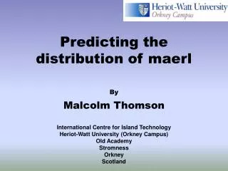
SUMARE Workshop: Underwater Robotics for Ocean Modelling and Monitoring. Classification of maerl beds using video images. Malcolm Thomson. International Centre for Island Technology Heriot Watt University(Orkney Campus) Old Academy Stromness Orkney Scotland, UK.

E N D
SUMARE Workshop: Underwater Robotics for Ocean Modelling and Monitoring Classification of maerl beds using video images Malcolm Thomson International Centre for Island Technology Heriot Watt University(Orkney Campus) Old Academy Stromness Orkney Scotland, UK
Use of video in marine habitat mapping SUMARE and the maerl case study Recognition of different maerl features Influence of altitude on classification Data outputs & problems
Video in marine habitat mapping • Widely used by divers and in ROVs for seabed survey • Human interpretation required • Simple data processing, e.g. animal counting • Used to “ground truth” acoustic survey results, e.g. Sound of Arisaig SAC
“Unsupervised” video processing • Used by Lebart et al. (2000) to detect features in sea floor video transects • looking for discrete features • Seabed habitat mapping is a priority in marine research e.g. ICES, OSPAR, Habitats Directive • “unsupervised” classification tools have great potential • large data outputs
Project SUMARE - maerl application • Recap:- • Marine alga • Non-jointed calcareous structure • Can form large deposits on the seabed • Found in or near strong water currents • Is exploited commercially in France, the UK and Ireland • Very high species diversity - high conservation value
~2m Maerl mosaic from Wyre Sound, Orkney Islands
Information requirements for maerl • Dimensions of maerl beds • Variation in area coverage of maerl • variation in amount of living maerl may indicate the health status • SUMARE - use autonomous sensors to: • provide information on the boundaries of maerl beds • estimate the coverage of living (and dead) maerl within these beds. • Practical application • conservation & exploitation
Survey requires recognition of these features Characteristics of maerl habitats Analysis of video footage collected during SUMARE sea trials, August 2000 4 features: • Living maerl • Dead maerl • Macroalgae • Sand
Recognition of maerl features • Visual discrimination • Analysis of selected examples of maerl features, e.g. living maerl • examine greyscale properties for each feature • greyscale histograms characteristic of different features • histograms produced by MatLab • combined effort from biologists and computer programmers
Living and dead maerl... Dead maerl occupies the lighter portion of the greyscale histogram Living maerl occupies the darker portion of the greyscale histogram
Sand appears similar to dead maerl at certain altitudes Sand has a uniform greyscale range Sand...
Macroalgae exhibits a broad greyscale range at high altitudes Macroalgae.
Altitude and classification • Greyscale values vary with ROV altitude • Some confusion between different features with similar greyscale histograms • To improve classification: • collect images from different altitudes • compare greyscale histograms
Living maerl... 8.4m 6.5m 4.6m 1.1m 0.5m
Dead maerl... 8.4m 5.3m 2.3m 0.9m 0.7m
Sand... 5.3m 4.5m 3.7m 2.5m 0.6m
Macro-algae 6.9m 4.8m 2.8m 1.6m 0.8m
The result • Histogram sets • for each of the 4 maerl features • living maerl • dead maerl • sand • macroalgae • for varying altitudes (0.5 - 8m) Reference database
Computer algorithm • Written in Visual C++ • Analyses maerl bed video footage • Identifies maerl features by reference to histogram database • Accuracy of classification improves with the number of images in each database • Quantify area of seabed covered by living and dead maerl • application in exploitation and conservation of maerl
Problems • Variation in image exposure • depth • light conditions (sun, cloud) • water clarity • Indistinct boundaries between features • e.g. sand and dead maerl • Presence of “other” features • e.g. rock, other species of algae
Future work • Continued development of classification algorithm • Field trials in 2002 (Orkney)