Download
1 / 22
220 likes | 243 Vues
Explore the potential environmental and cultural impacts of the Inter-Arabian Coastal Highway construction in Yemen, focusing on the area between Al Hodeidah and Al Khokhah. This report discusses the significance of preserving coastal ecosystems and traditional settlements, highlighting violations of environmental and cultural protection laws.

E N D
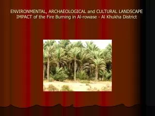
ENVIRONMENTAL, ARCHAEOLOGICAL and CULTURAL LANDSCAPE IMPACT of the Fire Burning in Al-rowase - Al Khukha District
Summary • The Government of Yemen is currently constructing an “Inter-Arabian Coastal Highway” that stretches from the border of Saudi Arabia to the border of Oman. To date most of the area has had neither an environmental, nor a cultural impact assessment of the planned roads. The following report is a rapid assessment of the possible environmental and cultural impact of the road between Al Hodeidah and Al Khokhah. • This assessment covers approximately 1.5km of the effected area from Al Hodeidah to Al Khokhah. Within this area the which has been temporarily halted. what remains of nationally important coastal ecosystems, and a highly important traditional settlement system, which has remained culturally intact for thousands of years. • It is abundantly clear that the disaster fire at the forest near the Red Sea will significantly destroy the environment, as well as the cultural, landscape and tourism potential of the area. t [ 1 ] and culture [ 2 ] and violates the international commitments made in the Convention to Protect Wetlands (Ramsar convention). The fired area will have major negative social impacts and will most likely not achieve the expected economical effects. • [ 1 ] Environment Protection Law 1996, Article • [ 2 ] The Republic of Yemen Antiquity Law # 21, Section 3 :11 - 14
1. Introduction1.1 Current State of the fired area The Al Khokhah- Al Hodeidha road is part of a larger “Inter-Arabian * Coastal Highway” that is to connect Saudi Arabia and Oman along the entire coast of the Yemeni peninsula. The road construction has already begun between Al Hodeidah and Al Khawkhah. The coastal road from Hudayda has reached beyond the outer limits of the city itself (8km), to the south, while the coastal road from al Khawkhah has reached the village of al Buqa’ (20km), to the north. It will reach the area just north of the village of Fazah. From there the two roads are to be joined by a third road. Each of these road sections is contracted to different road engineering companies. The Consulting Engineering Center will be responsible for building the coastal road north of Fazah to Hodeidah as well as four separate connection roads from this area to the main asphalt road (Hudaydah, Zabid, Taiz), which is around 30km from the coast. While part of the investment has already been undertaken the * remaining parts are currently surveyed and are to be finalized by 2008 .
1.2 Responsibility • The implementation agency for this project is the Ministry of Public Works (MOPW) and the General Corporation of Roads and Bridges (GCRB).[1]Other relevant stakeholders for the planned road are the Governor of Al Hudaydah, the Local Council and Sheiks. The Ministry of Tourism and Environment (MOTE), Environmental Protection Authority (EPA), the Ministry of Culture and the General Organization for Antiquities, Museums, and Manuscripts (GOAM) are also entitled to be involved. • [1]contact: Eng. Mohammed Al Majani, 71122651, further responsible: Mr. Adafai
Legal status • The planning and construction of the road is in violation of the Environmental and Cultural Legislation of Yemen and is therefore illegal. The Ministry of Public Works has not undertaken an Environmental Impact assessment as required by the Environmental Law, (Article 36). Without major modifications the road is further violating Yemen’s international Commitments by destroying major wetlands. The government of Yemen, by signing the Convention to Protect Wetlands (“Ramsar”), has committed itself to preserve its precious wetlands. • The construction of this road is further illegal according to Yemen’s Antiquity law and Arab League Laws. These laws require impact assessments for all roads and development projects that could lead to damage of cultural sites.
1.5 Previous experiences • Due to environmental considerations the road has already been modified and rerouted as much as 30 km inland at Bab Al Mandab. It is important to note that the rapid impact assessment covers only around 100 km out of 730 km ofRed Sea coastline and 2000 km along theIndian Ocean. The entire impact of the planned Yemeni coastal road, therefore, cannot be determined without the proper environmental and cultural assessment suggested here. The importance of such assessments can be seen inSocotra, where due to ongoing discussions regarding similar environmental considerations, a planned road at Qualansia had to be modified
1.6 Results of the fire Impact Assessment • Environment and cultural experts undertook two field visits. A preliminary fire impact assessment was conducted. This preliminary assessment covered the ‘at risk’ areas between alKhokhah and Hodeidah with a focus mainly on the sub-provinces of Tuhaytah, Bayt al Faqih and Durayhimi.
The fire burned covers approximately 1.5km3000palm trees in the forest. This makes the direct impact area 10m wide with an additional 15m of impact on either side of the area itself, The indirect impact e.g. disturbing breeding birds, waste, infrastructure development and cultural damage, can reach up to 15km. This estimate includes predicted damages such as later development along the forest, and damage caused to the environment which does not only destroy the landscape, and the fragile ecosystems of the region, but is likely to disturb the state of archaeological site preservation
2. Ecological risks of the Fire Burning • Yemen has a unique and globally important fauna and flora, which is under heavy threat. TheFire destroyed the around 1.5KM area, which belongs according to WWF, amongst the 200 globally most important biodiversity areas. The main habitats found at the coastal line are: sea-grass assemblages, inertial sand-flats, salt marshes (sabkhah), wetlands, palm groves, shifting sand dunes and the marine ecosystems.[1]Importantly, many of these habitats are not static, but are temporally dynamic systems. For example, a sea-grass assemblage recorded one year may have ceased to exist by the following year.[ 2]Therefore human interference is especially destructive and the possible effects of the road can be more significant than a description of the current situation might imply. The Fire burning was near “Critical Habitats”[3], which are feeding, nesting, and breeding or nursery places for marine organisms, major sources of nutrients, and areas particularly rich in species and of special scientific interest. The road is in violation of the international commitments made byYemen under the Ramsar convention to protect the wetlands[[1 Marine habitats of the Red Sea, A. Rushdi, M. Abubakr, H. Hebba, 1994 • [2] Protection of Marine Ecosystems of the Red Sea Coast of Yemen, A. Abdul, T. Rouphael, S. & R. Marchant, 1999 • [3] Ray, 1976
Main ecosystems affected by the • Wetlands/ Salt marches/ Sea Grass • Palm groves/ Wadi deltas • Moving sand dunes • Red Sea marine ecosystems • 2.1 Wetlands, salt marshes and Sea Grass habitats
The Fire polluted air and destruction of the wetlands and palm groves. The polluted air increased disturbance will negatively affect migrating birds’ use of the wetlands for their nests. • Sandy Coast: • Sandy coasts offer important nesting sides for turtles such as Green and Hawksbill turtles. They are also habitats for many crustaceans.
2.2 Wild Palm grooves and Wadi deltas • The dominating wild palms in the area are Dom palms Hypaenethebica. Dom is found in dense patches in the area due to the available groundwater. Dom palms are used for firewood, rope and mattresses. Wild and cultivated date palm Phoenix dactylifera groves can be found in association with Dom palms. Its Dates are eaten and sold in the markets of the region. In the wadi deltas, patches of Salvadorapersicatrees are frequent. Many people use SalvadoraPersica branches as toothbrushes. • Wild and cultivated Kadhi palms are grazed by domestic animals and its flowers are used in households to perfume clothes. Birds, foxes and domestic animals are dependant on this coastal vegetation.
The fire cut through some of the palm groves and wadi deltas. The vegetation will be directly affected through logging and increased use for fuel wood. • Despite the lack of significant rainfall (250mm/year) the dense palm vegetation and other vegetation in the area grow mostly due to sufficient groundwater, which originates on the coastal plain. In the area groundwater is accessible only 2-3 meters under the surface. The effected area will likely affect the groundwater and the water flow in the wadis through the use of heavy machinery in construction, oil pollution and compression of earth.
The disaster area will cut the natural movement of the dunes. Expensive measures will be necessary to fix the dunes or permanent maintenance on the destroyed area to keep it sand free. • 2.4 Red Sea marine ecosystems • The Red Sea marine ecosystem is one of the world most precious biodiversity hot spots. The Red Sea is the warmest and most saline of the world's seas. No permanent coastal rivers or streams flow into the Red Sea, and it is partially isolated from the open ocean. Together, these features contribute to a unique flora and fauna. The diverse and spectacular coral reefs for which the Red Sea is renowned are found not far from the area of concern. The read sea is a distinctive coral ecosystem, comprising a regional centre of endemism for fish and invertebrates. The Red Sea hosts also a number of marine turtles including: green (Cheloniamydas), loggerhead (Carettacaretta), leatherback (Eretmochelysimbricata), olive ridley (Lepidochelysoliacea) and hawksbill (Eretmochelysimbricata).
The burning area will add to the over-fishing and further pollution through coastal development and threaten this unique ecosystem.
3. Risk for the tourism potential The area between Al Hodeidah and Al Mukha, e.g. the 60 km between Ad Durayhimi- Wadi Jahabah and Al Fazah-Wadi Zabid has great potential for ecotourism. The area is characterized through its variety of landscapes, ecosystems and cultural monuments. The undisturbed beaches are ideal for day trips from Hudaydah and Zabid, and for camping and other ecotourism activities such as camel and horse riding.
3.1 Major income generation possibilities for the local population through tourism • Run local guesthouses • Rent camels, horses and boats • Sell local products (Fish, fruits) • Sell local handicrafts (straw products, textiles, pottery) • The protection of the coastal area can increase the income of the local population and can change tourism development in Yemen. Today tourists visit Yemen for an average of 12-15 days. With additional trips to the Tihama tourists will be tempted to visit Yemen for a significantly longer period of time or will return for following visits. (1. visit to the northern part, 2.visit to the southern part).[1] • [1] M. Livadotti, 2003
4. Risks to the cultural landscape and to archaeological sites 4.1 Cultural Landscape attractions The Tihama coastal plain provides a unique landscape in contrast with the highlands of Yemen. Its cultural traditions (i.e. architecture, marketplaces, customs etc.) coexist with its diverse sub-tropical landscapes, which include arid active dunes, thriving mangroves and marshes, sub-tropical intensively cultivated inter-wadi and wadi plains, and its wide sand beaches. The Tihama remains one of the most original and interesting regions in the Middle East, which has untouched cross-cultural traditions stemming from thousands of years of integration, trade and cultural contact between Africa, Asia and the Middle East.
Highlights of the area • - The city of Zabid • - The city of al Mukha • - Bayt al Faqih • - The old center of al Hudayda • - Islamic Tihaman architecture • - The archaeological site of al Hamili (Hajar al Qyamah)
B) Cultural/ Historical Monuments: Fazzah Mosque Al Ti’faf and al Mujaylis Mosques Qala’at al Jah Ghulayfiqa Forts The Immam Summer Palace Ta’if Al Durayhimi Fort Al Durayhimi Mosque