Download
1 / 33
330 likes | 348 Vues
This article discusses the use of Unmanned Aircraft Systems (UAS) in improving hurricane prediction, with a focus on the capabilities of high altitude, long endurance (HALE) UAS such as the Global Hawk and Zephyr. It explores the potential applications of UAS in monitoring hurricane surface winds, central pressure, oceanic temperatures, and maintaining communication in affected areas during landfall.

E N D
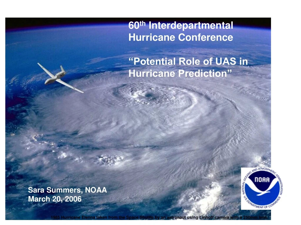
60th Interdepartmental Hurricane Conference “Potential Role of UAS in Hurricane Prediction” Sara Summers, NOAA March 20, 2006 1985 Hurricane Elenna taken from the Space Shuttle by an astronaut using Linhoff camera with a 250mm lens.
Motivation "We must move new but proven observing systems into an operational environment and redirect associated resources and research toward exploring new technologies, such as unmanned aerial vehicles, to meet future requirements.“ VADM C. Lautenbacher, FY2007 Annual Guidance Memo to NOAA
Motivation Improved data and observationshold the key to saving lives, property and resources: improved hurricane track and intensity predictions, drought mitigation, understanding global climate systems and the state of the planet’s natural resources,
Motivation Improved data and observationshold the key to saving lives, property and resources: improved hurricane track and intensity predictions, drought mitigation, understanding global climate systems and the state of the planet’s natural resources, The devastation caused by Katrinahas challenged NOAA to develop a program that will require applying the best science and technology available to improve hurricane prediction. Unmanned Aircraft Systems (UAS) are an emerging technology. Their role in hurricane track and intensity prediction is currently being assessed by the scientific community.
Short-Term Forecast – Key - NOAA and NWS do a good job at on-going improvement of hurricane track prediction accuracy - Skill in intensity prediction at time scales from 0 to 4 days and related predictions of storm surge and inland flooding is significantly less. • In the last three years, New Orleans and the Louisiana coast has been under threat of a Category 4 hurricane strike four times: hurricane Katrina was the first to reach the coast at that intensity. • Similarly, Hurricane Charley hit the Florida coast as a Category 4 storm, when a weak Category 3 had been expected.(Alexander E. MacDonald, Coastal Guardians, Sept, 2005)
Definitions *UAS = Unmanned Aircraft “System” Plane + Platform + Coms Operated from the ground. Autonomous *High Altitude Long Endurance (HALE) HA = High Altitude, i.e. > 45 k feet LE = Long Endurance, i.e. airborne for 25 hours or more Loitering capability allows us to observe evolution of system Payload capability varies; large payloads can support broad sensor suite e.g. Global Hawk, Altair, Global Observer *Medium Altitude Long Endurance (MALE) MA = High Altitude, i.e. 15- 45 k feet LE = Long Endurance (same as above) e.g. Predator B *Low Level Fly low and slow Limited payload capability, limited endurance e.g. Aerosonde, Scan Eagle, Sierra, Silver Fox
HALE System Equipped with Ku-band (over the horizon)
Potential Use of HALE Unmanned Aircraft Systems During Hurricanes • An aircraft like the Global Hawk could fly above the hurricane at 60 to 65 K, staying with the storm for extended periods. • It could use remote sensors (radar and Stepped Frequency Microwave) to continuously monitor hurricane surface winds. • It could drop sondes to continuously monitor storm central pressure, and oceanic sondes to determine sea temperatures. • It could carry repeaters so that it could maintain cell phone communications in the affected areas as the storm makes landfall.
“A Global Profiling System for Improved Weather and Climate Prediction” Proposes a new long-term global observing system that would provide routine, detailed vertical profiles of measurements in the atmosphere over oceans and polar regions, as well as adaptive soundings. Dr. Alexander MacDonald
ADAPTIVE SOUNDINGS Moisture * The cycle of eyewall replacement * Ocean Interaction * Hurricane Environmental Interaction Key Scientific Issues:
Global Hawk * Range: 14,000 miles * Speed: 350 knots * Altitude: 60,000 feet * Payload: 1960 lbs
Dropsonde Pod NORTHROP GRUMMAN PRIVATE/PROPRIETARY LEVEL 1-COMPETITION SENSITIVE
QinetiQ Proprietary Zephyr HALE UAS • Solar-powered HALE UAS • Operational altitude 50kft to 65kft+ • 50ft wingspan with future option to scale to 80ft for greater payloads • Continual operation (weeks or months) • Autonomous flight • Low unit cost; low cost of operation & support; hand launch and recovery; no operating base/runway needed • No fuel distribution network needed • Lightweight solar array and lithium based rechargeable batteries • Low mass <60lbs / low projected production cost / Satcom capable 2 successful flights at WSMR in 2005; 6 hour duration & 27,000ft altitude-WSMR limited
QinetiQ Proprietary Drop-sonde design Dropsonde dispenser • Alternative drop-sonde • Capable of dispensing micro-sondes for atmospheric research • Measure PTU + wind speed • Drop-sonde mass ~20g • Utilizes patch antenna • Communicates with Zephyr • Zephyr Satcom relays data back • Drop sonde dwell time ~30mins • Independent power supply • Operate between -56oC and +40oC • Lightweight dispenser • 60 sondes per dispenser • Multiple dispensers on Zephyr • Release on command • Simple design / few moving parts Aeroshell for descent braking Sonde mock-up In-flight release
General Atomics Aeronautical Systems, Inc. Altair • Wingspan 86 ft • Fuselage 36 ft • Max. Altitude 52K ft [45K ft] • Endurance, max. 30+ hours [20 hours] NOAA “dull, dirty and dangerous” missions • Total weight 3000 lbs • Engine Honeywell turboprop (TPE 331-10T) • Typical speed 150 – 200 kts (77 – 103 m/s or 172 – 230 mph) • Max Distance 10000 km [5000 – 6640 km] • Unpressurized and no temperature control in payload bay • Internal payload 660 lbs. [300 lbs.]
Proposed Altair/Predator B Path – Circumnavigating the Storm
Sensor Suite From ‘05 Altair Demonstration Passive Microwave Vertical Sounder (NOAA) Ocean Color Sensor (NOAA) Ozone Sensor (NOAA) Gas Chromatograph (NOAA) Digital Camera System (NASA) EO/IR (GA_ASI)
Aerosonde Range: ~1800nm Altitude: up to 20k ft 30+ hours flight time GPS Navigations Communications UHF Radio, LEO Satellite Wingspan ~10 ft Autonomous Engine 24cc Fuel-injected Weight 29-33lbs
NOAA satellite image of Tropical Storm Ophelia taken on Sept. 16, 2005, at 9:15 a.m. EDT
NASA Wallops Flight Facility, Wallops Island, VA. 7:30-5:30 EDT X NOAA satellite image of Tropical Storm Ophelia taken on Sept. 16, 2005, at 9:15 a.m. EDT
Low Level UAS • Low level hurricane environment too dangerous for manned planes • Atmosphere/Ocean interface is where the strongest winds are • It is the environment where the ocean's warm water energy is directly transferred to the atmosphere just above it. • Most of coastal population lives at sea level, so short-term forecasts are critical at this level • Low-level in situ measurements will enhance existing observational capabilities within the tropical cyclone environment
Hurricane Workshop Key Participants from the Hurricane community: NOAA, NASA, DOE, Academia Question: How can we collaborate on hurricane monitoring + research ? • Our Agencies have different mission objectives, but our end goals are the same • First step in our pathway forward: National mission / experiment involving UAS • Develop a plan for Near Term #1 NOAA Priority identified by modeling and forecasting community: very low altitude operations & research, i.e. <300M • Conduct a low level UAS Hurricane demonstration in 2006 (Joe Cione)
Hurricane Meeting Objectives for Low-Level UAS Hurricane Mission NOAA NASA Map Surface Wind Flight vehicle technology verification Measure maximum wind Air-sea interaction (research) Measure 1 minute windMeso-scale mapping Monitor rapid intensificationLoiter in the eye Forecast verification Initialize next-generation hurricane modelVerification HWORFLife cycleImprove forecastingMeasure Fluxes Objectives for High Level UAS Hurricane Research Mission NOAA requires OSSEs
Importance of Accurate Water Vapor Observations Atmospheric river on 9 Jan 2005 Fatal mudslides and floods on 10 Jan 2005 - Importance of in situ measurements • Satellites do not show horizontal transport of water
Russian River flooding in Monte Rio, California 18 February 2004 GPS IWV data from near CZD: 14-20 Feb 2004 Bodega Bay Atmospheric river photo courtesy of David Kingsmill IWV (cm) IWV (inches) Cloverdale 10” rain at CZD in ~48 hours Russian River, CA Flood Event of 18-Feb-04 Atmospheric River generates flooding CZD IWV (cm)
Key Questions: • Will UAS platforms/instruments provide data that will IMPROVE THE FORECAST ? • Will the data improve the models and provide a better analysis for forecasters, particularly in the short-term ? • What will the data provide above what we are already getting from satellites and manned planes ? • Where are the current data gaps, and what combination of UAS(s) and sensors would serve to fill those gaps ? • Could the UAS test platform(s) be used to develop and test new instruments ?