Hurricane Katrina
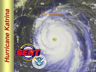
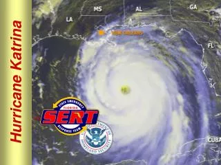
Hurricane Katrina. Created by Dr. A. Davila May 9, 2011. On August 28, 2005, Hurricane Katrina was in the Gulf of Mexico where it powered up to a Category 5 storm on the Saffir -Simpson hurricane scale packing winds estimated at 175 mph . http://www.ncdc.noaa.gov/special-reports/katrina.html.

Hurricane Katrina
E N D
Presentation Transcript
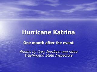
Hurricane Katrina Created by Dr. A. Davila May 9, 2011
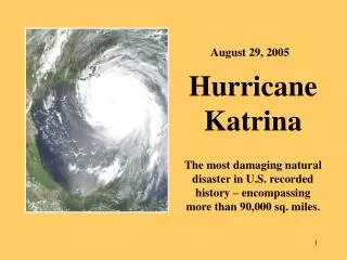
On August 28, 2005, Hurricane Katrina was in the Gulf of Mexico where it powered up to a Category 5 storm on the Saffir-Simpson hurricane scale packing winds estimated at 175 mph.http://www.ncdc.noaa.gov/special-reports/katrina.html http://www.ncdc.noaa.gov/special-reports/katrina.html
New Orleans levees gave way flooding parts of the city. The storm tossed around boats at the marina.http://www.katrina.noaa.gov/helicopter/helicopter-2.html http://www.katrina.noaa.gov/helicopter/helicopter-2.html
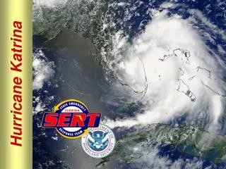
In late August, Katrina became the 11th named storm of the turbulent 2005 Atlantic hurricane season and its most deadly and destructive.August 25Katrina officially becomes a Category 1 hurricane, according to the National Hurricane Center.August 26• 5 a.m.: After weakening briefly to a tropical storm, Katrina regains hurricane status and moves on to the Gulf of Mexico. • 11:30 a.m.: The hurricane is upgraded to Category 2, with the storm's feeder bands continuing to pound the lower Florida Keys. • 4 p.m.: The National Hurricane Center warns that Katrina is expected to reach dangerous Category 4 intensity before making landfall in Mississippi or Louisiana. Hours later, in anticipation of a possible landfall, Mississippi Gov. Haley Barbour and Louisiana Gov. Kathleen Blanco declare states of emergency.
August 27• 5 a.m.: Katrina is upgraded to a Category 3, or major hurricane, with the Gulf Coast in its path. • During the day, residents of Louisiana's low-lying areas are told they must evacuate; residents in other low-lying areas are urgently advised to do so. President Bush declares a state of emergency in Louisiana. • Highways leading out of New Orleans are filled with bumper-to-bumper traffic. Several major interstates are converted to one-way routes away from the city. • 11 p.m.: The National Hurricane Center issues a hurricane warning from Morgan City, Louisiana, to the Alabama-Florida border, an area that includes New Orleans. A warning means that hurricane conditions are expected within the warning area within the next 24 hours.
August 28• 2 a.m.: Katrina escalates to Category 4 strength, heading for the Gulf Coast. The last time Mississippi or Louisiana saw landfall from a Category 4 or stronger storm was 1969 with Hurricane Camille. • 7 a.m.: Hurricane Katrina intensifies to Category 5, the worst and highest category on the Saffir-Simpson scale. • 10 a.m.: As Katrina hits 175 mph winds, New Orleans Mayor Ray Nagin orders mandatory evacuations as the storm seems to beat a direct path to the city. • During the day, Bush declares a state of emergency in Mississippi and orders federal assistance. The National Hurricane Center says low-lying areas along the Gulf Coast could expect storm surges of up to 25 feet as the storm, with top sustained winds of 160 mph, hits early the next day.
http://www.time.com/time/photogallery/0,29307,1948183_2013814,00.htmlhttp://www.time.com/time/photogallery/0,29307,1948183_2013814,00.html
http://www.time.com/time/photogallery/0,29307,1948183_2013814,00.htmlhttp://www.time.com/time/photogallery/0,29307,1948183_2013814,00.html
http://www.time.com/time/photogallery/0,29307,1948183_2013814,00.htmlhttp://www.time.com/time/photogallery/0,29307,1948183_2013814,00.html
The Census Bureau reported on Thursday that 343,829 people were living in the city of New Orleans on April 1, 2010, four years and seven months after it was virtually emptied by the floodwaters that followed the hurricane. Population estimates for July 1, 2004 were 462,269. It was considered the 35th largest U.S. city) http://www.census.gov/newsroom/releases/archives/hurricanes_tropical_storms/2005-09-06_hurricanes_tropical_storms.html
http://news.nationalgeographic.com/news/2005/09/0906_050906_katrina_facts.htmlhttp://news.nationalgeographic.com/news/2005/09/0906_050906_katrina_facts.html http://www.tropicalweather.net/hurricane_katrina_facts.htm http://dsc.discovery.com/convergence/katrina/facts/facts.html http://www.severe-weather-fan.com/hurricane-katrina-facts.html http://www.time.com/time/photogallery/0,29307,1948183_2013814,00.html