Download
1 / 22
220 likes | 241 Vues
This study presents an ensemble approach using four land surface models to estimate soil moisture and drought characteristics over the contiguous United States, offering a reproducible basis for identifying drought-affected regions.

E N D
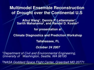
Multimodel Ensemble Reconstruction of Drought over the Continental U.S Aihui Wang1, Dennis P. Lettenmaier1, Sarith Mahanama2, and Randal D. Koster2 for presentation at Climate Diagnostics and Prediction Workshop Tallahassee, FL October 24 2007 1Department of Civil and Environmental Engineering, University of Washington, Seattle, WA 98195 2NASA Goddard Space Flight Center, Greenbelt MD 20771
Outline • Motivation • Models • Methodology • Results • Summary
Widely used, but link to direct observations (e.g., of soil moisture) is weak – hence reliance on indirect methods, such as PDSI. • Need for reproducible basis for identifying drought-affected regions. • Land surface model representations of soil moisture (and runoff) offer an alternative means for estimating severity, frequency, duration, and variability of current droughts, and linking them to the climatology of observed droughts. Motivation
Models • VIC: Variable Infiltration Capacity Model (Liang et al. 1994) • CLM3.5: Community Land Model version 3.5 (Oleson et al. 2007) • NOAH LSM: NCEP, OSU, Air Force, Hydrol. research lab (Mitchell et al. 1994, Chen and Mitchell 1996) • Catchment LSM: NASA Seasonal-to-Interannual Prediction Project (NSIPP) LSM (Koster et al. 2000; Ducharne et al. 2000)
Data • Daily precipitation and temperature max-min, other land surface variables (downward solar and longwave radiation, near-surface humidity, and wind) derived via index methods. Methods as described in Maurer et al. (2002). Data duration is from 1915-2003, and period of analysis is 1920-2003 . Spatial resolution 0.5 (3322 land grid cells), domain conterminous United States. • Soil and vegetation parameters are from different sources for different models (generally NLDAS), as provided by model developers. Other parameters are model standard setup.
The challenge: Different land schemes have different soil moisture dynamics Model simulated soil moisture at cell (40.25N, 112.25W)
Solution: Normalized total column soil moisture • For each model, total column soil moisture was expressed as percentiles (hence by construct, uniformly distributed from zero to one). • Percentiles were estimated for each model by month, using simulated total column soil moisture for the period 1920-2003. • Percentiles were computed using the Weibull plotting position formula.
Ensemble methods Two ensemble methods were used: Ensemble-1: averaged 4 modeled soil moisture percentiles of each grid cell on monthly scale. Ensemble –2: first, normalized column total soil moisture modeled by 4 models individually; second, averaged those normalized soil moisture of each grid cell in 4 models; third, calculated percentiles of those averaged values .
NE NW SW SE Areas for spatially averaged soil moisture percentiles Box sizes are 5 x 5 degrees
July 1934 Multimodel comparison –soil moisture as percentiles VIC CLM3.5 NOAH Catchment Ensemble-2 Ensemble-1
November 1952 VIC CLM3.5 NOAH Catchment Ensemble-1 Ensemble-2
October 1963 CLM3.5 VIC NOAH Catchment Ensemble-1 Ensemble-2
February 1977 CLM3.5 VIC NOAH Catchment Ensemble-1 Ensemble-2
June 1988 CLM3.5 VIC NOAH Catchment Ensemble-2 Ensemble-1
June 2002 CLM3.5 VIC NOAH Catchment Ensemble-2 Ensemble-1
Conclusions • Current drought products suffer from the absence of reproducible, objective methods for identifying drought extent and severity. • Although widely used, PDSI has well-known shortcomings, especially the absence of a strong link to physical processes • Land surface parameterizations, such as the family of NLDAS models, avoid these shortcomings. However, soil moisture, a key drought-related variable, is model-dependent • Multi-model estimates of soil moisture, appropriately normalized, address all of the above shortcomings. When forced with common observations, major drought events appear to be plausibly reproduced by the individual models, and two methods of combining results into a multi-model ensemble.