Download
1 / 43
470 likes | 941 Vues
Stream Mitigation and the Clean Water Act Sec. 401 and 404: Midwest Status . Federal Jurisdictional Authority. Section 10 of the River and Harbor Act of 1899 “Navigable waters and their tributaries” Section 404 of the Clean Water Act “Waters of the US”

E N D
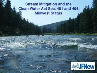
Stream Mitigation and the Clean Water Act Sec. 401 and 404:Midwest Status
Federal Jurisdictional Authority • Section 10 of the River and Harbor Act of 1899 “Navigable waters and their tributaries” • Section 404 of the Clean Water Act “Waters of the US” • Code of Federal Regulations (CFR) 33 part 325-333 published April 10, 2008
Federal Guidelines For Mitigation • Emphasizes watershed approach to mitigation • Requires measurable and enforceable performance standards • Requires regular monitoring for all types of compensation/mitigation • Requires financial assurance and identification of responsible parties for long term protection • Establishes a preference for the use of mitigation bank credits (wetlands and streams)
State Authority • Section 303 of The Clean Water Act requires all states to have water quality standards for surface waters (e.g., streams, lakes, wetlands) • Section 401 of The Clean Water Act • Federal Permit or license requires State Water Quality Certification (WQC) • WQC certifies the project does not violate State Water Quality Standards • Mitigation can be required by state to meet water quality standards and Corps must include as a condition of Federal Permit
Stream Mitigation in Kentucky • In 2000 the legislature passed KSR 150.255 which established: - Wetland and stream mitigation fund through KDFWR (an in-lieu fee program) - Northern Kentucky University (in-lieu fee program) - Metropolitan Sewer District Jefferson County (in-lieu fee program) • On site (applicant based mitigation) • Mitigation Review Team (MRT) – EPA, Corps, KDFWR, KDOW, USFWS - defines conditions under which in-lieu-fees may be used - review and approves individual mitigation projects - provides annual reviews of completed and on-going projects
Kentucky Stream Mitigation Guidelines • Draft published in 2002 - Established criteria for when mitigation necessary - Required data to support relocation projects - Established criteria for stream relocation design - Established physical monitoring requirements - Required Biological monitoring - Described acceptable mitigation types - Provided draft guidance for credit calculations
Kentucky Draft Guidelines (cont.)Criteria for when mitigation necessary • Requires mitigation for losses over 200 ft. • Defines Waters of the Commonwealth as dashed or solid blue lines on recent USGS topographic maps. • Partial losses of in-stream habitat, channel armoring, channel widening and deepening, as well as relocations that do not utilize Natural Channel Design principles also require compensation • Establishes “no permanent impact” policy on Outstanding State And National Resource Waters, exceptional Waters, or Coldwater Aquatic Habitat. Any impacts to these waters require individual 401 Certification.
Kentucky Draft Guidelines (cont.)Required supporting data • Fluvial geomorphic principled design • Includes stable planform and profile • Appropriate in-stream structure • Minimum 25 ft. riparian buffer each side • Reference reach if existing channel not stable • All project information and Level II Rosgen data collection and analysis • Technical information on structure(s) to be installed, riparian vegetation, mitigation monitoring & schedule
Kentucky Draft Guidelines (cont.)General criteria for stream relocation projects • Stream relocation implemented according to plans unless prior approval by KDFWR • Widening of channel cross section above bankfull only, widening of floodprone area encouraged • Revegetation required from bankfull elevation to 25 feet from stream (minimum) • 4 native shrub/tree species @ 300 live stems per acre required after 3 years
Kentucky Draft Guidelines (cont.)Physical monitoring requirements • Relocation monitoring required for 3-8 years with annual reports, enhancement monitoring less (not defined) • As-built survey (channel slope, valley slope, bankfull, cross sections, plan view, monuments) • Permanent photographic stations • Riffle and channel pebble counts • Bar samples • Vegetative monitoring • Habitat assessment
Kentucky Draft Guidelines (cont.)Required biological monitoring • Use 2008 KDOW “Methods for Assessing Biological integrity of surface waters” http://www.water.ky.gov • Site Characteristics (particle size, morphology, canopy cover) • Physiochemical monitoring • Habitat assessment • Algae • Phytoplankton • Macroinvertebrates (may include mussels) • Fish community • Contaminant analysis
Kentucky Draft Guidelines (cont.)compensatory guidelines(credit calculations) • Linear distance of loss = credits required • Daylighting + full restoration = 1 credit/ft • Daylighting + enhancement = 0.8 credits/ft • Full scale restoration = 0.8 credits/ft • Stream enhancement = 0.2-0.6 credits/ft (riparian, bank stabilization, in-channel work - 0.2 each) • Preservation = 0.1 credit/ft
Ohio Stream Mitigation Status Authority:Ohio Water Quality Standards chapter 3745 and 6111 of the Ohio Revised Code • Ohio EPA is lead agency • Guidelines under development since 2004 • Draft rules circulated in 2006 • PHWH use designations added 2008 (PHWH = Primary Headwater Habitat) • Stakeholder group meeting Sept. 2009
Ohio Stream Mitigation Beneficial use designations • CWH – Cold Water Habitat • SSH – Seasonal Salmonid Habitat • EWM – Exceptional Warmwater Habitat • WWH – Warmwater Habitat • LWH – Limited Warmwater Habitat • LRW – Limited Resource Water • PHWH – Primary Headwater Habitat
Ohio Stream MitigationProposed tiered mitigation approach • Impacted stream = LRW, LWH, Class I modified PHWH, Class 1 PHWH: no weighting factor for mitigation, requires protection of downstream uses (1:1). • Impacted stream = MWH or Class II PHWH: requires relocation project to protect in-stream and downstream uses without a weighting factor or requires simple weighting factor of 3 times LF of impact (2x if impact site was previously modified) for off site mitigation. • All other stream types (high quality) detailed weighting factor applied to impact site (next slide).
OhioDraft Weighting Factors for Stream impacts and proposed mitigation
Ohio Stream Mitigation Proposed Mitigation Categories 1 2 3 4 LRW (most) Modified PHWH Class I and II Class I PHWH LRW acid mine Drainage with QHEI > 45 LWH Class II PHWH MWH WWH CWH Class III PHWH WWH= OSW, SHQW, ONRW EWH CWH + native fauna Stream Type Onsite floodprone area replacement or offsite mitigation Onsite relocation according to protective criteria or offsite mitigation for floodprone area Debit-Credit model used to calculate mitigation requirements No impacts w/o socio-economic justification and max. avoidance, otherwise debit-credit calculation applies Mitigation requirement
Ohio Stream Mitigation • Stream Credit-Debit Summary Sheet (draft) • On site web tool (draft) http://www.epa.state.oh.us
Indiana – coming Soon… No published guidelines for stream mitigation Three Corps Districts and IDEM to develop Louisville District Corps is lead First meeting held in October 2009 Which state guidelines should Indiana mimic?
Mitigation Components • Channel Stability Measurements • Channel classification (valley & stream type) • Channel morphology (channel evolution) • Riparian Vegetation (diversity & density) • Aquatic life (diversity, density, native) • Invasive non-native species presence
What is a Stable Channel*? • Dimension: depth and width of bankfull channel, and floodprone area • Pattern: meander width, length, and curvature of bends • Profile: slope, riffle-run-pool-glide sequence and spacing *IN THE PRESENT CLIMATIC CONDITIONS
Dimension: depth and width of bankfull channel, and floodprone area • Pattern: meander width, length, and curvature of bends • Profile: slope, riffle-run-pool-glide sequence and spacing
Dynamic Equilibrium Stable Channels Have a Pattern, Profile, and Dimension All in Stable Equilibrium
Channel Evolution Models Schumm, Harvey, and Watson. 1984. Incised channels: Morphology, dynamics and control Type 1 – Initial Channel condition (stable?) Type II – Channel incision and entrenchment > stream power Type III – Channel widening, less depth and stream power Type IV – Aggradation and building of new floodplain Type V – Return to stable dimension, pattern, and profile Simon and Hupp. 1986. Stage 1 – Pre-modified stable channel Stage 2 – Constructed (u-shaped) channel Stage 3 – Degradation (downcutting) Stage 4 – Channel widening and further degradation Stage 5 – Aggradation associated with continued widening Stage 6 – Channel Equilibrium (stable dimension, pattern & profile)
Rosgen Channel Classification • Dr. David Rosgen. 1996. Applied River Morphology • Based on objective measurable stream characteristics for the primary purpose of providing a consistent frame of reference. • Level I -Geomorphic Characterization: considers geology, Valley slope/sinuosity, meander width, channel shape, channel patterns (stream types A-G) • Level II - Morphological Description: considers entrenchment ratio, width/depth ratio, channel slope and sinuosity, and bed materials (modifiers 1-6) • Level III - Stream Condition: vegetation, woody debris, deposition patterns, bank erosion potential, current stability of dimension, pattern and profile, bed load • Level IV - Validation Level: measured values of bedload, suspended sediments, hydraulics
LEVEL 1: Valley Types Type I: V-notched (A channels) Type 2: Colluvial (B-channels) Type 3: Alluvial Fans (A,B,G, and D channels) Type 4: Gorge (canyons and other confined channels)
Valley Types Continued Type 5: U-shaped glacial valley with developed terrace Type 6: Fault controlled Type 8: Broad terraced floodplain Type 7: Dissected
Valley Types Cont. Type 9: Glacial outwash (plains, coastal and tundra areas) Type 10: Coastal floodplain (low slopes with wetland floodplain)
What’s the Big Deal? • The Rosgen Classification System Provides: • Common Language – A C4 stream in Bangladesh should have the same geomorphic characteristics as a C4 in Indiana. • Baseline Data Ranges – Allows us to compare our stream data with others working on similar streams and projects. • Compare Project Components By Stream Type – What works (or doesn’t) and on what stream type/condition.
Importance of Bankfull • “Bankfull” – The channel forming flow. Elevation corresponding to point of flooding with a reoccurrence interval of roughly 1.5 years. • Single most important stream morphology variable: • Determines other data collection parameters. • Provides target elevations for structures. • Nearly (but NOT) synonymous with OHWM.
Importance of Bankfull • Bankfull location varies on any given stream. • It is sometimes, but not always, the “top of bank”.
“A” and “B” Streams Steep Slopes “A” are typical step-pool streams. “B” are steepest of riffle-pool complex streams. Point bars absent Rosgen Stream Types Type A Type B
“C” Streams Moderate Sinuosity Slightly Entrenched/ Regular Flooding Point Bars Present Common Type Throughout Midwest Rosgen Stream Types Type C
“D” and “DA” Streams High Sinuosity Multiple Channels Often Related to Large Rivers and Deltas or glacial outwash Rosgen Stream Types Type D
“E” Streams High Sinuosity Slightly Entrenched/ Regular Flooding “Classic” Trout Stream Rosgen Stream Types Type E
“F” Streams Typical of Maintained Ditches Wide and Shallow Often Morphologically Unstable Rosgen Stream Types Type F
“G” Streams Actively downcutting Entrenched/ Restricted Floodplain Rosgen Stream Types Type G
The Reference Reach and Data • Utilizing a Reference Reach or Reference Data Provides: • Point of Reference – Just like ecosystem restoration…gives a goal “state” to aim. • Data Verification – Are my calculations/assumptions/techniques correct? • Baseline Data Ranges – Allows comparison.