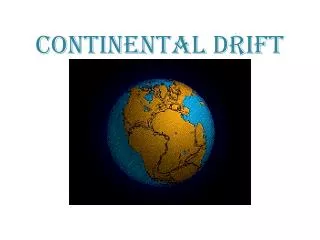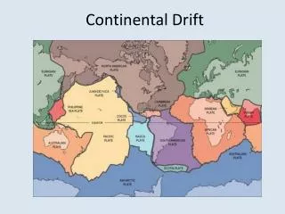
Continental Drift
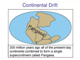
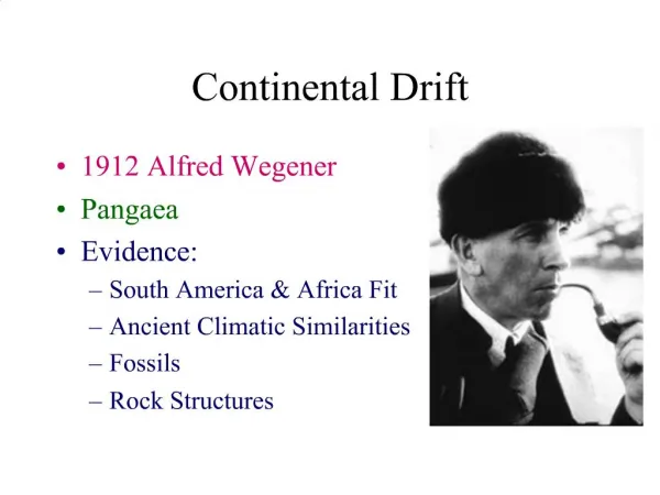
Continental Drift. The earth in motion. A few contributors. Early days. Wegner: Noticed the fit between South America and West Africa. Made measurements from Greenland that he thought showed continental drift in action; the rate he proposed was clearly wrong…

Continental Drift
E N D
Presentation Transcript
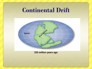
Continental Drift The earth in motion
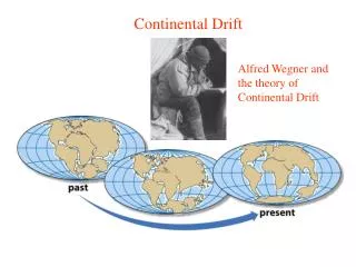
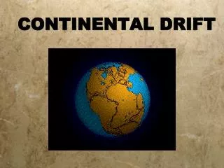
Early days • Wegner: Noticed the fit between South America and West Africa. • Made measurements from Greenland that he thought showed continental drift in action; the rate he proposed was clearly wrong… • Pointed out geological continuities between North America and Europe, some real (formations that link up– the Appalachians, for instance) and some imagined (glacial morraines that he thought also linked up). • Proposed that the ‘plasticity’ of the mantle could allow the continents to move slowly through the ocean beds.
Jeffrey’s challenge • The geophysics just doesn’t work– continents can’t sail through the ocean bedrock. • Some mistakes in Wegner’s work also undercut his case– some elements of which were very strong. • The case for biogeography– Wegner & later du Toit worked this up: Land bridges were ruled out on fundamental grounds of isostacy. But paleontological evidence made it very clear that
The Southern Influence • From the 1930’s into the 1950’s Several geologists from the southern hemisphere, including Alexander du Toit (from South Africa) continued work on continental drift while European and North American geologists regarded it as absurd and indefensible. • Their evidence showed very convincingly that the southern continents had once been united. • But the rest of the geological world was not ready to accept such a radical idea.
Post War Geology • After WWII the U.S. Navy donated and loaned many surplus ships for oceanographic work. • Sonar, developed for military purposes, turned out to be very useful for mapping features on the sea floor; other new technologies, including drilling rigs, were also put to work. • The Ocean of Truth, by William Menard, is a wonderful book about the geological work that these oceanographers did, mapping the sea floor and revealing the world-girdling network of mid-ocean ridges.
More details • Deep ocean trenches were also found in many places. • Relations between these features and the distribution of volcanoes and earthquakes were identified. • Meanwhile, an entirely new kind of evidence was being developed: paleomagnetism. • As volcanic rocks cool and solidify, magnetic minerals in the rocks align with the earth’s magnetic field. • Investigation of volcanic rocks’ magnetic orientation and age thus provided a way of identifying whether and how the earth’s magnetic field had changed over time.
Two important points • The north magnetic pole had clearly wandered over time. • More surprisingly, the path it seemed to have followed was different in Europe than in North America. • The two paths could be turned into one consistent path, but only by slowly closing the Atlantic Ocean as older and older rocks were compared. • Further, the results also showed that, at long and varying intervals, the direction of the earth’s magnetic field had been reversed—at times, the earth’s field had its ‘north pole’ in the south and vice versa.
Harry Hess • In 1960 Princeton geologist Harry Hess provided an imaginative bit of ‘geopoetry,’ as he called it. • Hess proposed that the earth's mantle is really a giant convection system. Like hot air in a room material heated by radioactive elements in the earth's interior slowly rises out of a relatively fluid layer of the earth's mantle called the asthenosphere. • This lava surfaces at the mid-ocean ridges causing higher water temperatures. As it flows away from the ridges, it hardens into a more rigid layer called the lithosphere. When new lava oozes out, it attaches itself to the older lithosphere and continues to move laterally from the mid-ocean ridges. • Millions of years and thousands of miles later, the lithosphere plunges back into the earth, carrying its sediment with it and forming deep ocean trenches found at the edge of continents. • Hess's theory provided a workable mechanism needed by continental-drift theorists. It was the sea floor itself that moved. Like giant conveyor belts, the ocean bottoms transported the earth's huge land masses on top of them and spread them apart.
The smoking gun • The mid-ocean ridges were obviously fundamental to the geography of ocean basins. • Magnetic profiles of the orientation of the ‘frozen’ field of igneous rock moving out from a ridge were measured by Vine and Matthews. • They showed alternating stripes, indicating a simple pattern of spreading from the ridge, with rock closest to the ridge oriented in line with the present field, followed by a stripe oriented against the present field, and so on as the profile moved out from the centre of the ridge.
Tuzo Wilson • Born on October 24, 1908, in Ottawa, Ontario • Studied geophysics at the University of Toronto, the first student in Canada to take such a course • Did graduate work at Cambridge and Princeton, received a doctorate in geology in 1936 • During the 1960's he refined and championed the theory of plate tectonics, which was then held in disrepute • Introduced the idea of "hot spots" which remain stationary under the moving plates and produce chains of islands like Hawaii and Japan • First to identify "transform faults" which link trenches (where the plates collide) and rifts (where the plates pull apart)
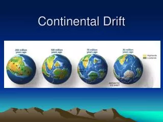
Theory and fact • Once again, a theory proposed on the tenuous basis of a few striking facts became an established fact in geology. • The relations between far-distant phenomena– mountain chains, formations, fossils (some parts of Newfoundland have European trilobite fossils) provide dramatic evidence of the connections that have been broken up, torn asunder, rearranged and rejoined over the history of the earth. • We can even measure the expansion of the Atlantic ocean (it’s continuing at about the rate that our fingernails grow). • Ocean crust is younger near ridges, and steadily older as we approach trenches. No ocean crust has yet been dated to before the Jurassic.