Unveiling Earth's Layers: Moho Discontinuity and Crust Exploration
100 likes | 149 Vues
Explore the Earth's layers, from the crust to the inner core, including the Moho Discontinuity. Learn about seismic waves, Moho's discovery, depth variations, and geological drilling projects. Discover how tectonic forces reveal mantle material.

Unveiling Earth's Layers: Moho Discontinuity and Crust Exploration
E N D
Presentation Transcript
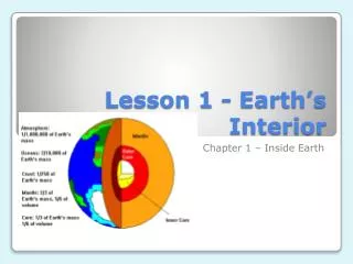
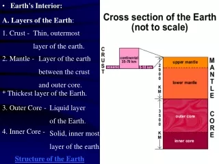
A. Layers of the Earth: 1. Crust - Thin, outermost layer of the earth. • Earth's Interior: 2. Mantle - Layer of the earth between the crust and outer core. * Thickest layer of the Earth. 3. Outer Core - Liquid layer of the Earth. 4. Inner Core - Solid, inner most layer of the earth. Structure of the Earth
The crust and upper mantletogether are called the lithosphere. The lower mantle is called the asthenosphere. Litho=stone Athenos=weak
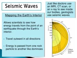
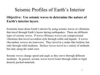
What is the Mohorovičić Discontinuity? -The "Moho", is the boundary between the crust and the mantle. The red line in the drawing below shows its location. Why "discontinuity“? It is used for a surface at which seismic waves change velocity. At this discontinuity, seismic waves accelerate. *Seismic waves- are waves that travel through the Earth, most often as the result of a tectonic earthquake, sometimes from an explosion.
How Was the Moho Discovered? • The Mohorovicic Discontinuity was discovered in 1909 by Andrija Mohorovicic , a Croatian seismologist, after the Pokuplje (Kupa Valley) earthquake of 8 Oct 1909. He realized that the velocity of a seismic wave is related to the density of the material that it is moving through. He interpreted the acceleration of seismic waves observed within Earth's outer shell as a compositional change within the earth. The acceleration was caused by the waves moving through a higher density material at that depth.
How Deep is the Moho? The Mohorovicic Discontinuity marks the lower limit of Earth's crust. *average depth = 8 kilometers beneath the ocean basin *average depth = 32 kilometers beneath the continents. ??WHY THE DIFFERENCE?? Oceanic crust has a relatively uniform thickness while continental crust is thickest under mountain ranges and thinner under plains.
The map illustrates the thickness of Earth's crust. Note how the thickest areas (red and dark brown) are beneath some of Earth's important mountain ranges such as: Andes (west side of South America), Rockies (Western North America), Himalayas (north of India in South-central Asia) and Urals (north-south trending between Europe and Asia)
Has Anyone Ever Seen the Moho? • No one has ever been deep enough into the earth to see the Moho and no wells have ever been drilled deep enough to penetrate it. Drilling wells to that depth is very expensive and very difficult because of the extreme temperature and pressure conditions. The deepest well that has been drilled to date was located on the Kola Peninsula of the Soviet Union. It was drilled to a depth of about 12 kilometers (7.6 miles). Current deep drilling projects include: The San Andreas Scientific Drilling Project in Parkfield CA (2.5 mi); The Hawaii Scientific Drilling Project on Hilo, Hawaii (1.8 mi); Chesapeake Bay (1.1 mile bore hole into an impact crater); Integrated Ocean Drilling Project in the Atlantic Ocean (.9mi); Read More about drilling projects going on around the world.
There are a few rare locations where mantle material has been brought to the surface by tectonic forces. At these locations, that used to be at the crust - mantle boundary is present. A photo of rock from one of these locations is shown below.