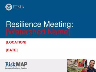
Resilience Meeting: [ Watershed Name]
160 likes | 274 Vues
Join us for a comprehensive meeting focused on understanding flood risk within your community and watershed. We will share insights from our mapping update project, offer strategies for risk reduction, and provide resources available for implementation. Learn about effective communication methods to engage your constituents and enhance community preparedness. We'll also discuss best practices adopted by other communities and present grant programs that can assist in mitigation efforts. Together, we can build resilience against flooding in our region.

Resilience Meeting: [ Watershed Name]
E N D
Presentation Transcript
Resilience Meeting:[WatershedName] [LOCATION] [DATE]
Risk MAP Project Status • Where have we been? • Completed a mapping update project to update: • Study area A • Study area B • Study area C • Digital conversion • County-wide map format • Released the preliminary map and accepted comments • Working locally to adopt ordinances • Finalized the FIRM and FIS and anticipate effective release Regional user/STARR – this slide is set up for a conversion project, modify for Risk MAP projects or as needed based on meeting timing
Meeting Objectives • To help you better understand: • Your flood risk, as individual communities and as a watershed • Strategies you can use to reduce your risk • Resources available to help you implement those strategies • The importance of communicating flood risk to your constituents
Best Practice: [Community A’s Issue] The problem: The process: The solution: Insert Photo if Available Insert Photo if Available
Best Practice: [Community B’s Issue] The problem: The process: The solution: Insert Photo if Available Insert Photo if Available
Best Practice: [State/FEMA-promoted Issue] The problem: The process: The solution: Insert Photo if Available Insert Photo if Available
Strategies to Reduce Flood Risk There are many strategies you can take to reduce your flood risk • Prevention • Affects future development • Includes ordinances and building codes • Property protection • Affects existing development • Includes elevation and acquisition • Public education and awareness • Informs people about risk • Includes outreach activities • Natural resource protection • Protects water quality • Protects Habitats • Restores resources • Emergency services protection • Protects critical facilities • Structural projects • Involves construction • Includes berms • Includes altering stream routes
Resources to Help You Reduce Your Flood Risk • FEMA grants • HUD and other Federal Agency grants • Resources from the NFIP, CRS, and floodplain management • Online resources • Technical assistance by other Federal agencies and professional associations
Local Mitigation Plans • County Hazard Plan TITLE • Includes list communities • FEMA approved DATE • Expiration DATE • Summary • Community-Specific Hazard Plan TITLE • FEMA approved DATE • Expiration DATE • Summary • How to participate in plan development
Grant Program Information Refer to Handout: Funding Resources for Mitigation Activities • Hazard Mitigation Grant Program • Pre-Disaster Mitigation Grant Program (PDM) • Flood Mitigation Assistance Grant Program (FMA) • Repetitive Flood Claims Grant Program (RFC) • Severe Repetitive Loss Grant Program (SRL) • Disaster Resilience for Rural Communities Grants • Natural Resources Conservation Service Emergency Watershed Protection Support Services • Business Physical Disaster Loans • Economic Injury Disaster Loans • Disaster Recovery Enhancement Fund (not all States qualify) • Planning Assistance to States (PAS) Program • Flood Plain Management Services (FPMS)
Mitigation Assessment and Planning • Small Group Discussion • Goals • Learn how to document areas of mitigation interest/strategies • Discuss strategies for reducing risk
Communicate About Your Risk • Flood risk awareness: • Leads to action • Increases overall community resilience • Builds support for implementing the mitigation plan • Your constituents*: • Expect to hear about flood risk from local officials, insurance agents, and real estate agents • Prefer to hear about it in the local news and through mailings * From 2010 FEMA Risk MAP Flood Risk Awareness Survey
Communicate About Your Risk (cont.) Risk MAP makes it easier to share flood risk information with your constituents: • Community outreach plan template • Draft letters to citizens • Draft media materials
Communication and Outreach Planning • Small Group Discussion • Goals • Identify areas of most impact from updated maps • Identify other areas of outreach need • Discuss demographics of impacted neighborhoods/areas • Discuss strategies for outreach • Document outreach strategies
Next Steps • Action Items • Contacts and Outreach Materials Sign-Up • Next steps - work together to coordinate on: • Mitigation planning • Grant applications or technical assistance • Communication Thanks for participating! We’ll be talking again soon.
Insert State logo Insert County logo

![Resilience Meeting: [Watershed Name]](https://cdn1.slideserve.com/2332628/resilience-meeting-watershed-name-dt.jpg)

![Flood Risk Review Meeting: [Watershed Name]](https://cdn1.slideserve.com/2624189/flood-risk-review-meeting-watershed-name-dt.jpg)