Download
1 / 43
460 likes | 731 Vues
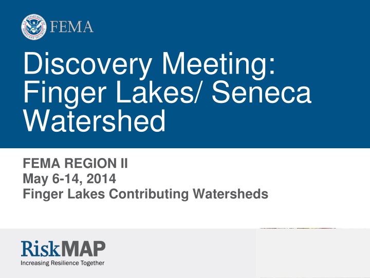
Discovery Meeting: Finger Lakes/ Seneca Watershed. FEMA REGION II May 6-14, 2014 Finger Lakes Contributing Watersheds. Agenda . Introductions Purpose of This Meeting Risk MAP Program Overview Discovery Process Flood Risk Products Finger Lakes * Watershed Data Mitigation Planning

E N D
Discovery Meeting: Finger Lakes/ Seneca Watershed FEMA REGION II May 6-14, 2014 Finger Lakes Contributing Watersheds
Agenda • Introductions • Purpose of This Meeting • Risk MAP Program Overview • Discovery Process • Flood Risk Products • Finger Lakes* Watershed Data • Mitigation Planning • NFIP and Community Rating System • Risk Communication • Next Steps • Discussion Session * Seneca HUC8 = Finger Lakes Watershed
Introductions Project Team • FEMA Region II: • FEMA Region II Representative • RSC Representative • New York State Department of Environmental Conservation • William Nechamen – Chief of Floodplain Management • Jennifer Horton – Environmental Engineer • Dave Sherman – Environmental Program Specialist • Bergmann / Atkins team • Cleighton Smith, Senior Water Resources Engineer – Bergmann • Jacob Tysz, Senior Scientist I – Atkins • Cidney Jones, Water Resource Engineer – Bergmann
Who’s Here? • State or Federal Representatives • County Officials • Local Communities • CEOs/Elected Officials • Floodplain Administrators • Emergency Planners • Town Engineers • Non-Governmental Organizations • Private sector • Other
Does Your Community … • Have a designated floodplain administrator? • Have GIS capabilities? • Have an approved hazard mitigation plan? • Participate in the Community Rating System? • Have coordinated comprehensive and hazard mitigation plans?
Purpose of This Meeting • Explain the Discovery process • Share your concerns about flood risk • Share any additional flood data you may have: • Areas of recent or proposed development • Areas of historical flooding • Overstated or understated flood hazard areas • Areas of possible mitigation interest • Risk communication needs • Explain the FEMA flood risk products and how they can increase your community’s resilience from floods • Share your thoughts on which FEMA flood risk products or mitigation projects you would like in your community
What is Risk MAP? • FEMA works with communities to develop flood risk products and flood hazard maps that are: • Based on the best available data from the community and latest technologies • Conducted on a watershed basis • You can use Risk MAP tools and data to: • Improve and implement your Hazard Mitigation Plans • Use information to influence decisions about development, ordinances, and flood mitigation projects • Communicate with citizens about flood risk • Our common goal: to maintain the sustainability of your community by increasing its resilience from floods and other natural hazards
Sustainable Communities • Sustainability • “meets the needs of the present without compromising the ability of future generations to meet their own needs” • Traditional indicators of sustainability are social, economic and environmental health • Sustainable Communities Take Action to Reduce Risk and Mitigate Hazards • By mitigating against natural hazards, and reducing vulnerability to them, we are enhancing sustainability • Sustainable communities minimize exposure of people and property to natural disasters; sustainable communities are disaster-resilient communities.
Shifting from MapMod to Risk MAP Risk MAP = Risk Mapping, Assessment, and Planning
Discovery Process • FEMA and communities “discover” and assess flood risk data • Discovery Data Collection Period • Stakeholder coordination and data analysis • Discovery Meeting • Initial Discovery Map • Post-Meeting Review • Final Discovery Map and Discovery Report • Scope Refinement
Discovery Products and Results • Discovery Report • Including summary of data, analysis, meetings, and action items or decisions • Discovery Map • Visual representation of meeting outcomes and feedback from stakeholders • Project Study Areas • Index of FIRM Panels to be Updated • National Metrics
Project materials posted to the RAMPP website and available to you include: • Pre-Discovery Webinar Presentation and Meeting Notes • DRAFT Discovery Report, including Appendices and Attachments • Meeting PowerPoint presentation • Wall Maps used at meetings https://www.rampp-team.com/ny.htm Scroll down near the bottom of the page to:
Opportunities for Collaboration • Project Charter/Cooperating Technical Partnership • GIS capabilities • Public/private partnerships • Education and outreach • Strategic communications plan development • Information materials development and dissemination • Media relations • Training • Web site and social media links
Flood Risk Products Non-Regulatory Products (new for Risk MAP) Traditional Regulatory Products DFIRM Database Traditional products are regulatory and subject to statutory due-process requirements Risk MAP products are non-regulatory and are not subject to statutory due-process requirements
Flood Risk Report • Increase General Flood Risk Awareness • Risk and Causes • Risk Reduction Techniques and Mitigation Practices • Deliver Community and Project Level Results • Project Results Summarized by: • Communities • Watershed or Project Area • Provide Information to Augment or Enhance Other Efforts • Local Hazard Mitigation Planning • Local Emergency Management Planning • Local Planning and Building Development
Changes Since Last FIRM Unchanged Unchanged SFHA Increase SFHA Increase SFHA Decrease Unchanged
Flood Depth and Analysis Grids • Datasets that show depth, velocity, and probability of flood inundation as functions of event’s magnitude • Serves as key inputs to HAZUS Risk Assessment Analyses • Increases flood risk awareness
Flood Risk Assessment • Identifies flood-prone areas and vulnerable people and property • Provides estimate of potential damage HAZUS MH Flood Risk Assessment
Areas of Mitigation Interest • Dataset that shows items that may have an impact (positive or negative) on the identified flood hazards and/or flood risks • Examples include: • Riverine and coastal flood control structures • (e.g. dams, levees, coastal berms, etc.) • At risk essential facilities and emergency routes that could overtopped • Stream flow constrictions (e.g. undersized • culverts and bridge openings, etc.) • Previous assistance and claims “Hot Spots” (clusters of IA and PA claims, RL) • Significant land use changes • Significant riverine or coastal erosion • Locations of successful mitigation projects • Enhanced/optional product
Finger Lakes/ Seneca Watershed • Study area is located in New York within FEMA Region II, New York • Cayuga County • Onondaga County • Ontario County • Schuyler County • Seneca County • Tompkins County • Wayne County • Yates County • And small portions of • Chemung County • Cortland County • Livingston County • Monroe County • Steuben County • Tioga County
Why Finger Lakes Watershed? • Age of maps and availability of recent data • Areas of high annual losses • Numerous LOMC • Incidence of repetitive loss structures • Number of declared flood disasters
Data Collection and Collaboration • Discovery is the process of data mining, collection, and analysis with the goal of investigating a flood risk or mitigation project or risk discussions within a watershed. • The following data was researched and reviewed before the meeting: • Average Annualized Loss data • Repetitive Loss Data • LOMCs • Effective Data (FIS, DFIRM, FIRM) • List of Communities & Contact Info • Hazard Mitigation Plan (online) • Hazard Mitigation Assistance Program grants received • Individual or Public Assistance information • Disaster history or history of disaster declarations • CRS, NFIP status • MNUSS –flood hazard mapping needs • High Water Marks • Dams and/or levees • Mid-term Levee Inventory (MLI) • Topo/Elevation Data • Gages • NHD streamline • Various GIS data for the discovery products • Structure Info (bridges, culverts)
Elevation Data Acquisition • LiDAR for Wayne, Seneca, Yates, Schuyler and portions of Onondaga Counties are in progress this Spring
Data Collection: Effective Studies • Current FIRMs outdated – some date to 1970s • Changes in NFIP policies and methodologies have since occurred, creating need for an update *Countywide FIRM
Data We Need from You • Review data collected during pre-Discovery meetings • Areas of Concern • Areas of recent or planned development • Areas of high growth or other significant land changes • Areas of historical flooding • Other flood risks • Mitigation projects • Your ideas about Risk MAP products and mitigation projects that may help your community • Your ideas about other ways to increase your community’s resilience from flooding To explain some of the actions that your community may take to reduce risk, we’ll review mitigation grants and planning and participation in the NFIP program
Hazard Mitigation Planning Coordinated and participative Planning Process • Risk MAP and Mitigation Planning • Local hazard mitigation plans must be updated every five (5) years. • Use new Risk MAP information to update local HMP. • Flood Hazard Profile • Risk Assessment • Mitigation Strategy Refer to the Plan & Keep it Current Identify hazards that can affect the jurisdiction Mitigation Planning Cycle Assess the risks from these hazards Adopt the plan and implement the mitigation strategy Develop strategy to mitigate the risks
Possible Mitigation Activities Mitigation should be part of overall hazard mitigation plan • Adopted a wellhead protection ordinance. • Vulnerability assessment of water and wastewater infrastructure. • Elevate, move and acquire flood damaged structures. • Identify vulnerable critical facilities. • Implement mitigation measures for repetitive loss properties. • Require elevation of new structures and substantially improved structures. • Natural stream restoration • 2 foot of freeboard for new structures. • Cumulative substantial improvement clause. • List of publicly owned buildings that have flood risk. • Acquisition of flood prone structures. • County GIS system. • Updated weather tracking equipment. • Stream bank stabilization projects • Identified sanitary sewer mains vulnerable to erosion from flood
Mitigation Grant Programs (FEMA) • Hazard Mitigation Grant Program (HMGP) Available after a major disaster declaration - the amount of funding is 15% of the total federal assistance provided by FEMA for disaster recovery under the major disaster declaration. • Pre-Disaster Mitigation (PDM) Nationally competitive grant program that funds cost effective, comprehensive mitigation activities that reduce injuries, loss of life, and damage to property.
Mitigation Grant Programs - FEMA (cont’d) • Flood Mitigation Assistance (FMA) Provides funding to assist States and communities in implementing measures to reduce or eliminate the long-term risk of flood damage to buildings, manufactured homes, and other structures insured under the NFIP. FMA incorporates the former Flood Mitigation Assistance Program with the former Repetitive Flood Claims and Severe Repetitive Loss Grant programs.
Mitigation Grant and Loan Programs • NYSOEM Manages FEMA Mitigation Grant Programs • NYSDEC: Stream Restoration and Water Quality Improvement Grants • NYS Office of Community Renewal • NYS Department of State • NYS Environmental Facilities Corporation • NYS Energy Research and Development Authority • NYS Department of State Office of Communities and Waterfronts • Corps of Engineers • HUD • NRCS
National Flood Insurance Program • Allows property owners to purchase flood insurance at below market rates • State and local governments agree to adopt and enforce floodplain management ordinances • Over 20,300 communities participate in the NFIP • 1,490 in New York
Community Rating System (CRS) • Flood insurance premium rates discounted to reward community actions that reduce flood losses, facilitate accurate insurance ratings, and promote the awareness of flood insurance • Class rating system from 1 to 10 • Each Class improvement (500 point increments) results in additional 5% discount • Uniform minimum credits give you points for activities on the state level (state laws) and make achieving a Class 9 relatively easy • 18 creditable activities, organized under four categories: • Public Information • Mapping and Regulations • Flood Damage Reduction • Flood Preparation • http://training.fema.gov/EMIWeb/CRS/ • Three communities in the watershed participate in CRS
Recommended Higher Standards • Go Beyond 2 feet of freeboard • Restrictions on hazardous material storage • Regulated high risk land uses (e.g. manufactured homes/critical infrastructure) • Setbacks/Buffers • Conservation/open space area • Cumulative Substantial Damage/Substantial Improvement • Lower threshold for Substantial Damage • Subdivision design triggering flood study • Prohibitions • SFHA development • Manufactured homes • Fill • Community Identified Flood Areas
Risk Communication • Federal/State/Local goals: • To reduce risk to life and property, ensure safer, sustainable communities • To effectively communicate risk and increase public awareness, leading citizens to make informed decisions regarding their risk • Key factors contributing to successful achievement of these goals are: • Community engagement and exchange of flood risk information • Effective collaboration through partnerships • Strategic communications plan development • Local understanding and implementation of mitigation action and strategies
Next Steps • Communities will provide additional data • NYS DEC will: • finalize Discovery Map and Discovery Report and distribute to communities and other stakeholders • update FEMA systems (Coordinated Needs Management Strategy, National Digital Elevation/Orthophotography Programs, etc.) • prepare Scope of Work for any Risk MAP projects • Communities and FEMA will coordinate regarding Community Cooperation Agreement, signed by the highest elected official, regarding community’s contribution to project
Feedback Deadline • We need comments returned by June 20, 2014 • Digital comments can be submitted to the NYSDEC floodplain mailbox: floodpln@gw.dec.state.ny.us • Written comments can be sent to: New York State Department of Environmental Conservation Attention: Jennifer Horton Floodplain Management Section 625 Broadway, 4th Floor Albany, NY 12233-3504
Resources • Risk Assessment, Mapping and Planning Partners: https://www.rampp-team.com/ny.htm – draft Discovery report, PowerPoint presentation, and maps are posted here • FEMA: www.fema.gov • FloodSmart, the official site of the National Flood Insurance Program (NFIP): www.floodsmart.gov • NFIP Reform: www.fema.gov/business/nfip/nfip_reform.shtm • National Committee on Levee Safety: www.nfrmp.us/ncls
Contact Information • FEMA : • Paul Weberg: paul.weberg@fema.dhs.gov • NYS DEC • William Nechamen: wsnecham@gw.dec.state.ny.us • Jennifer Horton: jehorton@gw.dec.state.ny.us • Bergmann / Atkins • Cleighton Smith: csmith@bergmannpc.com • Jacob Tysz: jacob.tysz@atkinsglobal.com • Cidney Jones: seneca@bergmannpc.com • This is a review of information already collected; chance to take another look.
Discussion Session • We want to hear from you! • What are areas of recent or planned development or high growth or other significant land changes? • What other flood risks are there? • What other mitigation plans and projects are there? • Do any of the Risk MAP products make sense for your community? • What are your community’s concerns? • How can we (both FEMA and you) communicate risk within your community and increase resilience from floods?