Download
1 / 21
210 likes | 317 Vues
Explore major river basins in Southeast Asia, water disputes, renewable water resources, and implications of climate change on water security. Learn how population growth impacts water supply and potential conflicts over water resources.

E N D
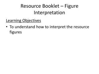
Resource Booklet – Figure Interpretation Learning Objectives • To understand how to interpret the resource figures
Things to think about How many major river basins are there in South East Asia? How many rivers drain into the Bay of Bengal Where do all of the rivers start? (e.g. their source) Figure 1
River Basin Locations Indus Pakistan 93%India 5%China 2% Hwang Ho (Yellow River) China Ganges (Padwa/Megna) BangladeshIndia Yangtze China Pearl Mostly ChinaVietnam Brahmaputra China (source)IndiaBangladesh Red ChinaVietnam Irrawaddy Burma (Myanmar) Mekong ChinaBurmaCambodiaLaosThailandVietnam Salween China (Tibet)BurmaThailand
Figure 2 Collect data on each country See table in your booklet Using Figure 1 and 2 Which country has the most rivers?
Think about… Which country has been involved in the most water disputes? Suggest why some countries are involved in more disputes than others? Figure 3
Potential for Conflict Rivers to add to the disputes Indus Brahmaputra Ganges/ Brahmaptra Mekong
Figure 4 Think about… Which location has the highest annual precipitation? (read question carefully) What do these rainfall patterns mean for water supply?
Renewable Water What is renewable water? Water continuously renewed within reasonable time spans by the hydrological cycle, such as that in streams, reservoirs, or aquifers that refill from precipitation, runoff, or groundwater recharge. http://chartsbin.com/view/1469
Figure 5 What has happened to the total renewable water per capita between 1988 and 2003? Suggest why there has been a change to the amount of renewable water per capita? Which country has seen the greatest decrease and why might this be the case? Which country used the most in 2002? Suggest why this country used more renewable water?
Total Renewable Water Resources by Country http://chartsbin.com/view/1469 This map shows total renewable water resources by country. It corresponds to the maximum theoretical yearly amount of water actually available for a country at a given moment. Total renewable water resources provides the water total available to a country but does not include water resource totals that have been reserved for upstream or downstream countries through international agreements. Note that these values are averages and do not accurately reflect the total available in any given year. Annual available resources can vary greatly due to short-term and long-term climatic and weather variations.
Total Renewable Water Resources by Country http://chartsbin.com/view/1469
Total Renewable Water Resources per capita by Country http://chartsbin.com/view/1470
Total Renewable Water Resources per capita by Country http://chartsbin.com/view/1470
Figure 6 Bangladesh has the highest % of renewable water resources originating outside of the country, suggest how this might cause a conflict?
Total Renewable Water Resources Dependency Ratio by Country This map shows the percent of total renewable water resources dependency ratio or originating outside the country What is Dependency ratio? Dependency ratio may theoretically vary between 0% and 100%. A country with a dependency ratio equal to 0% does not receive any water from neighbouring countries. A country with a dependency ratio equal to 100% receives all its renewable water from upstream countries, without producing any of its own. This indicator does not consider the possible allocation of water to downstream countries. http://chartsbin.com/view/1471
Total Renewable Water Resources Dependency Ratio by Country http://chartsbin.com/view/1471
Figure 7 How might population increase affect water security? Which country faces the most problems in terms of water security? (you need to link % renewable water used and the rising populations – look carefully don’t state the obvious)
A great deal of water is used agriculture in the Asian countries. Suggest how this might change in the future as populations continue to rise? Figure 8
There has been growth in the amount of cereals being irrigated and water required for this, but by far the biggest demand is in Pakistan, suggest why the demand is so much greater than China? Figure 9
This figure shows that between 1960-2000 all of the glaciers have decreased in mass. Suggest why this may have occurred during this time? How might a reduced in glacier size in Asia affect the river levels and amount of available water? Figure 10
Are glaciers actually decreasing? • Himalayan glaciers' 'mixed picture' http://news.bbc.co.uk/2/hi/science/nature/8355837.stm • Some Asian glaciers 'putting on mass' http://www.bbc.co.uk/news/science-environment-17701677