Download
1 / 17
170 likes | 372 Vues
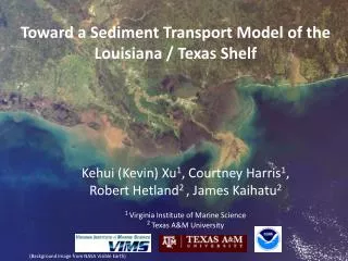
Toward a Sediment Transport Model of the Louisiana / Texas Shelf. Kehui (Kevin) Xu 1 , Courtney Harris 1 , Robert Hetland 2 , James Kaihatu 2 1 Virginia Institute of Marine Science 2 Texas A&M University. (Background Image from NASA Visible Earth). Questions.

E N D
Toward a Sediment Transport Model of the Louisiana / Texas Shelf Kehui (Kevin) Xu1, Courtney Harris1, Robert Hetland2 , James Kaihatu2 1Virginia Institute of Marine Science 2 Texas A&M University (Background Image from NASA Visible Earth)
Questions 1. Does the sediment from Mississippi and Atchafalaya Rivers mix with each other or not? 2. How is sediment transported and resuspended by wind-driven currents? 3. How does flocculation impact sediment dispersal on the shelf? 4. How do waves resuspend sediment? 5. Linking this hydrodynamic-sediment model to MCH2 and a biogeochemical model.
The Model Regional Ocean Modeling System (ROMS) Parallel model using a 16-cpu cluster Model Domain: ~800km × 300 km; Grid: 128 × 64 × 20 Spatially uniform but temporally variable (hourly) wind No tide (tidal range <0.5m), No wave (forthcoming) (70%) (30%) Atch. Bay Wind Station
Wind, Water and Sediment Discharges in 1993 ‘Storm of Century’ (USGS data from Charles Demas and Bob Meade)
Sediment properties Muddy 20m 50m 100m 300m Sandy US Seabed Data from Jeffress Williams (USGS) and Chris Jenkins (INSTAAR)
Results Salinity, Mean Current, Wind Miss. & Atch. sediment dispersal Near-bottom Current, Resusp. from sea bed
Results White line is 30 psu isohaline A A B B B’ B’ A’ A’ A’ A’ A A B B B’ B’
Deposition of Miss. and Atch. Sediments in 1993 80% flocculated sed. 20% unflocculated sed. 50% flocculated sed. 50% unflocculated sed.
Conclusions • Sediment from the Mississippi and Atchafalaya Rivers both contribute to sedimentation on the inner shelf southeast of the Atchafalaya Bay. • Mississippi sediment is more widely dispersed than that from the Atchafalaya. • Strong winds during storms can suspend seabed sediment extensively and may greatly rework sediment accumulation.
Future works • Estimate sediment resuspension by waves. • Continue to compare ROMS model estimates with LaTex observation data. • Generate the sediment concentration output files, and link turbidity to light attenuation in the biogeochemical model. • Run the model for 2006 and 2007, and compare with field data collected in cruises for the MCH2 (Mechanisms Controlling Hypoxia, 2) project.
Acknowledgement • Steven DiMarco (TAMU) • Bob Meade, Charles Demas and Jeffress Williams (USGS) • Chris Jenkins (INSAAR) • Aaron Bever, J. Paul Rinehimer, and Mary Ann Bynum (VIMS) • Chris Bording and Tom Crockett (William & Mary) • The sediment model is being developed as part of the NOPP (National Oceanographic Partnership Program) CSTM (Community Sediment Transport Model). • The model was run on the cluster SciClone at the College of William & Mary.