Download
1 / 22
220 likes | 350 Vues
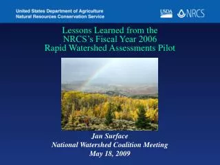
Lessons Learned from the NRCS’s Fiscal Year 2006 Rapid Watershed Assessments Pilot. Jan Surface National Watershed Coalition Meeting May 18, 2009. Objectives. Brief overview of RWA process and weblink to more information Overview of 2006 RWA pilot

E N D
Lessons Learned from the NRCS’s Fiscal Year 2006 Rapid Watershed Assessments Pilot Jan Surface National Watershed Coalition Meeting May 18, 2009
Objectives • Brief overview of RWA process and weblink to more information • Overview of 2006 RWA pilot • Summary of Lessons Learned from 2006 pilot
Provide a general picture of resource concerns for a broad area, an estimate of the conservation needs, and an estimate of funding needs as well as potential sources of funding. Rapid Watershed Assessments
RWA Watershed Resource Profile • Typical Elements in a Profile • Physical Description • Land Use Map • Precipitation Map • Common Resource Areas • Resource Concerns • Census and Social Data • 303d Impaired Waters • Progress/Status • References/Bibliography
RWA Summary Assessment Matrix Contains: • Current Conditions Table—detailing the current level of conservation in the watershed • Future Conditions Table—identifying appropriate suites of conservation practices needed to deal with the primary resource concerns for each major land use • Summary Table—summarizing the various costs associated with the Resource Management System
For More Information on RWA Process and examples of completed RWAs Visit the National RWA Website: http://www.nrcs.usda.gov/programs/rwa/index.html
FY 2006 Pilot • $1.35 million internal RWAs in 14 States (AZ, CO, ID, KS, MN, NO, NE, OK, OR, SD, UT, VT, WA, WI) and 12 watershed plans in 4 States (OR, SD, VT, WI). • $1.65 million of CCPI external RWAs in 15 States (AK, CO, ID, IA, KS, ME, MI, MS, MO, NM, NY, NC, SD)
Lessons Learned Questionnaire • Cost and Time to Complete RWAs • Geospatial Information • RWA Resource Profile Development • RWA Matrices Development • RWA use within States • Additional Feedback
Findings from 2006 Lessons Learned Questionnaire The Cost to complete RWAs: External : $70,667 Internal : $23,527 Time to Complete RWA: External: 19 weeks Internal: 7.5 weeks Many NRCS State offices commented that external entities lacked access to information required and/or thetechnical skills to complete the RWAs.
Availability of Geospatial Information • GIS data required to complete the RWAs was readily available • 82% of the respondents felt it would be helpful if the NRCS National Cartography and Geospatial Center provided basic GIS layers • Some States automated part or all of the GIS data processing allowing them to streamline RWA development
Findings from 2006 Lessons Learned Questionnaire Who Helped Develop RWA Profiles?
Findings from 2006 Lessons Learned Questionnaire Who Helped Develop RWA Assessment Matrices?
Findings from 2006 Lessons Learned Questionnaire What resources were used to develop matrices? • NRCS Contracting Database (ProTracts) 19% • NRCS Customer Service Database (Toolkit) 31% • NRCS Performance Results System (PRS) 73% • NRCS Easement Database 27% • Knowledge of field office staff 85% • Stakeholder input 69%
Findings from 2006 Lessons Learned Questionnaire RWA Matrices Landuse Types
Findings from 2006 Lessons Learned Questionnaire How are RWAs being used within each State? • Setting Local Priorities for Farm Bill Programs 44% • Prioritize Implementation of Conservation 68% • Set Future Staffing Levels 20% • Marketing Tool for Programs 44% • Information Source for Grant Proposal 88% • ID Partnerships to Leverage Funding 50% • Platform for more extensive planning 76%
Findings from 2006 Lessons Learned Questionnaire Who’s Using RWAs? • NRCS 82% (Field 58%, Area 63%, State 79%, Multi-State 27%) • Soil and Water Conservation Districts 68% • State Technical Advisory Committee 18% • Resource Conservation and Development 59% • Local Work Groups 63% • Federal Agencies 23% • State Agencies 63% • Non-profits 41%
NRCS Next Steps • RWA Process Institutionalized; no more special funding • NRCS States may use base Conservation Technical Assistance to complete additional RWAs • RWA Guidance on website; language included in NRCS Policy documents
For more information on Rapid Watershed Assessments, visit the NRCS Website http://www.nrcs.usda.gov/programs/rwa/index.html
NRCS State RWA Info on the Web • Michigan • Minnesota • Missouri • Nebraska • North Dakota • Oklahoma • Oregon • Pacific Islands Area • Pennsylvania • South Carolina • Utah • Virginia • Washington • Wisconsin • Arizona • Colorado • Delaware • Idaho • Indiana • Iowa • Kansas • Louisiana
Questions/Comments Contact Jan Marie Surface National Watershed Planner 202-690-3501 jan.surface@wdc.usda.gov


![The LIFE LESSONS LEARNED FROM A DANDELION (7) [motive]](https://cdn1.slideserve.com/2228602/the-life-lessons-learned-from-a-dandelion-7-motive-dt.jpg)