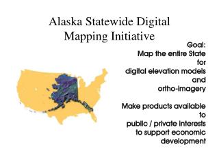
Version 1 Statewide Parcel Mapping Project
Version 1 Statewide Parcel Mapping Project. Howard Veregin State Cartographer. Wisconsin Real Property Listers Association 62 nd Annual State Meeting Sheboygan, Sept. 2014. Overview. LinkWISCONSIN EBM Parcel Project Parcel mapping in Act 20 Version 1 Statewide Parcel Project


Version 1 Statewide Parcel Mapping Project
E N D
Presentation Transcript
Version 1 Statewide Parcel Mapping Project Howard Veregin State Cartographer Wisconsin Real Property Listers Association 62nd Annual State Meeting Sheboygan, Sept. 2014
Overview • LinkWISCONSIN EBM Parcel Project • Parcel mapping in Act 20 • Version 1 Statewide Parcel Project • Project benefits • Questions and discussion
Project Team Howard Veregin Project co-lead SCO Peter Herreid Project co-Lead DOA Codie See Project Coordinator SCO David Vogel GIS Specialist SCO AJ Wortley Data Integration Methods SCO Jim Lacy Communications/Outreach SCO Brenda Hemstead Communications/Outreach SCO Davita Veselenak Communications/Outreach SCO
Project Rationale • Provide access to statewide parcel data for effective governance, economic development, planning, and other purposes. • Wisconsin has excellent local geospatial data but little integrated statewide data. • We have fallen behind other states. • NSGIC 2013 Geospatial Maturity Assessment shows that15 states (includes DC and PR) have a complete (95% +) statewide parcel layer.
LinkWISCONSIN EBM Project
EBM Guiding V1 Project • EBM project is part of Public Service Commission of Wisconsin (PSCW) LinkWISCONSINbroadband initiative • SCO/DOA main objective: Statewide address point and parcel layers derived from local data • Layers designed to aid broadband service mapping efforts for PSCW
About LinkWISCONSIN • Ongoing project to map broadband access and aid communities to improve local connectivity • Administers Broadband Expansion Grant, works with local stakeholders to advise local broadband growth • Using address and parcel data to better identify Community Anchor Institutions • LinkWISCONSINEBM Project data proving helpful in reconsidering how access is mapped
EBM Project Funding • Funding by PSCW through the NTIA (National Telecommunications and Information Administration) via American Recovery and Reinvestment Act (ARRA) • Federal funding, not WLIP • $168,000 over one year • Similar projects in other states
EBM Workflow • Integration of 72+ local datasets in a variety of formats • Data cleanup and standardization • Integration into common data model (“ETL”) • Post-ETL processing (e.g., Census areas) • QA/QC • Documentation and feedback to data suppliers
EBM Timeline Currently completing final report, county feedback reports (and CAI deliverable).
Participation • 100% participationfrom all 72 counties • 6 municipalities also contributed • Only 5 counties requested a license agreement • Only 1 county requested payment • 64 counties submitted data within 1 month of call for data
Finaladdresslayer • 2.7 million address points • Not all counties have complete address data
Finalparcellayer • 3.7 million address points • Not all counties have complete parcel data
City and Village gaps in Address Layer • 49 cases
City and Village gaps in Parcel Layer • 39 cases
From EBM to V1 Build knowledge and capacity to perform statewide data integration A successful model for the future Lessons from EBM can be directly applied to VI and improved upon
Technical Knowledge • Infrastructure for data submission • Data assessment methods • GIS tools and workflows • Issues and roadblocks • Best practices
Sharing of Knowledge • Dissemination of knowledge back to local data custodians • Best practices for data standardization to facilitate integration (SCO-hosted workshop) • County feedback reports (20+ metrics of data quality and observations to be supplied to counties, along with county EBM data) • Information on boundary overlaps and gaps with adjacent counties • Information for the community as a whole • Workshops, publications, reports, presentations
Parcel Mapping, Counties 59.72 Land information. (2)Duties. (a) No later than June 30, 2017, the board shall post on the Internet, in a searchable format determined by the department of administration, the following information related to individual land parcels: 1. Property tax assessment data as provided to the county by municipalities, including the assessed value of land, the assessed value of improvements, the total assessed value, the class of property, … the estimated fair market value, and the total property tax. 2. Any zoning information maintained by the county. 3. Any property address information maintained by the county. 4. Any acreage information maintained by the county.
Parcel Mapping, DOA 16.967 Land information program. (3)Duties of department. (h) Establish an implementation plan for a statewide digital parcel map. … (7)Aid to counties. 2m. In coordination with the department, the creation, maintenance, or updating of a digital parcel map.
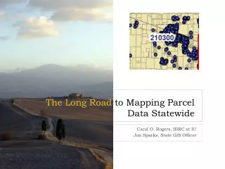
What is the V1 project? • Part of Statewide Parcel Initiative mandated by Act 20 • Will help counties meet s. 59.72(2)(a) requirementsfor online parcel information • Will produce Wisconsin’s first public statewide digital parcel map • Partnership between DOA and SCO; collaboration with local governments • Approx$123K over 15 months, primarily to support 1.5 staff and 1 student on project.
V1 Deliverables Statewide parcel database • Aggregated from county and municipal data • To include attributes required by statute • Assessment data • Zoning • Addresses • Acreage Set of final reports • Methods used • Recommendations for export standards • Benchmarking
Technical Implementation • A “conventional” data integration approach • Source datasets are physically integrated based on a common data model • Resulting database is a snapshot in time
No changes required to source data formats or local government workflows. Distribution formats must meet Act 20 requirements: Online in a searchable format. Repeatability requires stored procedures, documented methods, common data model. Standards help.
Local Gov’t Involvement • No changes to local workflows required • No changes to local data formats and standards • One call for data – to include parcel geometry, required Act 20 attributes, and possibly other attributes – in fall 2014 • What is needed: the most accurate, up-to-date parcel data
Out of V1 Scope for SCO • Data hosting • Data updates • Filling in gaps • Coordinate manipulation (e.g., rubber sheeting) • Resolving boundary discrepancies • Prioritization of investments/allocation of WLIP funds • Create governance structure to implement standards
Future Implications • Benchmarks: Provide mechanism to identify and prioritize WLIP strategic funding • Data Standards: Common, consistent ways to encode data to facilitate integration and make it more efficient • Repeatability: How to maintain and update the statewide dataset All three of these topics will be addressed in the V1 project reports
Benchmarks • Standard or level on a specific measure of data quality for a particular dataset
Data Standards • VI Project will focus on specifying a preferred local export format to facilitate integration • Longer-term goals are to be determined
Repeatability • V1 goal is a snapshot of most current data • Counties vary in terms of their update cycles • Vintage of the data will vary from county to county • Will not necessarily synch up perfectly with assessment data due to different dates • Any update process needs to find a way to accommodate these issues – a future objective
Repeatability • V1 goal is a snapshot of most current data • Counties vary in terms of their update cycles • Vintage of the data will vary from county to county • Will not necessarily synch up perfectly with assessment data due to different dates • Any update process needs to find a way to accommodate these issues – a future objective
Project Benefits • Create the first public, statewide, digital parcel map for Wisconsin • Help counties meet Act 20 requirements • Help DOA advance Statewide Parcel Initiative • Better access to geospatial data created with public funding
Project Benefits (cont’d) • Develop benchmarks to prioritize improvement efforts and funding • Propose standards for data exchange • Enhance working relationships between local and state governments
Project Benefits (cont’d) • Educational benefits to model successful statewide integration effort for future projects • Develop in-house experience in data integration methods and challenges • Develop expertise in jurisdiction-specific data issues • Provide feedback to local data stewards on data quality • Provide assistance to local data stewards for data conversion and standardization tasks • Incentive to develop standards for data exchange
Project Benefits (cont’d) • Meet business needs for statewide parcels from government, academia, private sector, non-profits, etc. • Connect parcel data to features like soils, elevation, aerial imagery, etc. • Enhance ROI for GIS infrastructure and WLIP funding by putting data to work
Project Benefits (cont’d) Put Wisconsin back in a GIS leadership role