Download
1 / 7
70 likes | 338 Vues
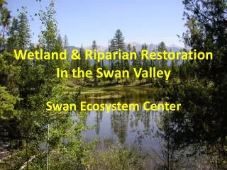
Wetland and Riparian Area Protection Policy. NBWA Watershed Monitoring Workshop-November 30 Meetings – Jon Bishop. Aquatic Resource Monitoring and Assessment Framework. POLICY OVERVIEW: 3 PHASES. Phase 1: Will Include: Wetland definition Wetland area delineation method

E N D
Wetland and Riparian Area Protection Policy NBWA Watershed Monitoring Workshop-November 30 Meetings – Jon Bishop Aquatic Resource Monitoring and Assessment Framework
POLICY OVERVIEW:3 PHASES Phase 1: Will Include: • Wetland definition • Wetland area delineation method • A monitoring and assessment framework for State waters • Regulations: For permitting dredged and fill material consistent with Clean Water Act Section 404 federal program Phase 2: Will Include: • Wetland beneficial use definitions • Water quality objectives • Implementation program Phase 3: Will Include: • Protection of riparian area water quality related functions • Beneficial use definitions, water quality objectives • Implementation program
Monitoring and Assessment Framework Purpose: • To support existing aquatic monitoring and assessment programs • To report the condition of aquatic resources including wetlands • To report the effectiveness of California Water Board permitting requirements including compensatory mitigation for impacts to aquatic resources.
Monitoring and Assessment Framework Description: • (1) Will be implemented in coordination with the State Wetland and Riparian Area Monitoring Program (WRAMP) under the auspices of the California Water Quality Monitoring Council • (2) Will specify reporting ecological conditions of aquatic resources including wetlands and the effectiveness of protection measures. • (3) Will provide for a watershed approach that includes the development of regulatory assessment standards to guide the application of assessment information to various regulatory decisions. • (4) Will be based on an adopted wetland definition and associated delineation method along with standard wetland classification and mapping approaches. • (5) Will provide for internet access to assessment and monitoring information.
Monitoring and Assessment Framework Information Collection and Reporting Structure: • Based on three levels of information with each level supporting the next: • Level 1: GIS-based aquatic resource inventory • Level 2: Rapid Assessment: Use of California Rapid Wetland Assessment Method (CRAM) • Level 3: Intensive Site Assessment • Will utilize Wetland Tracker GIS database for data management and reporting
Monitoring and Assessment Framework Additional Elements: • Coordinate with the SWAMP Regional Data Centers (RDCs) for data quality assurance/quality control services • Tools under development: • Cram modules for wetland types and CRAM training clinics • Wetland Tracker for mitigation project tracking • Online 401 application with GIS tool to input project impact/mitigation maps into Wetland Tracker
Monitoring and Assessment Framework General Support and Funding: • Funding: assessment framework initially will be provided through existing California Water Board programs.