Download
1 / 15
150 likes | 268 Vues
This project by Hill Country Conservancy focuses on evaluating the vulnerability of water resources in the Hill Country region of Texas. It involves defining and mapping vulnerability through a detailed methodology that incorporates geological and hydrological characteristics. By identifying key parameters such as soil composition and vegetation cover, the project aims to develop a practical tool for land conservation. The ultimate objective is to prioritize areas for preservation to safeguard precious aquifer systems against contamination and ensure long-term water resource sustainability.

E N D
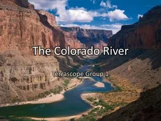
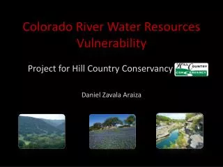
Colorado River Water Resources Vulnerability Project for Hill Country Conservancy Daniel Zavala Araiza
- Outline - Outline • Hill Country Conservancy • Defining vulnerability • Mapping vulnerability • Methodology • Results • Conclusions
- Hill Country Conservancy - • Land preservation agreements. • Conserve a property in its natural state. • Land conservation -> impact on aquifer system.
- Objective - Development of a tool that is useful in determining which parts or parcels of land are more valuable in terms water resources vulnerability to focus on their preservation. Yildirim, M., and Topkaya B., (2007), Groundwater Protection: A Comparative Study of Four Vulnerability Mapping Methods. Clean 35 (6), 594 – 600.
- Defining Vulnerability - Intrinsic geological + hydro geological characteristics which determine sensibility of groundwater/surface water to contamination. intrinsic vs. specific • Point sources (oil spills, leakage) • Risk mapping • All kinds of pollutants • Vulnerability mapping
- Mapping Vulnerability - Yildirim, M., and Topkaya B., (2007), Groundwater Protection: A Comparative Study of Four Vulnerability Mapping Methods. Clean 35 (6), 594 – 600.
- Selected Parameters - Soil thickness Soil KSAT + + + + steep high thin How much filtration? Amount of water that can be absorbed. How easily water flows through the soil. *ranking based on amount of ground cover - - - - low flat thick Slope Vegetation How likely water is to runoff? How much water will be impeded by vegetative cover?
- Creating layers - Soil thickness Soil KSAT Weighted sum SSURGO Vulnerability map HCC study area NED (USGS) Slope Reclassify *raster Vegetation NLC (USGS) *raster
- Soil Datasets - • Soil Survey Geographic Database (SSURGO) Soil Data Viewer for ArcMap Soil Survey Geographic Data Base Data Use Information, USDA, 1995,pp.110
- Layers - KSAT Soil Thickness Vegetation Slope
- Results - Hickory Aquifer Edwards Aquifer
- Further work - • Add Cave Density as parameter. • Compare groundwater to surface water vulnerability • Sensibility analysis for relative importance of parameters in weighted sum.
- Conclusions - • Vulnerability mapping as a valuable tool. • Couple their use with other methods (risk mapping). • Importance of parameters selected and their weight.