Download
1 / 18
180 likes | 296 Vues
Global Terrestrial Network for Permafrost Contributions to cryospheric and climate monitoring. Sharon Smith Geological Survey of Canada. Kananaskis, March 2, 2005.

E N D
Global Terrestrial Network for PermafrostContributions to cryospheric and climate monitoring Sharon Smith Geological Survey of Canada Kananaskis, March 2, 2005
Permafrost is soil or rock that remains below 0°C throughout the yearPermafrost is an important component of the cryosphere and an integral part of the climate system • variations in permafrost temperatures can be a sensitive indicator of climate change and variability • warming and thawing of permafrost can have impacts on natural and human systems: • Permafrost variations have implications for terrain stability, hydrology, gas fluxes, infrastructure, northern development and ecosystems.
Permafrost is an important feature of the northern landscape Massive ice Pingo Patterned ground Permafrost affected peatlands
Presence of permafrost and ground ice presents challenges to northern development • presence of permafrost and thaw settlement/frost heave considered in design of infrastructure • techniques used to preserve infrastructure integrity Foundation design for permafrost environments Thawing of massive ice Techniques to preserve frozen ground Utilidors
Warming and thawing of frozen ground can lead to instabilities in the landscape Unstable ground Thawing of ground ice and thermokarst terrain Active layer detachment Damage to buildings and infrastructure
Global Climate Observing System (GCOS) and the Global Terrestrial Network for Permafrost (GTN-P) • Key cryospheric variables for monitoring through WMO’s GCOS • Active layer • Permafrost thermal state • GTN-P established under leadership of International Permafrost Association (IPA) in 1999 • Provide long-term observations of active layer and permafrost temperature that are required for: • understanding the present permafrost conditions • detection of terrestrial climate signal in permafrost and its temporal and spatial/regional variability • development and validation of permafrost, climate change and impact models • assessment of carbon sources and sinks in permafrost regions • northern development and land use decisions • design of adaptation strategies to mitigate the impacts of climate warming in permafrost • improving our ability to provide ongoing, large area, timely assessment of cryospheric change
GTN-P web site gtnp.org GTN-P Thermal monitoring sites
Measurement of thaw settlement Ground surface Thaw depth Circumpolar Active Layer Monitoring (CALM) Network • 125 sites contribute to CALM • Active layer thickness determined through • probing • thaw tubes • temperature measurements • Measurements maybe done • at points • along transects • on grids Active layer, Mackenzie Delta Thaw depth determined from interpolation of ground temperature profile at Baker Lake BH4
Permafrost Thermal State • Borehole monitoring • few metres to several 100 m deep • frequency of measurements varies from daily to monthly to annual to several years • Method • Single probe • Permanent multi-sensor cable • manual measurements • continuous measurements with data loggers Alert 15 m Trend 1994-2000 +0.15°C/yr
Manual Measurements Alert BH5 High frequency data collection with data loggers Alert BH5 Temperature Envelopes - Alert
Peatland site – Northern Alberta Ground surface temperature Mackenzie Delta region Ground surface Thaw depth Determination of onset of freezing and thawing Evaluation of impact of warming Model validation Analysis of trends in air and permafrost tempeature Iqaluit - Monthly ground temperatures at 5 m depth
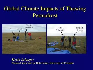
High Arctic Observatories – Hydrocarbon Wells Data retrieval from Gemini near Eureka • Deep temperature measurements using single probe • High frequency temperature measurement to depths of 80 m since 1991 • Data used to determine ground surface temperature history Challenges of Arctic field work Data retrieval from Pat Bay, Lougheed Island
High Arctic Observatories • High resolution data collection • Development of ground surface temperature histories through application of mathematical inversion techniques 65.75m Mean annual permafrost temperature from Gemini, near Eureka 35.75m 47.75m 30.75m Mean annual permafrost temperature from Pat Bay, Lougheed Island 25.75m 20.75m
Gemini GSTH Reconstruction of Ground Surface Temperature History • Inversion of deep logs for hydrocarbon wells (Pat Bay and Gemini) + inversion of shallow temperature logs (1991-97) Comparison of Gemini and Pat Bay GSTH Comparison of inversion of 800 m log with inversion of 800 m log and 8 one year means for Gemini
Alert – Ground Surface Temperature History Reconstruction • GSTH determined from shallow (to 60m) temperature logs • Simultaneous inversion of 9 one year means (1979-2000)
Development of Remote Sensing Techniques • Remote sensing techniques can potentially extend the in situ measurements from GTN-P to the broader spatial domain • GTN-P can provide data for development and validation of remote sensing techniques • Information provided through remote sensing can complement the in situ measurements and lead to for example • quantification of freeze-thaw states • quantification of carbon budgets • improved climate change impact assessments
Summary GTN-P provides information that can be used to: • Document and quantify fluctuation in permafrost conditions • Improve understanding of cryosphere-climate processes • Develop and validate permafrost-climate models • Including improved representation of ground thermal regime in climate models • Development and validation of remote sensing techniques Permafrost temperature trends, Mackenzie Valley, south of Norman Wells