Download

1 / 14
160 likes | 585 Vues
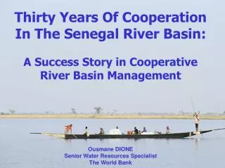
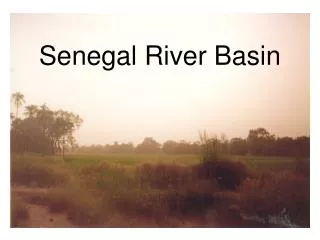
Senegal River Basin. Jill Kjellsson February 28, 2012. Overview. Background Information Issues the Basin Faces Organization Development Lessons Learned. Background. Guinea, Mali, Mauritania, Senegal 1800 km Major Tributaries: Bafing , Bakoye , Faleme , Karakoro , Gorgol

E N D
Senegal River Basin Jill Kjellsson February 28, 2012
Overview • Background Information • Issues the Basin Faces • Organization Development • Lessons Learned
Background • Guinea, Mali, Mauritania, Senegal • 1800 km • Major Tributaries: Bafing, Bakoye, Faleme, Karakoro, Gorgol • 3 sections: Upper, Valley and Delta • Population: 3.5 million (85% live near river)
Activity in the Basin • Agriculture • Fishing • Other: sugar cane production, rice farming, mining (small) • Navigation
Manantali Dam • Built in1986 • Prevent flooding during rainy season and provide freshwater during dry season • In 2002, put online for hydroelectric power production • 700 GWh/year • Mali (52%), Mauritania (15%), Senegal (33%)
Diama Dam • Built in 1988 • Prevents salt water intrusion • Raises level of upstream water creating reserves for irrigation and double cropping
Current Issues • Drought • Extreme Poverty • Environmental Impact of the 2 Dams • Waterborne Diseases • Degraded Pastureland and Fisheries • Population Growth
Development of Organizations • 1963 - Bamako Convention; Interstate Committee (CIE) • 1968 - Labe Convention; Organization of Boundary States (OERS) • 1972 - Organization for the Development of the Senegal River (OMVS) • 2002 – Senegal River Charter • 2005 – Guinea rejoins the OMVS
Participatory Approach: Water Development and Management Master Plan (SDAGE) • Organized and Implemented by the OMVS with support from: • BRL Consulting Firm • Eau Vive NGO • The French Agency for Development • 3 Phases • Phase 1 - Diagnose Conditions • Phase 2 - Develop Regional Sectoral Plans • Phase 3 - Develop the SDAGE Documentary being shown at the 6th World Water Forum in March
Lessons Learned • Stakeholder participation should be included at all levels of decision-making processes for optimal mutual gain. • Lack of participation of all basin nations weakens the overall negotiations and creates opportunity losses for those not participating. • Mutually beneficial projects and integrated investments create good neighbors. From Oregon State University’s Transboundary Freshwater Dispute Database
Works Cited [1] http://webworld.unesco.org/water/wwap/case_studies/senegal_river/ [2] http://www.fao.org/docrep/W4347E/w4347e0h.htm [3]http://www.transboundarywaters.orst.edu/research/case_studies/OMVS_New.htm [4] http://gridnairobi.unep.org/chm/waterbasins/senegal_river_basin-17-03-08.jpg [5] http://www.solutionsforwater.org/solutions/participatory-approach-for-the-design-of-a-water-development-and-management-master-plan-sdage-in-the-senegal-river-basin [6]http://www.counterpart.org/images/uploads/397%20Blog%20Senegal%20100608_SN_010.JPG [7] http://www.tractebel-engineering-gdfsuez.com/wp-content/uploads/2011/08/TEF_08-Manantali-1.jpg?9d7bd4 [8] http://www.eosnap.com/public/media/2008/11/africariver/20081126-africariver-full.jpg [9] http://cmsdata.iucn.org/img/r_tow_africawest_284_4221.jpg [10] http://www.guideforafrica.com/images/africa/senegal-river.jpg [11] http://en.structurae.de/photos/index.cfm?JS=95748
Questions • What do you think the advantages and disadvantages of allocating water to use sectors rather than to countries are? Do you think other countries should allocate water this way instead? Why might they or why might they not choose to allocate water in this way? • What impact (positive or negative) does Guinea’s absence from the OMVS have on the basin’s development? • Do you believe that similar cooperation is possible in other basins or were the circumstances in the Senegal River basin (decolonization and structuring of national infrastructure at the same time, mutual need for ways to lessen the impacts of severe drought, etc) so unique that the development based on mutual benefits is only possible here? • Do you think the participatory approach of developing the SDAGE currently being utilized in the basin can be used in other regions? What factors contribute to the success of such an approach and what factors hinder it?