Download
1 / 16
160 likes | 193 Vues
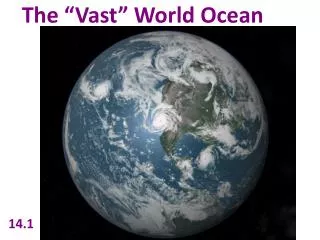
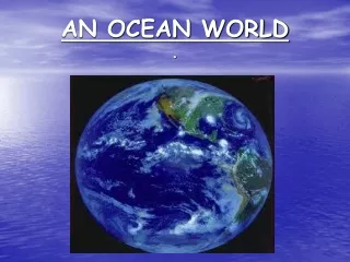
Explore the vast world of the oceans covering 71% of Earth's surface. Learn about the major ocean basins, the origins of water, and its impact on life. Delve into the history of ocean exploration and the modern tools and advancements in oceanography.

E N D
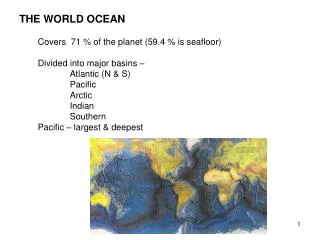
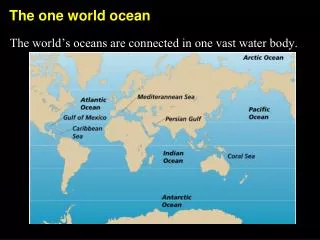
GENERAL INFORMATION • About 71% of Earth’s surface is ocean • Covers 71% of the earth’s surface • Average depth of 3800 meters • Major ocean basins • Atlantic • Pacific • Arctic • Indian • Southern
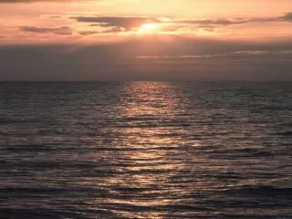
GENERAL INFORMATION • The oceans affect every aspect of life on Earth. • Scientists believe, and there is a lot of evidence showing, that life may have begun in the oceans. http://www.youtube.com/watch?v=BvrzM-BavDg&feature=related
Water And Water Vapor How did water and water vapor form on early Earth? • The Sun stripped away Earth’s first atmosphere • Gases, including water vapor, released by the process of outgassing, replaced the first atmosphere. • Water vapor in the atmosphere condensed into clouds. • After millions of years, the clouds cooled enough for water droplets to form. • Hot rain fell and boiled back into the clouds. • Eventually, the surface cooled enough for water to collect in basins.
½ total ocean area 1/3 earth’s surface Circular shaped Deepest trench-Marianas Trench Edges are irregular Many chains of active volcanoes…..”ring of fire” Many islands Vasco Balboa credited with discover Narrow/ S shaped Relatively shallow Mid Atlantic Ridge extends entire length Few Islands- largest is Greenland Romans named this ocean PACIFICATLANTIC
Confined to Southern Hemisphere except northern tip Shaped like a large triangle Apex- India Base- Antarctica Earliest mariners were Egyptians Shallow and small Separated from Atlantic by a ridge Surface covered by sea ice North Pole in its domain Least studied- inhospitable weather and permanent ice pack INDIANARCTIC
Atlantic Ocean Pacific Ocean Indian Ocean Arctic Ocean Southern Ocean Caribbean Sea Mediterranean Sea Gulf of Mexico Arabian Sea Hudson Bay North America South America Africa Europe Asia Australia TO KNOW
Hemispheric Symmetry • Equator is physical barrier. • Divides current patterns. • Divides life zones. • Curvature of the earth causes more heat at the equator. • Northern Hemisphere- mostly land. • Southern Hemisphere-mostly water.
http://videos.howstuffworks.com/hsw/27230-our-wondrous-oceans-the-history-of-ocean-exploration-video.htmhttp://videos.howstuffworks.com/hsw/27230-our-wondrous-oceans-the-history-of-ocean-exploration-video.htm
A BRIEF HISTORY OF OCEANOGRAPHY • The origins of marine science lie in voyaging. Technological advances have led to modern oceanography. • Modern marine science research is usually conducted by teams of specialists working for oceanographic or military institutions. • The tools of modern oceanography include satellites, piloted and remotely controlled vehicles, and computer modeling.
VOYAGING BEGINS • Voyaging on water was important to many early civilizations. The Egyptians, Cretans and Phoenicians were all skilled sailors. • Voyaging was first done to find new land and trade routes. Voyaging for science didn’t come until later. • Cartographers, or chart makers, recorded information about locations, landmarks and currents. • Today, charts are detailed graphic representations of water and water-related information.
1ST SCIENTIFIC EXPEDITIONS • Some past explorers did minimal scientific sampling. • The British Challenger expedition of 1872-1876 was the first oceanic expedition dedicated to scientific research. • The United States Exploring Expedition launched in 1838 was a naval and scientific expedition. • The HMS Beagle, on which Charles Darwin served as a naturalist, voyaged to South America and some Pacific Islands.
SCIENCE VOYAGES – 20TH CENTURYWhat advances in oceanic exploration occurred in the twentieth century? • Polar Exploration- explorers reached both the North and South poles in the twentieth century • The Meteor Expedition- the first expedition to use modern optical and electronic equipment for oceanographic investigation • The Atlantis–investigations by scientists on this research vessel confirmed the presence of the Mid-Atlantic Ridge. • The Trieste– a blimp-like bathyscaphe which descended into the Challenger Deep area of the Mariana Trench • Glomar Challenger–samples obtained by scientists on this drilling ship provided confirming evidence for seafloor spreading and plate tectonics.