Map Generalization Guide: Deciding Methods & Standards
Understand how to decide on map generalization methods and adhere to national accuracy standards. Learn about map components like legends, titles, and orientation elements. Explore the importance of scale bars, insets, and data sources in map design. Gain insights into text usage and font guidelines for creating effective maps.

Map Generalization Guide: Deciding Methods & Standards
E N D
Presentation Transcript
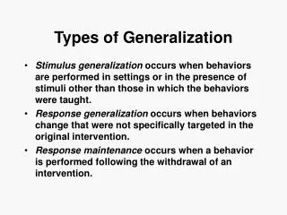
Generalization – how to decide? • Scale of the map may dictate your needs • May seem arbitrary at times, although it helps to simplify for easier viewing sometimes • Also, well-defined points can be important • Why?
Generalization: Standards • See: http://erg.usgs.gov/isb/pubs/factsheets/fs17199.html • National Map Accuracy Standards (est 1941) • At scales of 1:20,000 or smaller, the map must be checked for symbols that deviate more than 1/50” (0.02 centimeters) on the map. • 90% of checked points must comply. • Points include: large building corners, survey markers, major rail, road intersections. • e.g. At 1:24,000, this is roughly 12 m deviation, or 40 ft
B. MAP COMPONENTS neatlines, framelines legends north arrow (orientation) titles & subtitles scale data source insets
1.Frameline & Neatline Separated The frameline should include all map elements that viewers will need to understand the map. Neatline Frameline The neat line is used to define cropped regions of the map. The map elements need not be included within it. 3. Frameline acts as neatline 2.Frameline
LEGENDS Keep legends clean and simple. Verify that important features are represented correctly in your legend in terms of color and apperance Legends do not require and outline box, but sometimes they may improve appearance and/or clarity Legend headings help to understand the map's theme and purpose and units if app.
LEGENDS: Creating, Customizing More customized style; drawn in art program ArcMap – limited in scope, but adequate for most maps (customized legends possible)
LEGENDS: Symbols/Symbology Abstract Symbols – vary shape, size, color to highlight features and discern them (e.g. dots, squares) Representative Symbols that “look” like what the represent – e.g. flames for fire, dollar signs for banks Symbols by convention – water is usually blue, dots are often cities Symbology will be covered again when we work on thematic maps starting next week. Read ahead 196-226 if you are curious (Krygier & Wood, 2005)
TITLES and SUBTITLES Titles should be included on the map. Make them succinct Subtitles may include details such as years, one-word descriptions of data, locations The title should be the largest type on the map Avoid fancy and ornate type styles. Also avoid italics. Bold type is ok. Masking may be used if needed TITLE MASKED TITLE NOT MASKED
ORIENTATION - refers to the indication of direction on a map 1. May be depicted using a graticule (the 'grid' of latitude and longitudinal lines). Discussion of the graticule will be next week. 2. May be depicted using a north arrow
NORTH ARROW ArcMap has several available north arrows By convention: Use the most simple north arrow if you just need to orient the map viewer Use the compound arrows for navigational maps and charts ESRI North 2 is best
SCALE BARS Scale on a map : 1. gives th amount of reduction that has taken place in the map OR 2. allows users to measure distances on a map As a visual element, it is represented as a scale bar (also bar scale). Use it if distance is important to the viewer's understanding of the map.
SCALE BARS As with North Arrows, avoid complex scale bars. Stick to the most simple ones. Here, Scale Line 1, 2 or 3 are adequate. Deciding divisions depends on the map's intended use. Are estimates, or near exact distances needed? * Use round numbers, easy to double, triple for scale bar length (e.g. 200 miles) More on scale use next week!
INSETS • Smaller maps included within a context of a larger map • Locator inset • Ease congestion by enlarging • Depict changes, themes over time Inset styles may vary. There is no set convention. Suggestions: use neat lines, framelines and visual connectors to strengthen relationships
DATA SOURCE From where did your data come (e.g. dollars spent, houses sold, etc)?? Use plain, subtle text for this element Use this format: Source: California Department of Labor, State Housing Data Bank, April 1, 2000 Place it at the bottom of your map. It should be inconspicuous, but locatable.
Nomenclature - Type Type family – group of similar designs Type style – Roman, Bold or Italic (others exist such as condensed, expanded, light, extra bold Typeface – type of a specific family & style Type size – the “size” (height) of the type given in points (1 point = 1/72”) So what is a font? A font is the set of all alphanumeric and special characters of a specific type family, type style and type size.
General rules - type on maps Use the same type throughout the map. . Stay consistent. Exception: label water with Times New Roman in italics Avoid decorative type unless it is an especially unusual or decorative map. This is unlikely in professional envrionments. Do not make type too small. Type size should correspond to feature size. Do not blindly accept defaults in ArcMap, or in Ilustrator for that matter. Spell-check!
General rules - type on maps Point features 1. avoid overprinting (covering graphic objects) 2. avoid separation between features and labels by other features 3. use sequence of preferred locations for labeling point features 4. align type if more than one line involved (alignment) 5. label points that lie close to coasts (but are on land) on the land 6. label points that lie ON the coast entirely in water, or entirely on land 5th best 3rd best best 4th best 2nd best 6th best
General rules - type on maps Linear features: 1. Keep descenders (“g”, “y”) above the path. Keep type above the path, except for borders that require labeling on both sides of the feature 2. Follow the general trend if you have very curvy linear features 3. Use repetition instead of spreading text out 4. Place text upright and readable from left to right 5. If you are placing text vertically, make sure that it can be read from the right side of the page rather than the left (test by focusing your eyes toward the right side of the page and verifying that you can read it.
General rules - type on maps Areal Features 1. Use tracking to separate text in areal features. Also, try to use separation of AT LEAST 1.5 em's (tracking unit) between last letter and border of areal feature. 2. Consider using all uppercase lettering 3. For more than one line, exaggerate leading to cover area 4. If an areal feature is too small to place text within it, label it as a point . 5. If a line feature is thick and nearly areal (e.g. a canal), label as an area, following the general trend of the feature.