GEO 5159 GIS Applications in Environmental Systems
60 likes | 178 Vues
This seminar focuses on the development and application of GIS models in environmental systems. Participants will learn to identify existing models, evaluate their adequacy against specific questions, and understand the necessary data requirements. The seminar guides attendees through procedures for downloading models and data, implementing preliminary models, conducting sensitivity analyses, and reporting results effectively. Valuable links to ecological modeling resources and further reading material will be provided to enhance learning and application.

GEO 5159 GIS Applications in Environmental Systems
E N D
Presentation Transcript
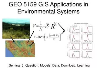
GEO 5159 GIS Applications in Environmental Systems Seminar 3: Question, Models, Data, Download, Learning
Procedure • Question/Problem • Identify existing models and read the documentation • Do they meet requirements of the question? • Yes: proceed to 2.2 • No: Prepare to create your own model • Are data available to run the model? • Yes: proceed to 3.0 • No: can information be modeled? • Yes: find models, recursion to 2.0 • No: ??? Continued
Procedure • Download the model • Download the data • Implement the model - preliminary • Example data and model runs available? • Yes: implement with provided material • No: create simplest possible datasets to run model • Compile from source code? Must have development environment software (VisualBasic, C, C++, Fortran, Python, etc.) • Run test cases on provided or simplest datasets - debug
Procedure 7. Implement the model – Functional • Run the model on real data. • Compare output with real world • Calibrate the model by “tweaking” calibration variables (these are subjective – which are the most uncertain?). 8. Sensitivity analysis • Which variables are most important (contribute most to variance in the output)? • Vary single variable over some range, collect output.
Procedure 9. Implement the model 2 – Experimental • Vary conditions according to scenarios • Collect output • Analyze in absolute and relative terms 8. Report the results: 1. What are the specifications of the model and its parameters? Repeatable! 2. What are the answers to the questions?
Some Interesting Web Sites • Server for Ecological Modeling http://www.wiz.uni-kassel.de/ecobas.html • Spatial Modeling Environment http://www.uvm.edu/giee/SME3/ • SERDP Ecological Models and Land-use Decisions http://www.esd.ornl.gov/programs/SERDP/EcoModels/index.html • Everglades Landscape Model https://my.sfwmd.gov/portal/page?_pageid=1314,2590324,1314_2555986:1314_2556170&_dad=portal&_schema=PORTAL&navpage=elm2 • Land Transformation Model http://ltm.agriculture.purdue.edu/ltm.htm