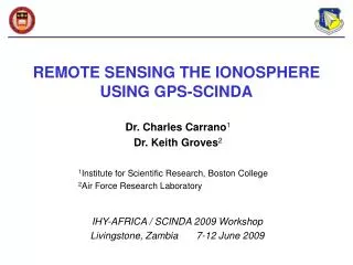
REMOTE SENSING THE IONOSPHERE USING GPS-SCINDA
660 likes | 1.28k Vues
REMOTE SENSING THE IONOSPHERE USING GPS-SCINDA. Dr. Charles Carrano 1 Dr. Keith Groves 2. 1 Institute for Scientific Research, Boston College 2 Air Force Research Laboratory. IHY-AFRICA / SCINDA 2009 Workshop Livingstone, Zambia 7-12 June 2009.

REMOTE SENSING THE IONOSPHERE USING GPS-SCINDA
E N D
Presentation Transcript
REMOTE SENSING THE IONOSPHERE USING GPS-SCINDA Dr. Charles Carrano1 Dr. Keith Groves2 1Institute for Scientific Research, Boston College2Air Force Research Laboratory IHY-AFRICA / SCINDA 2009 Workshop Livingstone, Zambia 7-12 June 2009
A real-time GPS data acquisition and ionospheric analysis system for SCINDA, written in C for the LINUX operating system Computes ionospheric parameters S4 and TEC using the full temporal resolution of the receiver. This high rate sampling (10-50 Hz) makes scintillation monitoring possible. Standard IGS/RINEX observations are inadequate for scintillation obs. Software designed for use with a number of relatively inexpensive and off the shelf receiver models (including the Ashtech Z-XII, Ashtech Z-CGRS, and the NovAtel GSV 4004B). Provides a real-time display of satellite tracking status and the ionospheric parameters. Includes a suite of scripts for automated data delivery, data management, and data backups onto CD-ROM or DVD media. A new configuration tool is included to assist with installation of the software and selection of data logging options. What is GPS-SCINDA?
Software for the calibration of GPS TEC measurements made using GPS-SCINDA. It is also written in C for the LINUX operating system. An extension of a Kalman filter approach developed at NOAA/SEC for TEC calibration called WinTEC (MS Windows). Our implementation (LINUX) includes several new features including estimation and removal of the plasmaspheric contribution to the TEC. It can estimate and remove instrumental biases associated with the GPS receiver and (optionally) the GPS satellites without any external information (e.g. satellite biases or almanac files), which makes it well suited for automated processing in the field Includes programs written in the GNU R to plot S4 and calibrated TEC. Scripts are included to automatically generate and archive daily S4 and TEC plots with 15 minute updates. WinTEC-P can also be executed manually (for post-processing) on GPS datasets of arbitrary duration (to create weekly plots, etc). What is WinTEC-P?
Previous versions of GPS-SCINDA recorded the differential GPS observables TECP and TEC but NOT the individual phases and pseudoranges. Therefore, it is not possible to create RINEX files from old GPS-SCINDA measurements except when recording the full raw 50 Hz data (campaign mode). The new version of GPS-SCINDA now records the standard NovAtel RANGE records to files with the extension *.rng at a rate of 1 every 10 seconds (by default). These RANGE files may be converted to RINEX using GPS-SCINDA. The WinTEC-P software for TEC calibration is now integrated into the GPS data collection system. Daily plots of S4 and TEC (and also optionally the post-processed data) are updated every 15 minutes and automatically archived on the computer for convenient access. It is no longer necessary to download the satellite and receiver biases for your specific receiver from the SCINDA Web site. Data can be delivered to multiple remote sites automatically. All users GPS-SCINDA users are encouraged to upgrade their software. What’s New with this Release?
GPS-SCINDA System Hardware Equipment List1: NovAtel GSV 4004B GPS receiver 2: NovAtel dual frequency antenna 3: Antenna cable (30 meter maximum) 4: Serial cable 5: Power cable 6: Personal computer running Linux
The GPS-SCINDA data acquisition and ionospheric analysis system: Runs on a PC or laptop running LINUX (Debian distribution preferred) Displays GPS tracking and ionospheric parameters with real-time updates Configurable by running a configuration script and answering questions Sends data to one or more hosts via a secure Internet connection GPS-SCINDA System Software
GPS-SCINDA GPS RX PC GPS-SCINDA GPS RX PC GPS-SCINDA GPS RX PC Contributions to the AFRL-SCINDA Network Global Data Products AFRL AFWA Boston College NOAA/NGDC AER Global Data Distribution Network maintenance Collaborative scientific studies Model development, etc.
System Operation, Part I GPS-System Boot Menu • Do not run • Normal mode • Campaign mode User can reboot at any time to choose a new mode of operation Default mode may also be changed by running configuration script GPS Data Collection System for SCINDA AFRL/Radex ===================================== ========== Choose the mode of operation (default = 2): ------------------------------------------- 1) Do not run the GPS software --> 2) Normal mode (collect SCINDA data only) 3) Campaign mode (collect SCINDA data and raw data) Use the up and down arrow keys to select and press enter when ready. You have 30 seconds to make a choice.
System Operation, Part II GPS Operational Display Receiver position Satellite PRN Azimuth Elevation C/No of C/A code C/No of P code on L1 C/No of P code on L2 S4 on L1 S4 on L2 (unusable) Relative (uncalibrated) TEC System status This screen is reached by Pressing the “Ctrl”+“Alt”+“F1” Keys at the same time
Debian GNU/Linux stable cvd-gps.bc.edu tty1 cvd-gps.bc.edu login: Switching to the Linux Console GPS Display To log in to the Linux console: At the prompt “cvd-gps login:” type root At the prompt “password:” type password Press Ctrl-Alt-F2 Linux Console Press Ctrl-Alt-F1 Note: the hostname “cvd-gps” will likely be different for your computer
A collection of Perl scripts manages the delivery and archiving of the data New data files (less than 24 hours old) are created here: /home/gps/data Files more than 24 hours old are moved to an archive directory according to the year and month. For example, data for July 2006 reside here: /home/gps/archive/2006/07-Jul/ Files moved to the archive are automatically compressed using the LINUX “gzip” command, which adds “.gz” to the filename (use “gunzip” to uncompress). Data files queued for delivery over the Internet are copied to this directory (and removed after they are sent): /home/gps/xfer/ GPS Data Collection and Storage
Types of Files Recorded Data collectionmode Files recorded (hourly) Description 090524_150000.nvd.gz – streaming raw data (50 Hz) 090524_150000.scn.gz – ionospheric statistics (S4, TECP, TEC) 090524_150000.psn.gz – receiver position (1 Hz) 090524_150000.msg.gz – diagnostic messages 090524_160000.ism.gz – GSV 4004B ISM messages 090524_150000.scn.gz – ionospheric statistics (S4, TECP, TEC) 090524_150000.psn.gz – receiver position (1 Hz) 090524_150000.msg.gz – diagnostic messages 090524_160000.ism.gz – GSV 4004B ISM messages (60 sec) 090524_150000.rng.gz – NovAtel RANGEB messages (for RINEX) YYMMDD_hhmmss – Time tag format (UTC via PC clock) campaign scinda year month(1-12) day(1-31) hour(0-23) minute (0-59) second (0-60)
# YY MM DD UTSEC T 03 09 30 42972 132.3 55.0 0.12 100 0.06 100 52.4 -1.105 0.78 38.1 74 09 52.0 38.0 0.16 100 0.09 100 23.8 13.767 1.37 35.9 76 26 57.0 20.0 0.10 100 0.03 100 52.8 5.995 0.80 60.3 16 29 . . . T 03 09 30 43032 131.8 55.6 0.07 100 0.03 100 50.1 -1.106 0.65 38.3 75 09 52.0 37.5 0.13 100 0.09 100 30.6 14.071 1.18 36.1 77 26 57.0 19.3 0.10 100 0.07 100 55.6 6.526 0.81 60.5 17 29 # AZ EL L1S4 %SAM L2S4 %SAM TECP TEC ROTI TECR N PRN 1st epoch 2nd epoch Format of the Ionospheric Statistics Files (*.scn) Legend: L1S4 – Scintillation intensity index on L1 L1S4 – Scintillation intensity index on L2 (do not use) %SAM – % samples taken compared to number expected (0-100%) TECP – Differential pseudorange (TECU) TEC – Differential carrier phase (TECU) ROTI – STD of rate of change of TEC over one minute TECR – Relative (uncalibrated) TEC (TECU) N – Time since last cycle slip (min) PRN – pseudorandom noise satellite identifier YY – 2 digit year MM – month DD – day UTSEC – seconds since midnight AZ – azimuth (deg) EL – elevation (deg Formats of the other files are given in an appendix to these slides and also a technical report
Generating RINEX Files using GPS-SCINDA Use this command to generate RINEX files from RANGE files using GPS-SCINDA: ./gps-scinda –r novd --interval 10000 --rinex *.rng interval in ms(1000 ms) This will produce hourly RINEX files. To generate daily RINEX files, concatenate the hourly *.rng files together first, and then generate RINEX from this daily file: cat 090601_*.rng > 090601.rng ./gps-scinda –r novd --interval 10000 --rinex 090601.rng
GPS-SCINDA Software The latest version of the software may be downloaded from this URL:https://wfs.bc.edu/carranoc/scinda/gps-scinda-bundle.tar.gz Files Description gps-scinda-bundle.tar.gz - Archive containing all the software for SCINDA install - Script to install (or upgrade) SCINDA softwaregps-scinda-1.76.tar.gz - GPS-SCINDA data collection software (binary version) gps-scinda-src-1.76.tar.gz - GPS-SCINDA data collection software (source code) wintec-p-1.05.tar.gz - WinTEC-P software for TEC calibration (binary version)wintec-p-src-1.05.tar.gz - WinTEC-P software for TEC calibration (source code) gps-scripts-2.00.tar.gz - Scripts for automated data management and delivery GPS-SCINDA component can also be used separately to post-process raw data collected previously, or to convert RANGE (*.rng) files to RINEX files. WinTEC-P component can also be used separately to calibrate TEC measurements previously collected with GPS-SCINDA.
Preparing a New Computer for GPS-SCINDA Steps to prepare a new computer for GPS-SCINDA: Install Debian LINUX and edit /etc/network/interfaces (if necessary) to connect the computer to the Internet Add a Debian repository to /etc/apt/sources.list so you can download packages with the apt-get package manager (otherwise apt-get will look for packages on the Debian CDs) Create a user account named “gps” Optional: Disable automatic startup of XDM/KDM/GDM (i.e. automatic start in X Windows) or you will not see the real-time display automatically after rebooting Recommended: Configure the bios to restart the computer automatically when power returns (after a power outage). These tasks can be accomplished with the help of a systems administrator (or we can send you a preconfigured system).
Installing or Upgrading the SCINDA Software Log into the computer as the root user and then do the following … root@hostname:~# cd /home/gps root@hostname:/home/gps# tar xzvf /path/to/gps-scinda-bundle.tar.gz install gps-scripts-2.01.tar.gz gps-scinda-src-1.76.tar.gz gps-scinda-1.76.tar.gz wintec-p-src-1.05.tar.gz wintec-p-1.05.tar.gz root@hostname:/home/gps# ./install unpacking the tar file gps-scripts-2.01.tar.gz starting configure.pl -------------------------------------------------- Configuring the GPS-SCINDA data acquisition system -------------------------------------------------- Enter the three letter station abbreviation [slz]: los Enter the GPS receiver type (uz=Ashtech uZ-CGRS, z12=Ashtech Z-XII, novd=Novatel): [novd] Start data collection in campaign or scinda mode (campaign/scinda): [scinda]
Installing or Upgrading the SCINDA Software Enter the IP address of remote host #1 where the data will be sent: [136.167.18.134] Enter the name of the user on 136.167.18.134 where the data will be sent: [los-gps] DSA key /home/gps/.ssh/id_dsa.pub was found (please email this file to charles.carrano@bc.edu) Enter the IP address of remote host #2 where the data will be sent: [66.155.158.52] Enter the name of the user on 66.155.158.52 where the data will be sent: [los-gps] DSA key /home/gps/.ssh/id_dsa.pub was found (please email this file to charles.carrano@bc.edu) Missing software: Looking for package openssh-server, Found openssh-server Looking for package libncurses5-dev, Found libncurses5-dev Looking for package libcurses-perl, Found libcurses-perl *** Warning: Could not find package libgsl0-dev. *** *** Warning: Could not find package r-base. *** Looking for package ntp, Found ntp The following prerequisite packages are missing: libgsl0-dev r-base Shall I install prerequisite software using apt-get? This requires internet access (y/n): [y]
Installing or Upgrading the SCINDA Software Install GPS-SCINDA and WINTEC-P from (b)inary package or (s)ource code package (b/s): [b] Backing up previously installed software Installing from gps-scinda-1.76.tar.gz Installing from wintec-p-1.05.tar.gz Checking the version of gps-scinda ... gps-scinda 1.76 is correctly installed Checking the version of wintec-p ... wintec-p 1.05 is correctly installed Setting the p1c1 option in wintec-p.conf according to the receiver type executing command: ./set-option.pl p1c1 1 wintec-p.conf Record NovAtel RANGE files during data collection (may be converted to RINEX later) (y/n): [y] Record RINEX files during data collection (they require a lot of disk space) (y/n): [n] Keep an archive of daily calibrated TEC files (they require a lot of disk space) (y/n): [n]
Installing or Upgrading the SCINDA Software The NovAtel GSV4004B can track up to three SBAS signals. Shall I update the sbas.dat file (y/n): [y] Please specify your longitude sector: 1=American, 2=African, 3=Indian, 4=Pacific, or 5=Southwest Asian: [1] 2 Updated sbas.dat as follows: 124 126 120 Checking the timezone of software clock (GMT or equivalent is recommended) Local time zone is set to GMT or equivalent. Configuring the NTP server (time will be slaved to this host) Activate the GPS software: [Y] The GPS system has been activated. Please reboot (type /sbin/reboot) for this change to take effect. Installation complete. To reconfigure this system, type "./configure.pl" root@hostname:/home/gps# /sbin/reboot After the computer reboots, the data collection software should start automatically. This configuration process may be repeated (i.e. if you make a mistake) by typing:./configure.pl
Enabling Automated Data Delivery • The recorded data is delivered over the Internet using SFTP • By default, all data files are delivered except the raw 50 Hz data (if present) and RINEX files, since these file are too large for slow networks to handle. • If the available bandwidth onsite is insufficient to deliver all the files, the system can be configured to omit certain types of files. • In order to connect to our servers using SFTP, an SSH key must be generated as the “gps” user on the computer: ssh-keygen –t dsa • This step is performed automatically (and only once) by the install script. We have already performed this step on computers we have configured for you. • The SSH key file /home/gps/.ssh/id_dsa.pub which is generated in this step should be emailed to us as an attachment so we can install it on our systems.
A statistical measure of the intensity of amplitude scintillations is given by the scintillation intensity index, S4 May be interpreted as the fractional fluctuation of the signal due to ionospheric modulation (e.g. S4=1.0 means 100% modulation) We typically use the C/No (converted to linear units) as a proxy for the signal intensity, although this isn’t strictly correct. We use the maximum data rate available (10, 20, or 50 Hz, depending on the receiver model) to calculate the S4. In addition to the normal GPS satellites, we can compute the S4 along the link to geostationary SBAS satellites which broadcast on L1 only Signal intensity standard deviation Signal intensity mean The Scintillation Intensity Index, S4
Monitoring SBAS Satellite Links NovAtel GSV 4004B can track up to 3 geostationary SBAS satellites in addition to GPS Highest elevation SBAS satellites from African Sector are PRNS 124, 126, 120
TECP TEC TECU UT (hours) Total Electron Content Estimation of absolute TEC using GPS involves two steps: - Levelling the phases to the pseudorange gives the relative TEC - Estimation/removal of instrumental biases (calibration) gives absolute TEC Absolute TEC: TEC= TECR - ( bR + bS) Relative TEC: TECR = TEC + <TECP – TEC>ARC bR - Receiver/station bias (TECU)bS - Satellite bias (TECU) TECP - Differential pseudorange (TECU) TEC- Differential carrier phase (TECU) < >ARC - Average over phase-connected arc GPS-SCINDA (*.scn file) provides TECP and TEC WinTEC-P uses these to estimate absolute TEC
Receiver Model Method used to measure the DPR Type of Satellite Bias to Remove Ashtech Z-12 L2(P2) - L1(P1) P1P2 bias Ashtech µZ-CGRS L2(P2) - L1(P1) P1P2 bias NovAtel GSV 4004B L2(P2) - L1(CA) P1P2 bias minus the P1C1 bias Types of GPS Satellite Biases to Remove The technique used by the receiver to measure the pseudoranges dictates how the satellite instrumental biases should be removed. Files containing monthly estimates for the P1P2 and P1C1 biases can be downloaded from the Center for Orbit Determination in Europe (CODE) at this URL: http://www.aiub.unibe.ch/download/CODE/. These satellite differential codes bias are not absolute timing biases, instead they average to zero. The unknown offset is immaterial in that it will be lumped together and removed along with the receiver bias.
The WinTEC-P Software for TEC Calibration Here we discuss only the use of the software. For the theoretical basis of this technique see: Carrano, C. S., A. Anghel, R. A. Quinn, K. M. Groves (2009), Kalman Filter Estimation of Plasmaspheric TEC using GPS, Radio Sci., 44, RS0A10, doi:10.1029/2008RS004070. and also our talk scheduled later in this workshop: Carrano, C.S., A. Anghel, K. M. Groves, Separating the Ionospheric and Plasmaspheric Contributions to GPS Measurements of Total Electron Content.
Compiling the WinTEC-P Program • The WinTEC-P software is distributed with gps-scinda-bundle and will be compiled automatically (as needed) on the GPS-SCINDA data collection computer. • However, you can compile WinTEC-P on any computer running LINUX. • To compile WinTEC-P from source, the GNU Scientific Library and GNU R are required (both are free). For Debian Linux, these can be installed by logging in as root and typing: apt-get update apt-get install libgsl0-dev r-base • The WinTEC-P software can then be compiled from the source code as follows: tar xzvf wintec-p-src-1.05.tar.gz cd wintec-p-src-1.05 ./configure make • This will create executables named “wintec-p” and “download_biases”.
Generating Plots of S4 and TEC Manually • Make sure the files wintec-p.conf, s4.conf, and tec.conf are located in the current directory along with the wintec-p executable and the scripts s4.r and tec.r. One can process an arbitrarily long sequence of ionospheric statistics files (*.scn) with WinTEC-P as follows: ./wintec-p -d -r 090601_000000.scn 090601_010000.scn … 090601_230000.scn • The coordinates of the station are obtained from corresponding *.psn files (if present), or they must be specified in the wintec-p.conf configuration file. Plots of S4 and calibrated TEC are generated using GNU R as follows: R --slave < s4.r R --slave < tec.r • Alternatively, you can run a script called “wintec-p-daily.pl” to automate this process: ./wintec-p-daily.pl *.scn • This will group the hourly input files into daily batches, which will be processed by wintec-p and then R to create daily plots.
Command Line Options for WinTEC-P • The wintec-p program creates a file called restart.dat when it finishes. This file contains the last Kalman state. When you are processing new data and wish the Kalman filter to restart from its last saved state, supply the “-r” command line option, e.g.: ./wintec-p –r 090602_000000.scn 090602_010000.scn … 090602_230000.scn If the restart.dat file cannot be found, the Kalman state will be initialized to zero. • Depending on the options selected in the configuration file wintec-p.conf, the wintec-p program can estimate the satellite biases from the data, or it can use satellite biases downloaded from CODE. The “-d” command line option indicates that wintec-p should attempt to download the appropriate differential code bias files from CODE automatically using “wget”: ./wintec-p –d 090602_000000.scn 090602_010000.scn … 090602_230000.scn This download requires Internet access. If Internet access is unavailable or unreliable, it’s probably best to have wintec-p estimate the satellite biases from the data.
Example of Plots Generated Using WinTEC-P GPS Scintillation Intensity Total Electron Content One can also generate separate plots for each satellite to see greater detail.
Output of the WinTEC-P Program When WinTEC-P is run automatically on the data collection computer, output files are created here: /home/gps/plots S20090524.PNG - Scintillation intensity index (S4) T20090524.PNG – calibrated TEC /home/gps/processed_data 090524_tec.dat.gz – calibrated TEC 090524_res.dat.gz – post-fit residual 090524_cov.dat.gz – covariances 090524_state.dat.gz – Kalman state 090524_model.dat.gz – zenith TEC estimates (ionosphere & plasmasphere) 090524_biases.dat.gz – Estimated receiver and satellite biases YYMMDD – Time tag format (UTC) If “no” is selected for the “archive calibrated TEC” option when configuring the software, these files will be overwritten each time (to save disk space on the data collection computer)
Format of the Calibrated TEC File (tec.dat) #YYMM DD UTSEC AZ EL PLAT PLON PCGLAT PCMLT S4 DPR PTEC STEC STECE VTEC VTECE PRN09 06 02 82822 322.10 47.40 -35.76 45.37 -44.27 25.77 0.05 -0.27 0.00 1.65 80.38 1.26 61.65 0309 06 02 82822 347.50 44.60 -35.02 46.62 -43.72 25.88 0.04 -0.46 0.00 2.89 80.41 2.13 59.33 0609 06 02 82822 215.00 15.90 -44.57 40.67 -50.54 25.10 0.10 12.73 0.00 -1.00 -1.00 -1.00 -1.00 1109 06 02 82822 154.40 13.10 -46.32 53.32 -53.27 25.79 0.26 9.19 0.00 -1.00 -1.00 -1.00 -1.00 1409 06 02 82822 10.90 18.70 -30.60 49.03 -40.06 26.19 0.17 2.10 0.00 -1.00 -1.00 -1.00 -1.00 1609 06 02 82822 276.50 52.60 -37.61 44.58 -45.69 25.65 0.05 5.05 0.00 3.52 80.38 2.88 65.72 1909 06 02 82822 298.00 25.50 -35.07 41.28 -43.59 25.54 0.10 16.46 0.00 7.70 80.42 3.99 41.63 2309 06 02 82822 91.50 53.50 -37.92 50.16 -46.28 25.98 0.05 1.85 0.00 2.98 80.35 2.46 66.36 31 Legend: YY – 2 digit year MM – month DD – day UTSEC – seconds since midnight AZ – azimuth (deg) EL – elevation (deg PLAT – latitude of IPP (deg) PLON – longitude of IPP (deg) PCGLAT – magnetic latitude of IPP (deg) PCMLT – magnetic local time of IPP (hrs) S4 – Scintillation intensity index DPR – Differential pseudorange (TECU) PTEC – plasmaspheric slant TEC (TECU) STEC – ionospheric slant TEC (TECU) STECE – estimated error in STEC (TECU) VTEC – vertical equivalent TEC (TECU) VTECE – estimated error in VTEC (TECU) PRN – pseudorandom noise satellite identifier -1 indicates missing values (e.g. elevation too low)
Format of the Biases File WINTEC GNSS C1-P2 DCB SOLUTION, ENDING D153, 2009 03-JUN-09 23:55--------------------------------------------------------------------------------DIFFERENTIAL (C1-P2) CODE BIASES FOR SATELLITES AND RECEIVERS:PRN / STATION NAME VALUE (TECU) RMS (TECU)*** **************** *****.*** *****.***G01 0.000 316.228G02 -15.712 56.796G03 7.520 56.796G04 7.478 56.796G05 0.000 316.228G06 7.711 56.796G07 1.397 56.796G08 9.441 56.796G09 4.433 56.796G10 7.671 56.796 ... ... ... G30 5.820 56.796G31 -5.805 56.796G32 8.778 56.796REC 31.053 56.796
The WinTEC-P Configuration File The configuration file wintec-p.conf specifies the options to use when calibrating the TEC: # Estimate the plasmaspheric TEC estimate_plasmasphere = 0 # Estimate the receiver bias estimate_rx_bias = 1 # Estimate the satellite biases estimate_sat_biases = 1 # Force TEC to be non-negative non_negative_tec = 1 # Set to 1 for receivers that track C/A code on L1, 0 for receivers that track P code on L1 p1c1 = 1 # Use the last bias estimates from the Kalman filter (to avoid transients) use_last_biases = 1 # Use the last plasmaspheric scaling factor from the Kalman filter (to avoid transients) use_last_plasmasphere = 1 # Specify the path to the satellite biases from CODE path_to_biases = ./biases
The WinTEC-P Configuration File # Assumed altitude of the ionospheric penetration point in km # alt_ipp = 350. # The elevation mask # elmask = 20.0 # Geographic latitude of the station in degrees (only used if no *.psn file is available) # slat = 0.0 # Geographic longitude of the station in degrees (only used if no *.psn file is available) # slon = 0.0 # Geographic altitude of the station in degrees (only used if no *.psn file is available) # salt = 0.0 # Max attained by Kp index over the past 24 hours (only used if estimate_plasmasphere > 0) # kpmax = 1.0 # 13 month average sunspot number (only used if estimate_plasmasphere > 0) # rbar = 7.9
The WinTEC-P Configuration File # Automatically download the satellite biases from CODE# download = 0# Restart the Kalman filter from a previously saved state# restart = 0# Print debugging information# debug = 1
The S4 Configuration File The configuration file s4.conf specifies the options for plotting the S4 index using the GNU R script s4.r: # Name of station (can be left blank)site = # Range for the time axis (set equal to -1 to autoscale)hr_min = 0hr_max = 24# Maximum value of S4 to plots4_max = 1.2# Type of output (bitmap,png,ps,eps)output_type = bitmap
The TEC Configuration File The configuration file tec.conf specifies the options for plotting the TEC using the GNU R script tec.r: # Name of station (can be left blank) site = # Variable to plot (vtec,stec,ptec) tec_type = vtec# Plot versus (ut=ut, mlt=mlt of IPP) time_type = mlt# Units for the time axis (min,hr) time_units = "hr"# TEC Range (set tec_max=0 to autoscale) tec_min = -2 tec_max = 60# Type of output (bitmap,png,ps,eps) output_type = bitmap# Plot type (no=all data on one page, yes=separate pages for each PRN) multipage = no
Mounting the GPS Antenna GPS Antenna should be installed high, with minimal obstructions from buildings, other antennas and equipment, power lines, and trees. Antenna cable length should not exceed 30 m to limit signal losses. GPS antenna Important: Moving the antenna or changing cables can change the receiver bias.
GPS Multipath Only the portion of the signal that travels along the direct path from the satellite is useful. All other contributions are called multipath. Signal interference at the antenna due to multipath causes fluctuations that can resemble scintillation, but these fluctuations are not caused by the ionosphere.
Day 53 Day 54 Day 55 Day 56 Day 57 Day 58 Day 59 Multipath and Scintillation The pattern of multipath scintillation changes slowly from day to day (due to the 4 minute daily rotation of the GPS constellation) Ionospheric scintillation changes quasi-randomly from day to day and is superimposed on the multipath background Multipath due to ground-based obstructions of the sky is usually encountered at low elevations Data from Ascension Island in 2006