Changing Earth’s surface
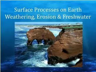
Changing Earth’s surface. Water Erosion. Udden - Wentworth Scale. Sediments in Motion. Runoff . Runoff : water that moves over Earth’s surface. Runoff flows in a thin layer over land = sheet erosion. Amount of runoff depends on: Amount of rain in an area. Vegetation. Type of Soil.

Changing Earth’s surface
E N D
Presentation Transcript
Changing Earth’s surface Water Erosion
Runoff • Runoff: water that moves over Earth’s surface. • Runoff flows in a thin layer over land = sheet erosion. • Amount of runoff depends on: • Amount of rain in an area. • Vegetation. • Type of Soil. • Shape of the land. • How people use the land.
Erosion by Rivers • Causes the Formation of: • Valleys • Waterfalls • Flood Plains • Meanders • Oxbow Lakes
Deposits by Rivers • Anytime moving water slows down, it drops, or deposits, some of the sediment. • Larger stones also quit rolling and sliding. • Creates these landforms: • Alluvial Fans • Deltas • Soil on floodplains
Alluvial Fans • A wide, sloping deposit of sediment formed where a stream leaves a mountain range. • The deposit is shaped like a fan.
Deltas • Sediment deposited where a river flows into an ocean or lake builds up. • Examples: Nile River (left) & Mississippi River (right)
Erosion and Sediment Load • A river is a dynamic system.
Erosion and Sediment Load • These factors affect how fast the river flows and how much sediment it can erode: • River’s slope • Increase in slope = water’s increase in speed • Volume of flow • More water flowing in a river = increase in speed • The shape of its streambed • River flowing in a strait line = water flows faster near the center of the river than its sides. • If a river curves = water moves fastest along the outside of the curve.
Credits • Schlumburger Website Retrieved on 3/12/12 http://www.google.com/imgres?q=picture+of+sediment+moving+in+water&hl=en&client=safari&rls=en&biw=1158&bih=702&tbm=isch&tbnid=cGZW6haL7-ve7M:&imgrefurl=http://www.glossary.oilfield.slb.com/DisplayImage.cfm%3FID%3D55&docid=Uzkq99EIoi0L6M&imgurl=http://www.glossary.oilfield.slb.com/files/OGL98036.jpg&w=393&h=400&ei=DlNeT6u1JqWuiQLP0YChBA&zoom=1&iact=hc&vpx=115&vpy=4&dur=244&hovh=226&hovw=223&tx=101&ty=117&sig=102853300329707996231&page=2&tbnh=165&tbnw=162&start=15&ndsp=20&ved=1t:429,r:10,s:15 • Earth Science Australia retrieved on 3/12/12 http://www.google.com/imgres?q=picture+of+sedimentary+rock+in+moving+water&hl=en&client=safari&sa=X&rls=en&biw=1158&bih=702&tbm=isch&tbnid=41-qN5iKWb-JXM:&imgrefurl=http://earthsci.org/education/teacher/basicgeol/sed/sed.html&docid=PNekaZnN3EjcOM&imgurl=http://earthsci.org/mineral/rockmin/sed/clastics.gif&w=627&h=368&ei=W1ReT-fiFYHTiALfy5noBA&zoom=1&iact=hc&vpx=99&vpy=419&dur=7108&hovh=172&hovw=293&tx=194&ty=89&sig=102853300329707996231&page=2&tbnh=123&tbnw=210&start=15&ndsp=20&ved=1t:429,r:5,s:15
Credits http://www.google.com/imgres?q=picture+of+sediment+moving+in+water&start=136&hl=en&client=safari&rls=en&biw=1158&bih=702&tbm=isch&tbnid=La1Bxo5KOmHZQM:&imgrefurl=http://geologycafe.com/class/week9.html&docid=sBMQI_npMjdq7M&imgurl=http://geologycafe.com/images/stream_sediments.jpg&w=800&h=600&ei=EFVeT8rhAbTViAK-vZDfBA&zoom=1&iact=hc&vpx=860&vpy=282&dur=3630&hovh=194&hovw=259&tx=69&ty=80&sig=102853300329707996231&page=8&tbnh=151&tbnw=201&ndsp=20&ved=1t:429,r:4,s:136 • Henry County Georgia retrieved on 3/13/12 http://www.google.com/imgres?q=picture+of+runoff&hl=en&client=safari&sa=X&rls=en&biw=1208&bih=691&tbm=isch&prmd=imvns&tbnid=gDG2L3H47Dqq3M:&imgrefurl=http://www.co.henry.ga.us/Stormwater/EffectsOfStormwaterRunoff.shtml&docid=hTY3kNciMaZVIM&imgurl=http://www.co.henry.ga.us/Stormwater/images/photo_RunoffEffects.jpg&w=457&h=336&ei=NmpfT9XOH-aiiQKwnvm7BA&zoom=1&iact=hc&vpx=314&vpy=305&dur=11&hovh=192&hovw=262&tx=129&ty=113&sig=102853300329707996231&page=2&tbnh=143&tbnw=195&start=15&ndsp=20&ved=1t:429,r:11,s:15 Virtual Geology Museum Retrieved on 3/13/12 http://www.google.com/imgres?q=picture+of+stream+erosion+and+deposition&hl=en&client=safari&rls=en&biw=1208&bih=691&tbm=isch&tbnid=0ZPFWRoQqYumUM:&imgrefurl=http://skywalker.cochise.edu/wellerr/VGM/opals-pals/058.htm&docid=Q-EmYyvDbY4izM&imgurl=http://skywalker.cochise.edu/wellerr/VGM/opals-pals/6opal058.jpg&w=640&h=451&ei=-9NfT4akDYaOiALa0LDFBA&zoom=1&iact=rc&dur=372&sig=102853300329707996231&page=1&tbnh=144&tbnw=204&start=0&ndsp=15&ved=1t:429,r:11,s:0&tx=71&ty=44