Download
1 / 5
Accurate UTM Zones Projection
50 likes | 179 Vues
Utilize Transerve Mercator Projection with UTM Zones to display the Earth accurately. Zones numbered and categorized for easy reference and boundary details provided.
Télécharger la présentation 
Accurate UTM Zones Projection
An Image/Link below is provided (as is) to download presentation
Download Policy: Content on the Website is provided to you AS IS for your information and personal use and may not be sold / licensed / shared on other websites without getting consent from its author.
Content is provided to you AS IS for your information and personal use only.
Download presentation by click this link.
While downloading, if for some reason you are not able to download a presentation, the publisher may have deleted the file from their server.
During download, if you can't get a presentation, the file might be deleted by the publisher.
E N D
Presentation Transcript
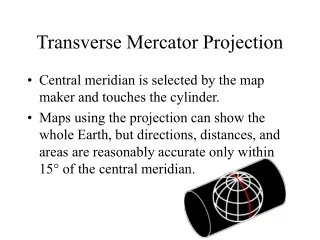
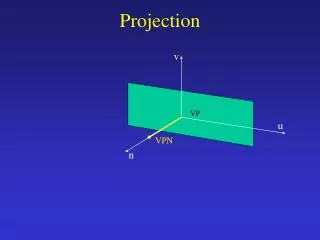
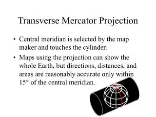
Transverse Mercator Projection • Central meridian is selected by the map maker and touches the cylinder. • Maps using the projection can show the whole Earth, but directions, distances, and areas are reasonably accurate only within 15° of the central meridian.
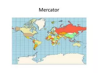
UTM Zones • World is divided into 60 zones. • Each zone is 6° of longitude wide. • Zones are numbered 1 to 60, starting at 180° and progressing to the east.


More Related